BY E-CHING LEE
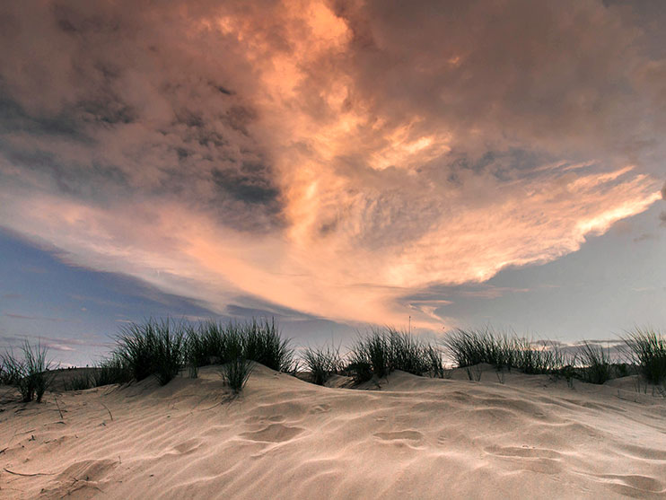
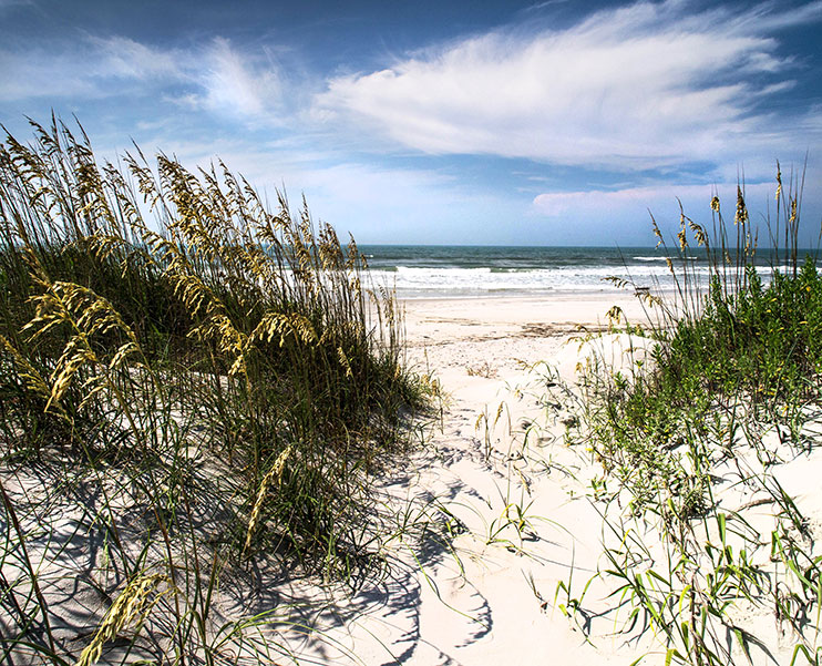
Visitors enjoy the colorful sunsets at Jockey’s Ridge State Park. Photo courtesy N.C. Division of Parks and Recreation.
Legislation that ultimately led to the creation of North Carolina’s state parks system was passed just over a century ago.
On March 3, 1915, the N.C. General Assembly crafted a bill enabling the state to buy land for a state park. Locke Craig, governor of North Carolina from 1913 to 1917, was a proponent of protecting the state’s rich natural resources.
North Carolina named its first park — Mount Mitchell State Park — in 1916. This area was created in response to extensive logging efforts that were perceived to threaten the forests on the Black Mountain range.
To commemorate the 100th anniversary of this legislation, Gov. Pat McCrory declared the first week of March as North Carolina State Parks Week, noting that the “State Parks System contributes immeasurably to the quality of life that makes North Carolina a great place to visit, to work and to live.”
But don’t limit your celebration of the parks to one week. North Carolina’s state parks are natural resource protectors, outdoor classrooms and tourist attractions, all rolled into one.
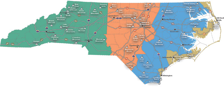
State parks dot the state, from the mountains to the coast. Courtesy N.C. Division of Parks and Recreation.
In 2014, state parks logged 15.6 million visitors, an increase from 14.2 million visits in 2013. Twenty-seven of 39 state parks and state recreation areas reported an increase in attendance. Fort Macon State Park in Carteret County and Jockey’s Ridge State Park in Dare County were among six locations that welcomed more than 1 million visitors.
North Carolina Sea Grant has collaborated with the N.C. Division of Parks and Recreation on various projects. Barbara Doll, Sea Grant water protection and restoration specialist, is working with colleagues at North Carolina State University’s biological and agricultural engineering department on a stream restoration project in Goose Creek State Park in Washington. She also has worked on the Carolina Beach State Park marina.
In addition, Jack Thigpen, Sea Grant extension director, collaborated with parks and recreation officials and other partners to develop the North Carolina Birding Trail.
When you visit the coast this summer, consider including nearby state parks. Then return next year to celebrate a century of North Carolina state parks.
“The state parks system will hold its centennial in 2016,” says Mike Murphy, state parks director. “Planning is underway for special events and opportunities to celebrate a system that has become an institution for recreation, conservation and connection with nature in our state.”
WALK THE BOARDWALK
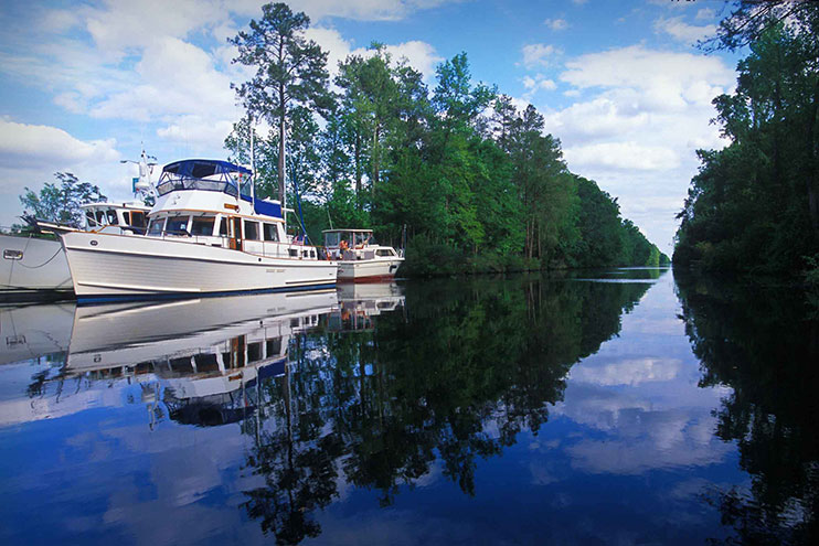
The Dismal Swamp Canal connects the Albemarle Sound to the Chesapeake Bay. Photo by Bill Russ/VisitNC.com.
The Dismal Swamp State Park protects 22 square miles — about 14,000 acres — of forested wetland in the Great Dismal Swamp, the largest remaining swamp in the eastern United States. Extensive ditching and logging have changed its character over the past 200 years. Settlers in the late 1600s would have found 1.28 million acres of soggy wetland, much wetter than it is today.
This park originally was authorized as a state natural area in 1974, becoming a state park in 2008. The adjacent Dismal Swamp Canal, dug entirely by slaves, is 22 miles long. It connects Deep Creek in Chesapeake, Va., to South Mills, N.C. Today, the U.S. Army Corps of Engineers maintains the waterway.
The overall Great Dismal Swamp spans northeast North Carolina and southeast Virginia. Parts of it are a National Wildlife Refuge. The National Park Service also has recognized this site as part of the National Underground Railroad Network.
Read Cynthia Sharpe’s story in the Spring 2015 issue of Coastwatch to learn about the escaped slaves who used the swamp as a refuge and a home.
FLY KITES

Hang gliders are a common sight at Jockey’s Ridge. Photo by Bill Russ/VisitNC.com.
Come to see the tallest sand dune on the Atlantic Coast, hang glide over this unusual desert-like environment and stay for the spectacular sunsets. Jockey’s Ridge State Park, established in 1975, covers 420 acres. It is located at Nags Head along the Outer Banks.
“Geologists believe that Jockey’s Ridge was formed when strong water currents from hurricanes and storms washed sand from large offshore shoals onto the beach. Throughout many years, the wind picked up this sand and blew it inland,” notes the N.C. State Parks website. The dune ranges from 80 to 100 feet tall, depending on weather conditions.
Although the principal dune lacks vegetation, wildlife still roam across its surface. Early in the morning, hikers can find tracks of foxes, rabbits and other animals that have emerged overnight. And, contrary to its first appearance, the park supports some plant life, such as American beachgrass, loblolly pine and live oaks, in dune areas at its perimeter.
Jockey’s Ridge — so named, some believe, because locals would race wild ponies at the base of the dune — is the largest of many dunes in the area. It also is the designated end point of the state’s Mountain-to-Sea Trail at www.ncmountainstosea.org.
RELIVE CIVIL WAR BATTLES
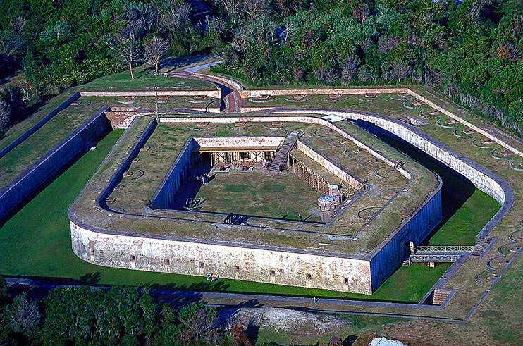
Restored areas in Fort Macon depict periods of soldier occupation. Photo by Bill Russ/VisitNC.com.
A Civil War fort? Check. Surf and sand? Check. A salt marsh? Check.
A state park since 1924, Fort Macon State Park seems to have it all. Located on Bogue Banks in Carteret County, the park is surrounded by three bodies of water — the Atlantic Ocean, Beaufort Inlet and Bogue Sound. Visitors can tour the old fort, view a Civil War reenactment or explore the beautiful beach.
Fort Macon was built in the early 1800s to guard Beaufort Inlet and Beaufort Harbor. The fort saw action in the Civil War, falling into Union hands in 1862. During World War II, the U.S. Army leased the area from the state and used the fort to protect important facilities located nearby.
Read more about Fort Macon in “Strongholds of the Coast” by Morgan Jones in the Holiday 2012 issue of Coastwatch.
LOOK FOR LOGGERHEADS
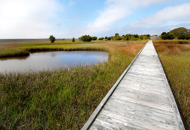
Hammocks Beach State Park added almost 300 acres to its area this spring. Photo courtesy N.C. Division of Parks and Recreation
Hammocks Beach State Park spans the mainland near Swansboro in Onslow County to Bear, Huggins and Jones islands. This park was established in 1961.
From April through October, a ferry goes between Swansboro and Bear Island. This island is known for female loggerhead turtles that come ashore to nest between mid-May and late August. These turtles may live up to 70 or 80 years and may weigh as much as 400 pounds. The loggerhead is on the federal list of endangered and threatened species.
Huggins Island is located in the mouth of Bogue Inlet, visible from downtown Swansboro. Its maritime swamp forest is listed as a Globally Rare and Significant Area. The island has a rich history, from serving as Native American fishing and hunting grounds, to housing a Confederate six-cannon battery in 1861 and 1862.
This spring, the N.C. Division of Parks and Recreation announced the addition of 289 acres to this park. The land was acquired from the heirs of John Hurst, son of a one-time slave who was caretaker of game lands owned by physician William Sharpe in the early 1900s.
FIND CARNIVOROUS PLANTS
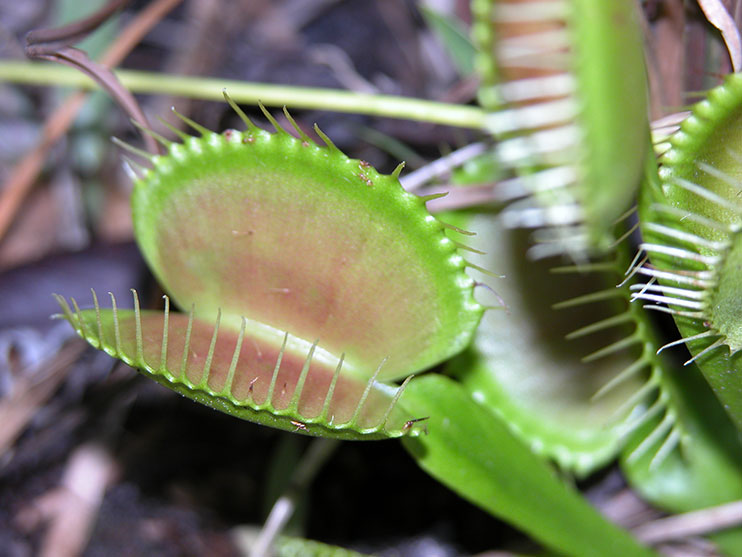
Find the rare venus flytrap at Carolina Beach State Park. Photo courtesy N.C. Division of Parks and Recreation.
Carolina Beach State Park offers a marina, camping areas, hiking trails and fishing spots along the Intracoastal Waterway and the Cape Fear River. Prior to colonial settlement in the early 1700s, the area was inhabited by the Cape Fear Native Americans.
But this park, which came into being in 1969, also is home to Sugarloaf, a 50-foot sand dune, and the carnivorous Venus flytrap plant.
The flytrap’s leaves, shaped like traps, can close around an insect. Digestive juices take three to five days to absorb nutrients from its prey. The trap reopens when the plant is ready for its next meal. After opening and closing three times, the leaf dies and is replaced with a new one.
But leave the plant where you see it. The Venus flytrap, a plant that is native to an area within 60 to 75 miles of Wilmington, is being threatened by habitat destruction. It now is considered a felony to remove the flytrap from the wild.
Head to the park to see and learn more about the Venus flytrap and its kin. Rangers at Carolina Beach offer a plant biology lesson for students in grades 5 through 8, focusing on carnivorous plants.
PLAY AND LEARN
At Fort Fisher, enjoy undeveloped shorelines. Photo courtesy N.C. Division of Parks and Recreation.
Fort Fisher State Recreation Area was established as a unit of the North Carolina State Parks in 1986. Located on the southern tip of Pleasure Island near Wilmington, this area lies between the Atlantic Ocean on the east and the Cape Fear River on the west.
The adjacent Fort Fisher State Historic Site is managed by the N.C. Department of Cultural Resources.
The fort was built in 1861 to protect Wilmington from Union forces. It fell into Union hands four years later, about three months before the Civil War ended. The fort grounds were used during World War II as a firing range. An airstrip built during that time destroyed a large piece of the historic earthwork.
Today, visitors to the recreation area can learn about seashells, salt marshes and the creatures that inhabit coastal habitats through free interpretive programs.
Fort Fisher presents an ever-changing terrain. Storms rearrange the landscape, sculpting and reshaping dunes, inlets, channels and even the shape of the beach. Depending on the season, visitors might find loggerhead sea turtle nests, plovers, Spartina marshes, birds of prey and waterfowl.
This article was published in the Summer 2015 issue of Coastwatch.
Information adapted from the N.C. Division of Parks and Recreation, ncparks.gov.