By Diana Hackenburg
August 3, 2016
A 3.3-square-mile area may seem like an inconsequential speck on the map when considering North Carolina’s 53,819 total square miles. But for the people, plants and animals that live there it’s more than just a tract of land — it’s home.
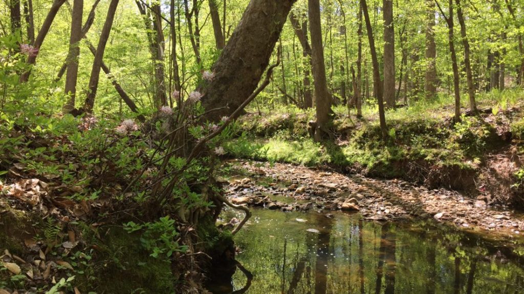
The Black Creek watershed is a small urban watershed in the Neuse River Basin. Photo courtesy of Christy Perrin/WRRI
This particular patch of earth, also known as the Black Creek watershed, was home for Christy Perrin, the sustainable water and communities coordinator for North Carolina Sea Grant and the Water Resources Research Institute of the UNC system, for 17 years. Like Perrin, we all live in a watershed: an area of land that drains all rain water or snow to one location, like a river or lake.
Our local watersheds sustain us, as Perrin explains, “Water is the basis of everything: our health, fun activities, economy, farmers and industries.” Unfortunately, we also interfere with the health and sustainability of our watersheds by adding pollution, including runoff and erosion, to the mix.
Many people and organizations across the state have dedicated themselves to protecting the more than 1,700 watersheds that make up North Carolina — and that they call home. Perrin helped establish one of these organizations — the Black Creek Watershed Association — and still works with them even though she has since moved. These efforts could make a difference locally but as Perrin observes, “no one person or group can protect water. It has to be a collective effort.”
![]() A band of dedicated watershed professionals came together over coffee beginning in 2011 to discuss how they could better support these local stewards. “That led to us cobbling together our resources to do a needs assessment, and from there, assembling a group of people to tell us what we should do with the results,” remembers Perrin, a key member of the coffee brigade.
A band of dedicated watershed professionals came together over coffee beginning in 2011 to discuss how they could better support these local stewards. “That led to us cobbling together our resources to do a needs assessment, and from there, assembling a group of people to tell us what we should do with the results,” remembers Perrin, a key member of the coffee brigade.
This stepwise process led to the creation in 2013 of the North Carolina Watershed Stewardship Network, which Perrin now co-coordinates with Grant Parkins of the University of North Carolina at Chapel Hill’s Institute for the Environment.
The network seeks to empower watershed stewards so they can more effectively protect and restore local waters, which are crucial to our environment, our economies and our communities — the triple-bottom-line approach to water, as Perrin describes it.
A steering committee with representatives from over 20 organizations leads the network. They developed a strategic plan that emphasizes taking a positive approach to solving problems by sharing local water success stories through networking events and workshops.
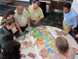
The watershed game, developed for North Carolina by Sea Grant staff, demonstrates how private landowners and local governments can work together and implement water quality improvement measures. Photo courtesy of Christy Perrin
This June, the network concluded a series of two-day watershed planning workshops, partnering closely with organizations such as the North Carolina Coastal Federation. “There are a lot of technical resources out there. With these workshops, we tried to fill a gap in social resources by helping people network and learn about the tools that already exist,” Perrin adds.
“The broad idea is to foster leadership that will result in greater protection of North Carolina’s watersheds,” explains Parkins, network co-coordinator and workshop lead. “We’ve gotten overwhelmingly positive feedback from the participants and hope to continue growing the program.”
One of the tools introduced during the workshop was the watershed game, an interactive tool developed by Minnesota Sea Grant and adapted for North Carolina by Gloria Putnam, North Carolina Sea Grant’s coastal resources and communities specialist.
“The game provides an easy and fun way to educate others about the connections between water quality and various land uses,” explains Putnam, who also serves as a member of the network’s steering committee. “It also demonstrates how private landowners and local governments can work together and implement measures that make a difference.”
Recently, the network started exploring the idea of planning a statewide summit to continue sharing positive lessons and to strengthen connections among stewards across the state. They especially are interested in working with coastal plain communities, the region with the lowest response rate to the network’s original needs-assessment survey.
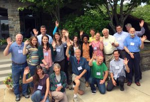
The network maximizes the skills of professionals and volunteers throughout the state by providing training and networking opportunities. Photo courtesy of Christy Perrin
“We want to keep broadening and building our network. The more people who join, the more power we will have to help support and start these local watershed efforts,” says Perrin, who just recently joined Sea Grant as staff. She hopes to use this connection to identify new coastal groups and individuals to bring into the fold.
“Having ties to the Watershed Stewardship Network creates more opportunities for Sea Grant and WRRI to get feedback from communities on the research, education and training support needed to effectively address their water resource challenges,” notes Susan White, executive director of Sea Grant and WRRI. “Network members will benefit from this input as Sea Grant and WRRI seek out partners and provide funding to directly address these identified research and educational needs.”
Watershed groups — like the Black Creek Watershed Association — can join the network by adding themselves to the interactive map, a new feature spearheaded by the group’s web tools working group. The map allows people to find their watershed and connect with information such as water quality conditions and active organizations specific to where they live, work or play.
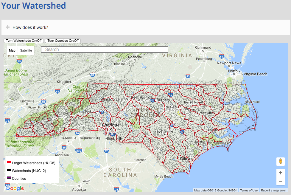
Click on the image above to explore the North Carolina Watershed Stewardship Network’s interactive map.
Individuals also can join the network by signing up for the e-newsletter, attending a training or volunteering on a working group. And anyone can help improve community health and economic development by making decisions that protect their local watershed — their home.
“It has to happen locally. State agencies can’t come in and do all the work. They just don’t have the resources, and people probably wouldn’t like that anyway,” Perrin concludes. “People want to have control of their own local destinies.”
This article concludes the celebration of North Carolina Sea Grant’s water resources work in support of the National Sea Grant network’s 50th anniversary. Look for features on graduate education during August, followed by healthy coastal habitats in September.