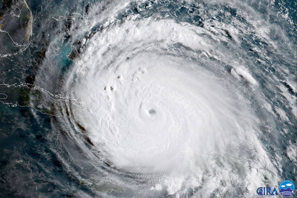
Above: The NOAA-NASA satellite GOES-16 captured this image of Hurricane Irma passing the eastern end of Cuba at about 8:00 a.m. EDT on Sept. 8, 2017. Photo by CIRA/NOAA.
This has been a stressful week for most of the Southeast. With Hurricane Matthew fresh in our minds, all eyes have — rightfully — been on Irma.
In recent forecast cycles, however, North Carolina officials and residents have noted that Irma’s forecast track cone has shifted more to the west, suggesting that mountain communities may deal with the worst of this storm within our state.
That’s not to say that our Piedmont and coastal areas won’t see Irma’s effects. The forecast cone shows only where the center of the storm may go. It does not show the limits of areas that will be affected. And this storm is HUGE.
As of today — Friday, Sept. 8 — even with Irma’s center tracking into Tennessee, central North Carolina still could experience heavy downpours. Also, gusty winds could bring down isolated trees and limbs weakened by thunderstorms in the past week.
Along the coast, red flags already are flying to tell swimmers to stay out of the surf zone. Gale warnings also have been posted for some of our coastal waters.
In the mountains, the threat for stronger winds and heavier rainfall remains, so landslides and flooding may be possible Monday and Tuesday. But as we all learned from Matthew in 2016, small shifts in the track of a storm can change the potential problems as geography affects impacts. It still is too early to let our guard down.
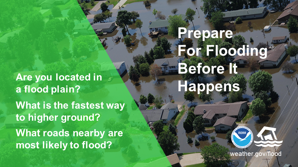
Flooding can occur anytime of the year. Be prepared, visit weather.gov/flood. Courtesy NWS
Now that I have your attention, this is a great time to review some of the terms you might hear over the next few days to describe what hazards you should be aware of from Irma.
As the storm approaches, you will begin to get notifications through apps on your phone or the Wireless Emergency Alert system. The National Weather Service can issue several types of watches, warnings and advisories, also called “products” in NWS lingo.
In working across many communities, I often hear people express confusion about what these terms mean. This was the case in the state during Hurricane Matthew last year: Not everyone knew what the weather and emergency information they were receiving meant.
With five NWS Weather Forecast Offices serving North Carolina, some products or message categories may differ slightly depending on your location. Given that Irma’s impacts may be felt statewide, I focused on a few that may be seen commonly throughout our state.
These are adapted from the NWS in Raleigh, but I tried to simplify the definitions:
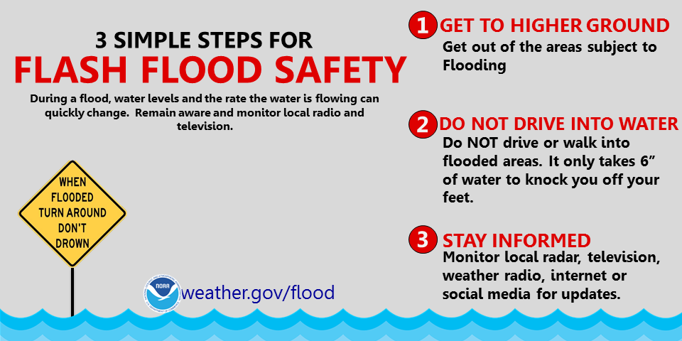
During a flood, water levels and the rate at which the water is flowing can quickly change. Courtesy NWS
Beginning up to two days before hazardous weather starts, the NWS will start issuing watches. In these cases, conditions are favorable for a weather hazard to develop, but that particular hazard is not yet happening. The watch allows people time to plan to protect their lives, and those of loved ones, along with property.
During a watch, keep in mind that hazardous weather may be on its way, and make sure that your preparation plans are ready for you to set into action if needed. Here are some watches you, or your family and friends, may see over this weekend as Irma approaches:
Flash Flood Watch: Your area may experience short-lived flash flooding resulting from heavy rain squalls that can produce 1 to 2 inches of rain or more per hour. Sometimes, this warning is also issued for potential dam failures when a large release of water is possible. Check now to determine if you live downstream of a dam.
High Wind Watch: Sustained winds of 40 miles per hour (mph) or greater, or wind gusts of 58 mph or greater, may develop within 24 to 48 hours.
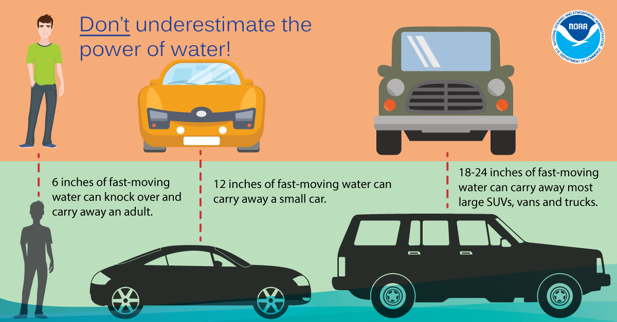
Don’t underestimate the power of water. Turn Around Don’t Drown! Courtesy NWS
A warning means that a hazard is imminent or happening. During a warning, get to a safe place and stay there.
The location of that safe place depends on what hazard or event you are avoiding. Generally, unless you’ve been told by authorities to evacuate, head indoors to a sturdy building and stay away from windows. In the case of flooding, get to a higher floor.
DO NOT, under any circumstances, drive where water is covering a roadway. The majority of deaths in North Carolina during Matthew and other storms happened when people underestimated the power of water to float even large vehicles — or were unable to see that a roadway had been washed out beneath the water.
Here are some warnings you may see over this weekend as Irma approaches:
Flash Flood Warning: Flooding is expected to result from storms with 1 to 2 inches of rain or more per hour, but should not last long — usually less than six hours. NWS also may use this type of warning when a dam has failed or when a dam failure is imminent.
Areal Flood Warning: Flooding that is slower to evolve, expected to last longer than six hours and cover a larger area. This type of flooding often results from steady rain of typically less than 1 inch per hour. These types of warnings are most common during long-duration rain, such as in the spring, that result in widespread flooding.
High Wind Warning: Sustained wind speeds not associated with a thunderstorm of 40 mph (35 knots) and greater and/or frequent wind gusts of 50 mph (43 knots) and greater, or any winds gusts 57 mph (50 knots) and greater.
Local NWS forecast offices issue advisories during important weather events that may have significant impacts, but not be as severe as those that would be expected under a warning. These are called advisories.
Here are some advisories you may see over this weekend as Irma approaches:
Flood Advisory: Localized flooding resulting from heavy rain. Water may start to threaten homes and businesses, and minor flooding of roads is possible.
Wind Advisory: Strong winds from a phenomenon other than a thunderstorm, including sustained wind speeds of 31 to 39 mph (27 to 34 knots), frequent wind gusts 40 to 45 mph (35 to 39 knots), and/or any wind gusts 46 to 57 mph (40 to 50 knots).
Here are links for you. Some provide options for apps to download to a smart phone.