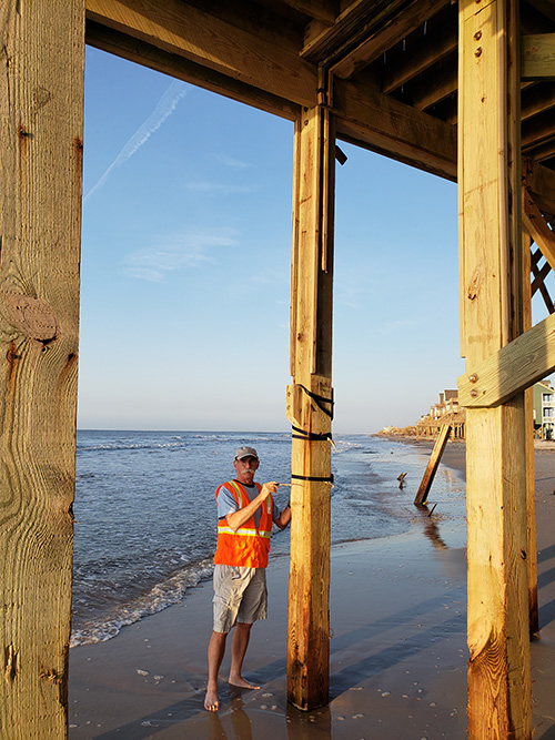
Spencer Rogers, North Carolina Sea Grant’s coastal erosion and construction specialist, attaches a wave gauge to a dock in North Topsail Beach. Photo by the Field Assessment Team.
Spencer Rogers, North Carolina Sea Grant’s coastal erosion and construction specialist, supplied the United States Geological Survey (USGS) last fall with wave gauge data to help build a flood map model of Hurricane Florence. The data-sharing effort was successful, Rogers says, and USGS recently publicly posted the data from all Hurricane Florence gauges.
Rogers partnered with the University of Notre Dame’s Andrew Kennedy, who sent gauges to deploy before Florence. Rogers set up gauges along North Carolina’s southeastern coast in Wrightsville Beach, Topsail Beach and North Topsail Beach.
One gauge in North Topsail recorded five feet of erosion and significant wave hits, Rogers says.
“Beginning with Hurricane Rita in 2005, USGS has installed wave gauges for storms,” says Rogers. “Before then, USGS had river gauges, but nobody in the country was in charge of collecting water levels after coastal storms and hurricanes.”
Researchers strap the gauges to stable structures; once secure, the instruments collect data on storm surge and wave conditions when waves hit. In addition to using the information for flood map modeling, scientists can determine how waves evolve over the duration of a storm.
Watch Flood Event Viewer data for Hurricane Florence
##