Posted Aug. 28, 2015
Casey Dietrich is a faculty member in North Carolina State University’s Department of Civil, Construction, and Environmental Engineering. He focuses on the development of computational models for wind, waves and coastal circulation, and their application to high-resolution simulations of ocean behavior.
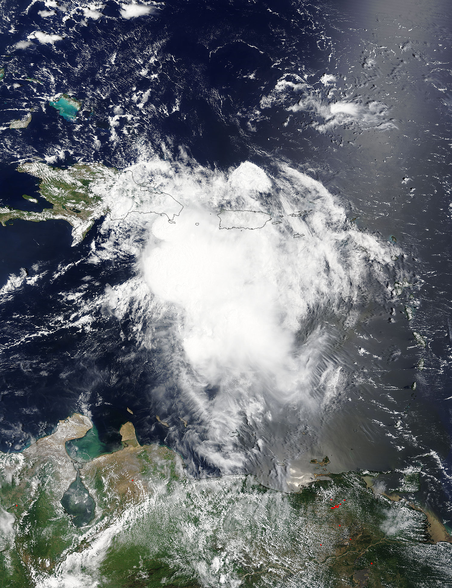
On Aug. 28 at 15:05 UTC (11:05 a.m. EDT), NASA’s Terra satellite saw Tropical Storm Erika approaching Hispaniola. Photo by NASA Goddard MODIS Rapid Response Team. For storm updates, go to the National Hurricane Center.
Research supported by North Carolina Sea Grant is feeding into emergency planning efforts as Tropical Storm Erika tracks toward the continental United States.
Even as the storm is hundreds of miles away, I am part of a team providing guidance for hurricane waves and coastal flooding — information shared directly with emergency managers and weather forecasters to support their decisions to be made within North Carolina.
This is a great opportunity to share our research in a meaningful way. We want our models to be useful, and we want to use our experiences during storm events to improve our models over a longer time frame.
When a storm is forecasted to affect our coastline, the Coastal Emergency Risks Assessment group uses computer models to simulate the behavior of the coastal ocean. These models rely on the official forecasts from the National Hurricane Center for the storm’s track, size and intensity, and then they predict its impacts on the waves and storm surge.
The forecast guidance is shared directly with county-level emergency managers, forecasters at the regional offices of the National Weather Service, and engineers with the N.C. Department of Public Safety. These groups also share with other critical state agencies, such as the N.C. Department of Transportation and federal partners such as the National Park Service.
This guidance is offered in formats familiar to them, and is generated by tools developed at NC State University as part of a Sea Grant project, mentioned in an earlier blog post.
During Erika and other storms, this guidance about wave heights and flooding levels is being shared every six hours. After the storm, the researchers will continue to improve both the accuracy of the forecasts and their utility during storm events, by working closely with end users around the state.
“This iterative process is a great example of Sea Grant researchers working directly with our partners who need accurate information in formats that can be used readily,” notes John Fear, Sea Grant’s deputy director.
Editor’s note: North Carolina Sea Grant also has been a long-term partner in CI-FLOW — the Coastal and Inland Flooding Observation and Warning project — led by the National Severe Storms Laboratory of the National Oceanic and Atmospheric Administration. CI-FLOW system captures the complex interaction between rainfall, river flows, waves, tides and storm surge, and how they impact water levels in the Tar-Pamlico and Neuse rivers and the Pamlico Sound in North Carolina. CI-FLOW data and output are included in the CERA forecasting. Check out the CI-FLOW website for the full listing of partners.