BY ALEX K. MANDA
featuring an excerpt from Troubled Waters: Understanding the Science Behind our Coastal Crisis
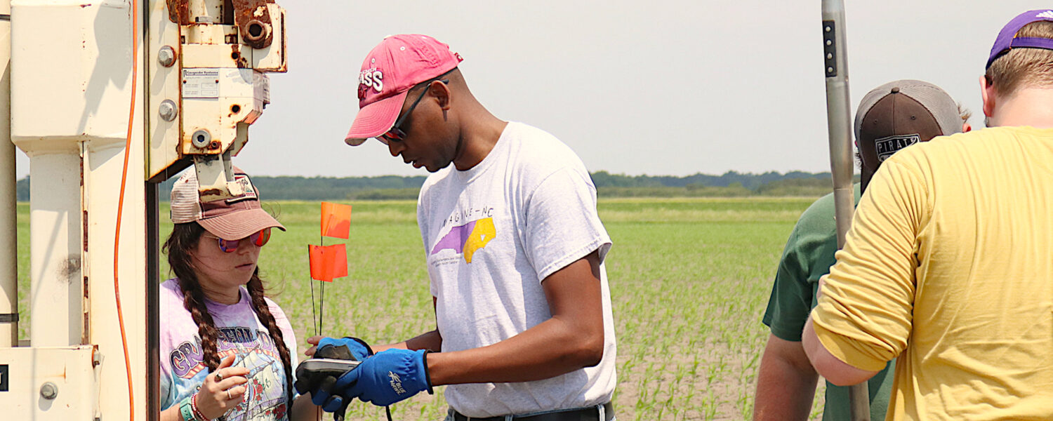
Alex K. Manda (above, second from left) is a geological scientist at East Carolina University. His wide-ranging research interests address a critical resource many people on the East Coast often take for granted: water. His work explores the origins of the water we use, whether water supply can meet demand for generations to come, and what factors determine water availability and quality. He also studies how climate change, population growth, and urban development affect the availability of potable water. In this article for the Summer 2021 issue of Coastwatch, he explains studies of two very different weather-related impacts on coastal North Carolina surface waters and groundwater. The first looks at the effect of winds on saltwater intrusion at the Emily and Richardson Preyer Buckridge Coastal Reserve. He then offers a short preview of his new work at Pine Knoll Shores for a North Carolina Sea Grant project designed to mitigate the effects of stormwater flooding after heavy precipitation.
WIND, SALT, AND BEARS ON THE INNER BANKS
Several years ago, we investigated saltwater intrusion in a coastal wetland system of the “Inner Banks.” In this region, saltwater intrusion is inundating low-lying lands that are used for agriculture and conservation purposes. Since certain types of vegetation are not tolerant to saltwater, any increase in saltwater content may seriously impact the health of this vegetation.
For example, in the Emily and Richardson Preyer Buckridge Coastal Reserve, various tree stands of Atlantic white cedar are showing signs of stress, potentially due to saltwater intrusion. According to the North Carolina Forest Service, the state of North Carolina has the largest acreage of Atlantic white cedar in the country. Thus, any loss of Atlantic white cedar will have severe consequences on the ecosystems in which these trees are found.
In other low-lying areas, saltwater is finding its way into agricultural fields, thereby preventing the growth and maturity of certain types of crops (e.g., soybeans, corn, etc.) that are important for the economic well-being of many coastal communities. Saltwater intrusion therefore threatens to decrease the yields of important cash crops.
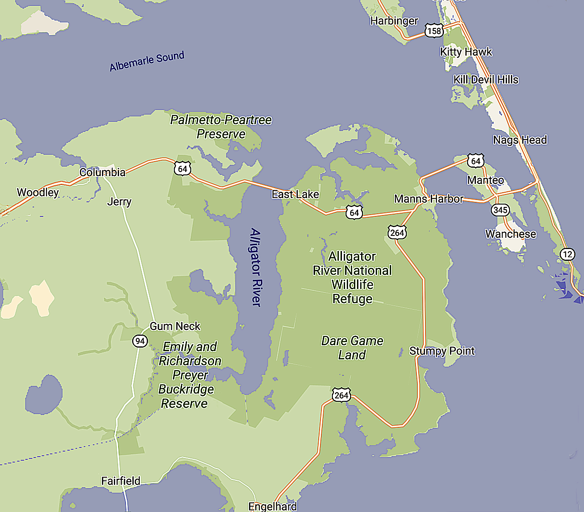
Alex K. Manda and his research team investigated whether wind tides were moving saline water into the Emily and Richardson Preyer Buckridge Coastal Reserve. Credit: Google Maps.
To adapt to these environmental changes, farmers might have to find alternate crops to grow, perhaps apply gypsum to their fields, or abandon their farms altogether. Some of these courses of action come at great cost, and thus are likely to cause farmers many sleepless nights. Determining the course of action depends greatly on the mode of saltwater intrusion, as well as the extent of the problem.
There are several ideas (working hypotheses) that can explain the source of the saltwater. One idea is that the saltwater is migrating inland from the ocean and sounds due to sea level rise. As the sea rises, ocean water would not only move farther inland, but the saltwater wedge beneath the coast would also migrate inland. Although this movement would lead to saltwater sources being near agricultural fields, the process would take years to mature because the rate of relative sea level rise is on the order of several millimeters per year in eastern North Carolina.
Another hypothesis that may explain aquifer/soil salinization is that saltwater intrusion is driven by overwash and storm surge from tropical cyclone activity. Under this process, there is an instantaneous injection of saltwater in inundated fields that then persists in the soil or groundwater for a very long time. Wind tide events are another mechanism by which saltwater can make its way from surface water bodies to agricultural fields. These wind tides may cause the water in channels to overflow into agricultural fields. The wind tides may also prolong the presence of salts adjacent to agricultural fields so that saltwater would then have sufficient time to permeate into adjoining fields, thereby contaminating cropland. Land subsidence may also cause saltwater intrusion by lowering the land that is adjacent to the sounds or ocean. The impact of this process is that the ocean/sound level would appear to rise relative to the land surface. As a consequence, the ocean would move inland and the saltwater wedge in the subsurface would move inland. Processes that may cause land subsidence in eastern North Carolina may include groundwater pumping from coastal aquifers in southern Virginia, or the lowering of the land surface as the Earth’s crust continues to relax due to the melting of an ice sheet in southern Canada/northern U.S. that occurred about 15,000 to 10,000 years ago.
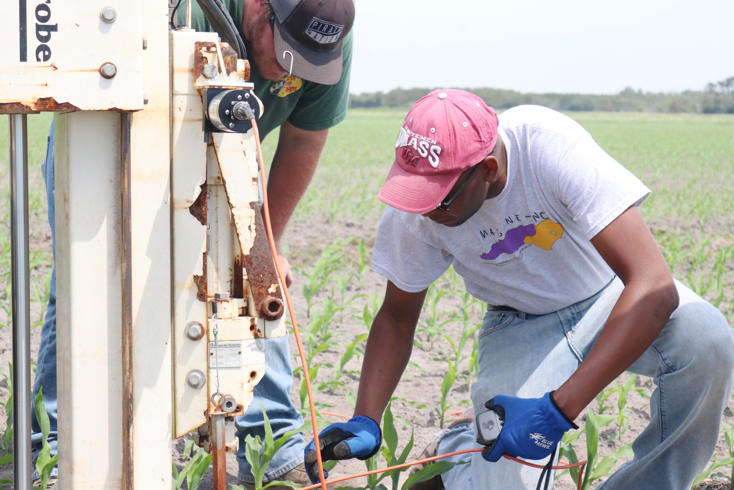
Manda’s wide-ranging research interests have provided opportunities for students to gain valuable experience out in the field. Photo courtesy of Alex K. Manda.
For this study, we deployed devices (known as loggers) that autonomously record water levels and specific conductivity (used here as a proxy for salinity) in surface water and groundwater bodies. The idea of the deployment scheme was to place the loggers in such a way that we could capture the height and the conductivity of the water from a potential source (a large human-made canal — the Alligator-Pungo River canal), along a river channel (the Alligator River, adjacent to the Reserve), to finally, a series of small canals in the protected Reserve.
The hypothesis that we were testing for this study was that the saline water detected in the Reserve originated from the large constructed canal. The saline water then made its way to the Reserve via the Alligator River and small canals. We further hypothesized that the driver for this movement was wind tides. To fully test these hypotheses, we collected weather data in addition to the water quality data and water quantity data.
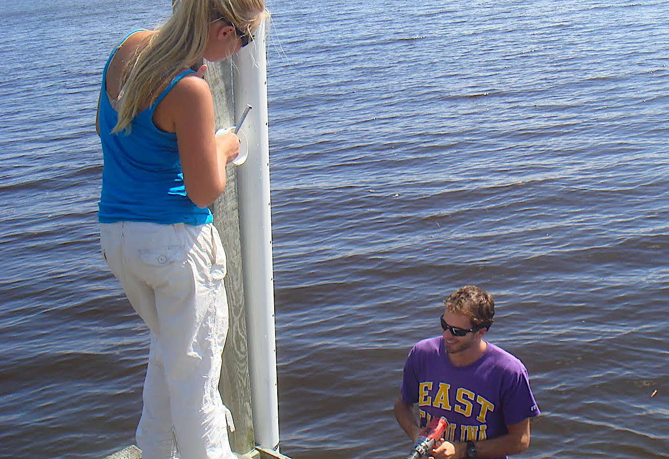
Installing monitoring wells, deploying loggers and collecting data in the Reserve and surface water bodies was an adventure unto itself. To understand the interactions between the surface water and groundwater regimes, my research team has installed and instrumented shallow groundwater monitoring stations (i.e., wells deployed in groundwater and surface water) in various locations in the Emily and Richardson Preyer Buckridge Coastal Reserve. These stations are visited periodically to measure or collect water quantity and water quality parameters in the various water bodies.
On one occasion, we needed to retrieve some data for analysis. Since the Reserve is far from Greenville, the location of East Carolina University, and is in a very remote area with plenty of wild animals, such as black bear, various snakes, alligators, and deer, I needed a field assistant to accompany me to the field site. On the day of the field excursion, my field assistant (whom I will call “Katie”) and I planned to spend the whole day at the Reserve to give us enough time to visit all of our well sites.
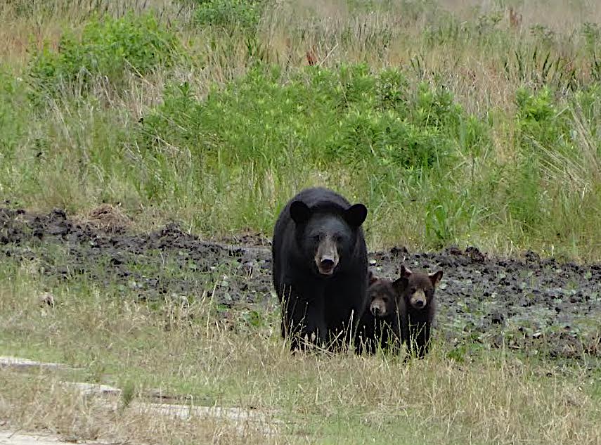
Black bear sightings on terrain along the Alligator River aren’t uncommon (above), but few people had stumbled across bears within the Buckridge Coastal Reserve before Manda and a student researcher had a chance encounter with one. Credit: Anton Joubert/USFWS.
Early on the morning of the trip, we set about hitching a trailer with an all-terrain vehicle (ATV) to one of my department’s field trucks. We were to use the two-seater ATV to transport ourselves and equipment to the field sites that were on dirt roads far from the main road leading to the Reserve. These dirt roads typically have canals on one or both sides and may have downed trees or mud holes that make travel difficult, particularly after precipitation events.
We got to the field site quite early and were soon at work collecting data from the wells in the northern part of the Reserve. We completed the work in time for lunch, which we had at a pier overlooking the Alligator River. Since we did not want to put the ATV back in the trailer as we relocated to the southern section of the Reserve, we decided to each drive one of the vehicles: I would drive the ATV, and Katie would drive the truck and trailer.
Katie did not know the way to the entrance to the southern part of the Reserve, so I took the lead on the ATV while Katie followed behind me. In a few minutes we were at the intersection of the road leading to the southern sites and the main road. We decided to leave the truck at the intersection so that we could both get on the ATV to get to the field sites. I beckoned Katie to park behind me, but to my astonishment she decided to drive the truck and trailer across a muddy, soggy shoulder and straight into a ditch!
I got off my ATV to survey the situation. The truck and trailer were truly stuck. I asked Katie to pull forward, to no avail. I asked Katie to pull backwards. No luck either. At this stage, we were left with no choice but to temporarily abandon our fieldwork to seek help from local residents to help pull us out. We drove the ATV to the nearest house where we were directed to another house where guys with a truck and chains could help tow us out.
Credit: Matt Smith/ECU.
As luck would have it, we found the right people to help us out of our predicament. Two young men got in their vehicle and came to the truck to help us out of the ditch. In just a few minutes, the truck was extricated and the two helpful young men were on their merry way. At this point, it was almost dusk and Katie assumed that we would be heading back home without the other data from the southern part of the Reserve. Katie was mistaken!
We jumped onto the ATV and started off for the remaining well sites. A few minutes down the dirt road into the Reserve, Katie pointed at something moving along the road in the distance.
“I think it is a bear,” I said.
“A bear? But we don’t have any protection!” Katie protested
“The ATV is sufficient protection,” I answered, “as long as we are driving and are on the ATV, we should be fine — on to the field sites!”
Sure enough, it was a bear that we saw. As we approached, it started running towards us on the narrow road.
“The bear is playing chicken with us,” I said, “and we are not going to blink!”
We raced towards each other and I started to sweat. About 30 feet away from the ATV, the bear leapt into the canal next to the road.
We continued on to our sites, seeing many bears of different sizes frolicking and playing on the dirt road. I have never seen so many bears in my life. In fact, in all my years working at the Reserve, the total number of bear sightings at the Reserve was only two. We quickly proceeded to the last well sites where I collected my valuable data and then started back to the truck and trailer.
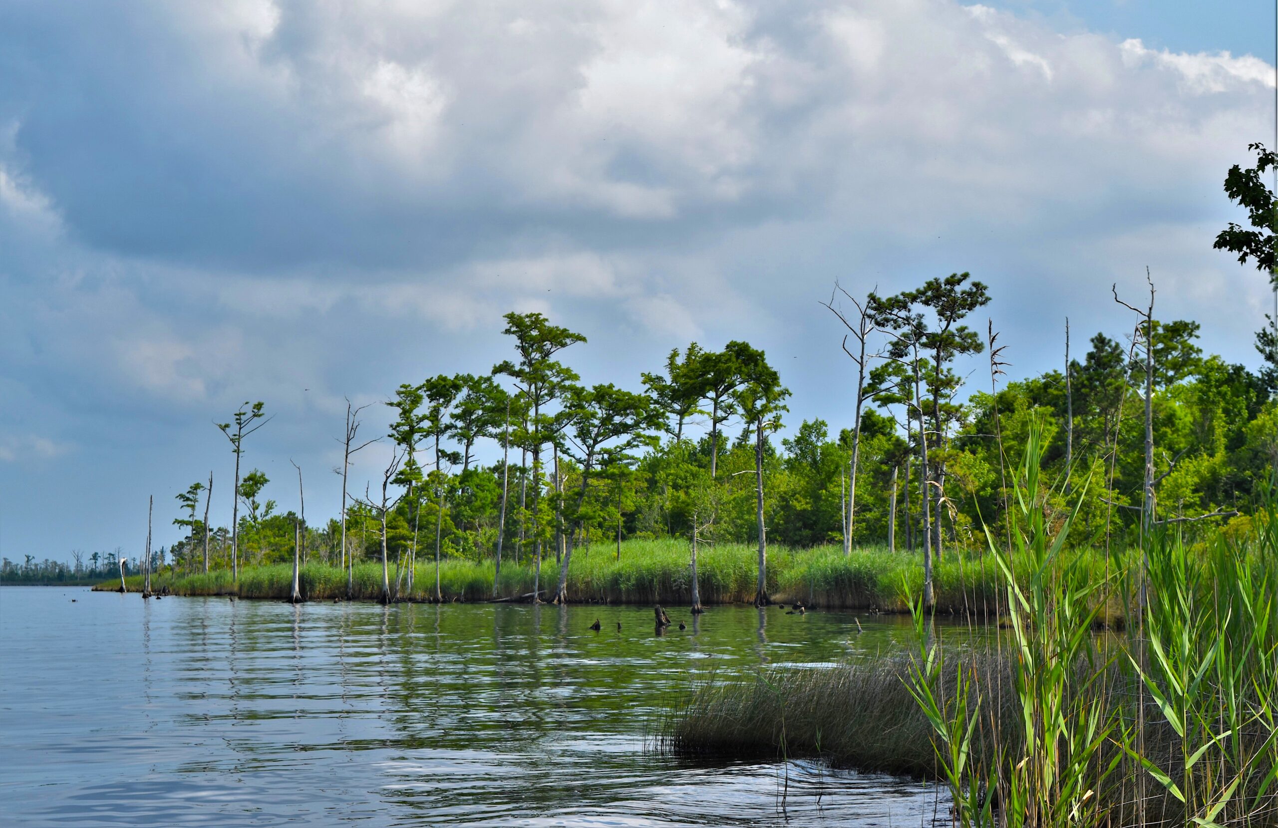
Manda’s work has shown that wind tides are in fact the major drivers of saltwater into the Buckridge Coastal Reserve. Credit: NC Wetlands.
By the time that we got back to the truck, it was dark. With data from the groundwater wells in hand, we loaded the ATV into the trailer and started off back to Greenville. Katie was very glad we were in the truck heading back to civilization. I was just glad we got to collect all the data that we needed for us to test the hypotheses for this particular study.
The results of our study confirmed our original hypothesis that the driver of saline water into the wetlands of the Emily and Richardson Preyer Buckridge Coastal Reserve was wind tides, and indicated that the source of the saltwater intrusion was the large constructed canal. Subsequent study identified the Pamlico Sound as the main source of the saltwater.
Since the region is protected from the ocean by almost uninterrupted barrier islands, astronomical tides have little influence on the daily water fluctuations in the region. Thus, wind tides were the major drivers of saltwater in the region. So, when the wind blows hard from the south, saltwater from the Pamlico Sound is pushed up the Pamlico River, through the Pungo River, along the Alligator-Pungo River canal, and ultimately to the Alligator River where any adjoining canals are overrun by saltwater. These are complicated processes that threaten agriculture in low-lying fields of the Inner Banks.
Our study was located in a part of one Reserve, but saltwater intrusion into agricultural fields occurs in several low-lying coastal counties of eastern North Carolina. Bears might not care about saltwater intrusion, but as coastal populations continue to grow, and as sea level continues to rise, saltwater intrusion problems will continue to be of major interest to humans for the foreseeable future.
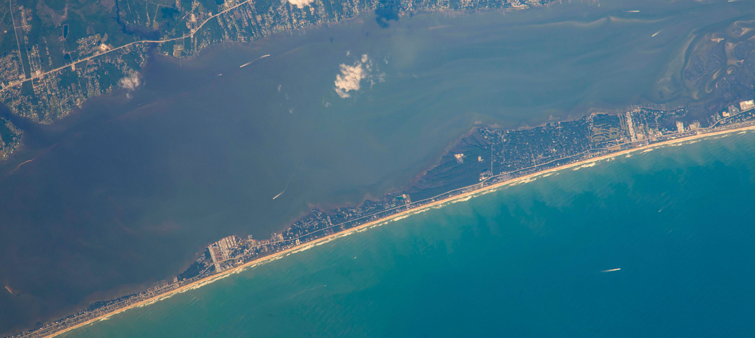
Pine Knoll Shores, site of Alex K. Manda’s latest work. Credit: ISS/NASA.
NEW RESEARCH: A CUTTING-EDGE APPROACH TO STORMWATER IN PINE KNOLL SHORES
Stormwater flooding is a major problem in many coastal regions. In the eastern U.S., such as on the barrier islands of eastern North Carolina, stormwater flooding is of particular concern because stormwater flooding events affect the emotional, physical, and financial well-being of seasonal and full-time residents of these coastal communities.
One strategy that has been implemented in other areas to reduce the amount of stormwater flooding involves the use of groundwater pumps to lower the water level beneath the ground. This strategy is based on the idea that the water in the ground can quickly rise to the land surface during heavy rainfall events. If, however, water managers can pump water out of the ground before a rainfall event starts, then more water can infiltrate the ground before the rainwater starts to pond on the ground surface.
If successfully implemented, this technique could reduce the amount of surface water runoff and stormwater flooding. Unfortunately, water managers do not currently have good tools (other than weather forecasts) to help them determine when it would be appropriate to initiate preemptive groundwater pumping strategies in readiness for potential flooding.
We are currently working with the town of Pine Knoll Shores to test a machine learning approach that would provide the water managers in the town with the information and indicators needed to start pumping before a rainfall event. One of the goals of the project is to build a mobile phone application that will use artificial intelligence to predict groundwater levels based on previous and current weather conditions. The application would then help water managers determine when to turn on groundwater pumps to start lowering the water table based on current groundwater levels, forecasted rainfall amounts, and other information.
If successful, this approach is likely to make coastal communities more resilient by providing coastal water managers with the tools for addressing stormwater flooding.
North Carolina Sea Grant supports Alex K. Manda’s machine learning approach to stormwater management as one of several projects addressing the impacts of weather events, among many other topics of importance in our coastal communities.
more about North Carolina Sea Grant’s research funding opportunities
lead photo credit: Matt Smith/ECU.
