Revealing The Deep: Teachers Explore Undersea Research and Technology

Inside a university auditorium, researcher Carrie Thomas leads science teachers on an exploration of the deep, dark sea.
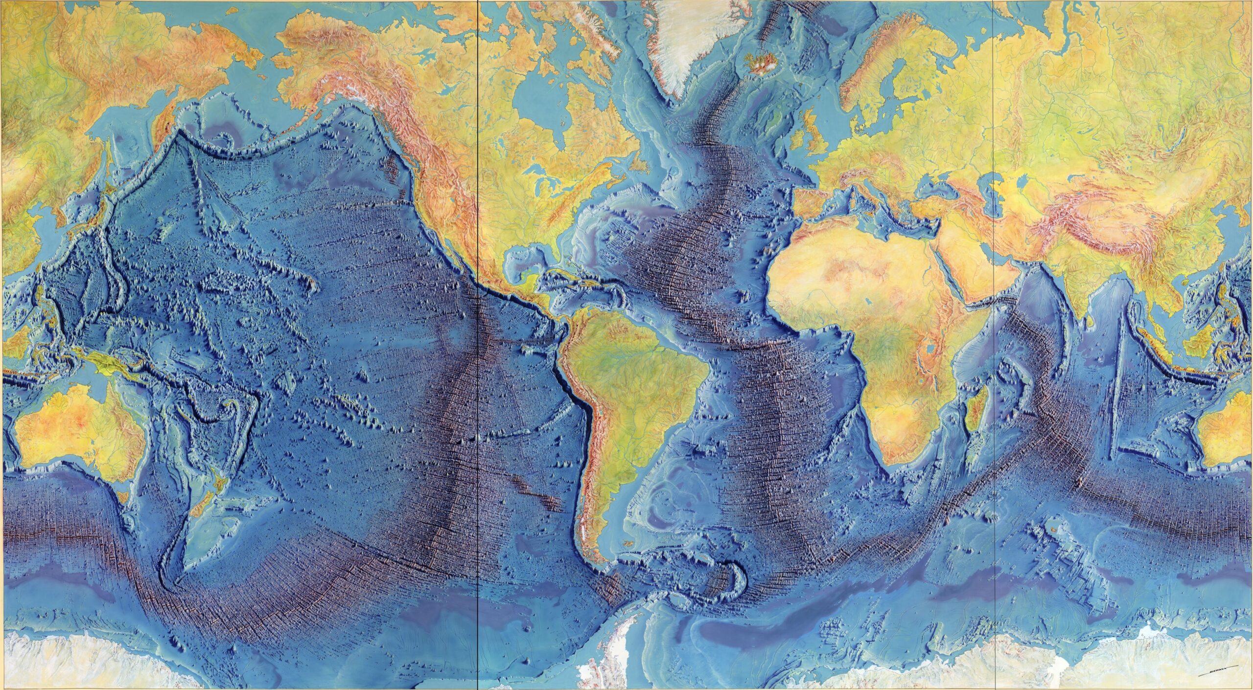
Thomas shows educators a quick way to measure topography — known as “relief — formed by mountain ranges, plains and canyons on the ocean floor. By using a simple shoe box with holes punched in the lid and other household materials, Thomas demonstrates how to map underwater terrain.
“This two-dimensional bathymetric or topographic map of submerged landforms creates a great visual picture of the ocean bottom for students,” explains Thomas, a North Carolina State University researcher and specialist with the Center for Ocean Sciences Education Excellence — Southeast (COSEE-SE).
“Today, oceanographers use advanced sonar systems for exploring and mapping the sea floor. In the old days, they used lengths of lines with lead weights at the ends to investigate depths of the ocean.”
To simulate soundings from today’s acoustical sonar, the teachers insert wooden sticks into the holes in their boxes. Each box contains a shaped foam liner or solid objects, such as rocks or blocks, which would correlate to lumps and bumps on the ocean floor. When the stick strikes a hard surface, teachers read the measurement and record results onto a paper grid.
Once the depth data is plotted, the teachers draw lines connecting points of the same depth to provide the two-dimensional profile of the box bottom. Finally, they open the boxes to reveal the three-dimensional simulated underwater contours and compare them to the map.
“The mapping activity surprised me,” says Sufiana Conover, an eighth-grade science teacher at Edwards Middle School in Rocky Mount. “The sudden drop in elevation was unexpected.”
The exercise is part of the 2008 COSEE-SE Leadership Institute held at the University of North Carolina Wilmington’s Center for Marine Science. This year the theme was “Undersea Research and Technology: Revealing the Deep.”
Throughout the week, scientists presented results from research projects and ocean explorations — sharing how physical, biological and chemical concepts are applied in the investigations. Topics included coral reef systems and light characteristics of the deep sea.
“This annual institute coordinated by COSEE-SE is a great way to link educators with scientists so that the teachers can learn about current research in marine sciences,” explains Terri Kirby Hathaway, North Carolina Sea Grant marine education specialist.
ADVANCING OCEAN EDUCATION
COSEE-SE serves North Carolina, South Carolina and Georgia. The organization is headquartered in Charleston at the South Carolina Sea Grant Consortium. Partners include North Carolina and Georgia Sea Grant programs and University of Georgia Marine Extension Service.
Middle and high school teachers and informal educators attended the institute in Wilmington. In addition to the COSEE-SE partners, the institute included the N.C. Aquarium at Fort Fisher, Massachusetts Institute of Technology (MIT) Sea Grant and several programs of the National Oceanic and Atmospheric Administration, including the National Undersea Research Program (NURP), Ocean Exploration and National Marine Sanctuaries.
“I am excited about this institute,” says Patti Grammens of South Forsyth Middle School in Gumming, Ga. “I like implementing ocean topics into physical science classes because it gets kids so excited.”
Each year, institute participants are selected based upon professional development needs, as well as the percentage of underrepresented students in their classrooms. The COSEE-SE staff also considers the teacher’s experience and desire to integrate science inquiry into classroom lessons.
At the 2008 institute, each teacher built a Remotely Operated Vehicle (ROV) to bring back to his or her home classroom.
Small ROVs can carry sensors and cameras to enable scientific study. Commercial or research ROVs add sophisticated video cameras and lights, to serve as “underwater eyes” during deep-sea explorations where divers or other submersibles cannot be used due to safety or weather conditions.
For both the simple and more advanced ROVs, a technical operator aboard a surface vessel controls the movements of the underwater tool.
“It is important for students to learn about undersea technology,” says Margaret Olsen, institute coordinator. “Most students know more about Mars than the undersea world. There are many underwater critical habitats that need to be protected.”
To construct the ROVs, educators used a kit provided by MIT’s Sea Perch project. As part of an Office of Naval Research’s (ONR) Initiative, the program teaches students how to build an underwater vehicle constructed out of PVC pipe.
“I plan on my students making ROVs and participating in a Marine Advanced Technology Education Center competition,” says Sandy Cecelski of Ashley High School in Wilmington, referring to the contest known as MATE. (See story on North Carolina MATE winners on page 2.)
ROVs range in size from a bread box to a small truck, according to NOAA. Deployment and recovery operations vary — from dropping the ROV over the side of a small boat to complex deck operations involving large winches for lifting and A-frames for swinging the ROV to the sea surface.
The U.S. Navy first used ROVs in the 1960s to perform deep-sea rescue operations to recover objects from the ocean floor. Later, the oil and gas industry began using the robots for offshore sites. By the mid-1980s, the marine research industry used ROVs to study deep-sea resources and environments.
“Sonar maps give us a good picture of the bottom contours, but we still need images and samples to know what kind of habitat is down there and what lives in it,” notes Andy Shepard, director of the NURP Southeast Regional Center based at UNCW.
MYSTERIOUS REEFS, NEW SPECIES
COSEE-SE considers the South Atlantic Bight (SAB) region as the “backyard ocean” for the region extending from Cape Hatteras, N.C., to Cape Canaveral, Fla. A bight is an embayment, or a long, gradual bend or recess in the coastline. The Gulf Stream and the edge of the Continental Shelf form the eastern edge of the bight.
“The SAB covers more than 100,000 square nautical miles. Its sea floor is almost 20 percent live bottom, or rock reefs covered with attached algae or animals,” Shepard explains.
That is a higher percentage of shelf hard bottom than what is found in the mid-Atlantic region to the north, or in the Gulf of Mexico, with the exception of the Florida Keys, Shepard adds. That makes the SAB home to many unique and productive deep coral habitats, according to UNCW researcher Steve Ross in a 2007 article published in Oceanography.
“The warming by the Gulf Stream helps maintain a productive subtropical reef community on the outer shelf and as far north as Cape Hatteras.” Two types of deep-sea corals are dominant in the underwater habitats of the SAB — Oculina varicosa and Lophelia pertusa.
Better known as ivory tree coral, Oculina varicosa is found on the Oculina Banks, which extend from Fort Pierce to Cape Canaveral off the eastern coast of Florida. Oculina colonies provide valuable habitat for a variety of fish species, including the economically important snapper/ grouper fishery.
During the 1960s and 1970s, the Oculina Banks area was a popular place for fishing boats, especially those looking for grouper, according to NOAA’s Marine Protected Area Web site. In the 1980s, shrimpers and scallop fishermen also started coming to the banks, often dragging their gear, Shepard says.
By the early 1990s, much of the fragile habitat had been altered, and fish stocks appeared to be severely depleted, according to NOAA. Current regulations ban fishing and trawling in some areas in efforts to reestablish reefs and associated fish populations. The Lophelia reef system is found from North Carolina to the Blake Plateau off South Carolina and south through the Straits of Florida. Lophelia pertusa, a hard coral, dominates this ecosystem.
Scientists are just beginning to investigate these mysterious deep-reef systems. “These poorly studied, fragile ecosystems are extensive, concentrating biodiversity and resources and providing enhanced productivity on the southeastern U.S. Continental Shelf,” Ross says. “In every animal group examined so far, we find species new to science,” he adds.
LINKING TEACHERS TO SCIENTISTS
Established in 2003, COSEE-SE is one of 12 COSEE centers across the United States. All receive funding from the National Science Foundation, NOAA, Sea Grant programs and ONR.
COSEE-SE coordinates professional development programs that rotate through the region. This year was the third Ocean Sciences Education Leadership Institute held in North Carolina. The first institute was held in Wilmington in 2003. In 2005, teachers gathered at the Trinity Center on Bogue Banks to learn about estuaries. COSEE-SE also sponsors Coastal Legacy workshops each summer that connect applied research to coastal communities.
Throughout the year, COSEE-SE is known for helping teachers find unique research experiences — in some cases aboard vessels gathering critical data. Last year, Kelly Smith of Smith Middle School in Chapel Hill joined Skidaway Institute of Oceanography scientists on a cruise to study continental slope sediments off the coast of New Zealand.
In May, Jan Healy, media specialist at Green Hope High School in Gary, went on NOAA’s RV Pelican in the Gulf of Mexico with researchers from NC State. As a guest teacher, Healy studied dinoflagellates, one type of marine plankton. “COSEE has opened up so many opportunities for me,” says Healy, who joined the 2008 institute team as an assistant instructor.
COSEE-SE also collaborates with regional research projects in ocean observing, climate change and deep-sea corals. For the SouthEast U.S. Atlantic Coastal Ocean Observing System (SEACOOS), COSEE-SE developed a series of posters and lessons on waves, hurricanes and ocean currents. The posters and information are available online from the Southeast Coastal Ocean Observing Regional Association.
“The challenge for any professional development program is to provide resources to the teachers that can be brought into their students’ world,” says Lundie Spence, COSEE-SE director and former marine educator for North Carolina Sea Grant.
The 2008 institute participants developed at least one teaching unit based on undersea research and technology. They plan to pilot the lessons in their classrooms. “I am thinking about doing a unit on density, basic chemistry and other physical properties,” Grammens says.
In addition, participants coordinate an Ocean Awareness Day for high school and middle school teachers at a museum, aquarium or education center. These events are part of the SouthEast Portal to Ocean Research for Teachers – known as SEPORTs.
In North Carolina, institute participants plan to conduct workshops at the N.C. Aquariums, the N.C. Museum of Natural Sciences and other educational centers.
“At COSEE-SE, we are trying to create leaders in marine education,” Olsen says. The program team also hopes to bring more visibility to a variety of ocean careers — from a marine technician to petroleum engineer.
“Learning new technologies, like those used in deep-sea exploration, is helping teachers get the next wave of engineers and ROV pilots ready for the high tech-job market,” Hathaway says.
“Government and industry needs knowledgeable young people who can design and program ROVs, as well as other marine technology, and keep them working.”
This article was published in the Autumn 2008 issue of Coastwatch.
For contact information and reprint requests, visit ncseagrant.ncsu.edu/coastwatch/contact/.


