Learning from the Past: Old Maps Help Build A New Future For The Eastern Oyster

In the age of online mapping services, paper maps may seem obsolete — but try telling that to Eugene Ballance, an Ocracoke fisherman who is transforming 118-year-old survey maps of Pamlico Sound into blueprints for restoring the Eastern oyster.
Using satellite mapping and sonar imaging technology, Ballance is modernizing a dozen maps created in 1886-1887 by Lt. Francis E. Winslow, a naval officer who surveyed the sound’s then-abundant oyster reefs.
The projections, or intersecting coordinate lines, on Winslow’s oyster maps are impeccable, says Ballance, who is also a mathematician. “They are better than anything that’s been done since then,” he insists.
Although Winslow’s projections remain accurate, the large, productive oyster beds he described are gone.
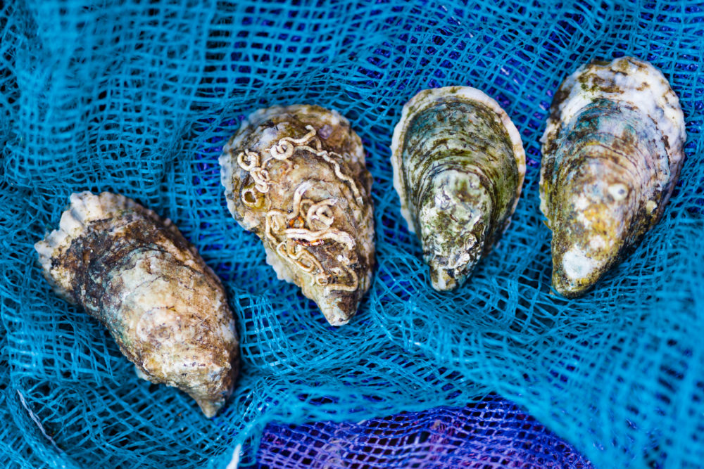
Eastern oysters (Crassostrea virginica) have declined steadily in Pamlico Sound for more than a century, mostly due to habitat destruction, water pollution and disease. The
disappearance of these “ecosystem engineers” — which filter water and provide habitat for dozens of aquatic creatures — is a trend Ballance and others in coastal North Carolina are trying to reverse.
To transform Winslow’s work, Ballance is using Geographic Information Systems (GIS), a computerized mapping program that combines thousands of data points from a certain place into “layers” of information. The result will be multi-layered, digital maps that show where oyster reefs once thrived and where they could likely thrive again — information that helps scientists and policymakers better focus restoration efforts and dollars.
Ballance received funding for the project from the N.C. Fishery Resource Grant Program (FRG), funded by the N.C. General Assembly and administered by North Carolina Sea Grant.
To get the thousands of data points required for each layer, Ballance begins by locating an oyster reef that appears on a scanned version of Winslow’s map. Next, he digitizes areas in the pixel coordinates of the scanned map. Ballance then projects this information to latitude and longitude coordinates using “control points,” or features on the map that remain in today’s surveyor databases.
After completing these steps, Ballance must field-check the new coordinate files. First, he transfers the files to a hand-held computer and verifies the coordinates using Global Positioning System (GPS) technology. GPS uses satellite signals to calculate exact positions of objects on earth. Then Ballance samples the area with a small, toothless scallop dredge to determine how much of the reef is left. Finally, he uses sonar imaging to take a picture of the sampled area.
REFORMING RESTORATION
Although the process is complicated, the results simplify choosing a restoration site, notes Jeffrey DeBlieu, director of The Nature Conservancy’s (TNC) Pamlico Sound Oyster Reef Restoration Project.
“It removes some of the guesswork about where we should be restoring oysters,” he says. And that’s a good thing, he adds, because restoration isn’t cheap.
In 2001, TNC received a multimillion-dollar grant from the National Oceanic and Atmospheric Administration (NOAA) to begin working in coastal systems. The North Carolina chapter of TNC received some of that grant to restore the Eastern oyster population in Pamlico Sound. The organization is cooperating with several partners, including the N.C. Division of Marine Fisheries (DMF) and North Carolina Sea Grant.
Before Ballance’s mapping project, site selection lacked a solid historical baseline. “But Gene’s work provides a very strong foundation for us to work from,” says DeBlieu. And the early results have already proved useful.
“We’ve utilized some of Gene’s information to do the first large-scale oyster sanctuary up in the Crab Hole area, between Oregon Inlet and Stumpy Point,” notes Craig Hardy, the DMF section chief for resource enhancement.
DMF and TNC also used Ballance’s data to help develop a sanctuary at Clam Shoal, located behind the southeast corner of Hatteras Island, and another in waters just north of Ocracoke Island.
The Clam Shoal and Crab Hole restoration sites are about 30 acres apiece, and each now contains numerous five- to six-foot-high oyster reefs built of limestone marl.
“It takes five or six years for a pile of limestone to become an oyster reef,” says DeBlieu. The new reefs are developing on schedule. Baby oysters, barnacles, fish and shrimp are already a regular sight, notes DeBlieu, who went scuba diving at Clam Shoal last summer and at Crab Hole in the fall.
“It’s not a beautiful place, like a coral reef,” he admits. “It’s kind of dirty and muddy and crummy looking — but that’s an oyster reef. It’s not real photogenic.”
The Pamlico Sound project will support additional reefs at each site next summer. The hope is that Clam Shoal and Crab Hole one day will be restored to large, continuous reefs similar to those documented by Winslow, says DeBlieu.
A SUPERIOR PIECE OF HISTORY
In 1998, Ballance was mapping sea grass beds near Ocracoke and Hatteras Inlet as part of another FRG project when he was inspired to apply GIS to Winslow’s oyster maps.
But it wasn’t until several years later that he met DeBlieu, who also had thought of applying GIS to Winslow’s maps. Pooling their collective resources and knowledge, Ballance and DeBlieu identified their first hurdle: obtaining the original maps.
Because each map is roughly the size of a large kitchen tabletop and hand-drawn on tracing cloth — “it’s like wax paper with fibers in it,” describes Ballance — they weren’t allowed to leave the N.C. Archives. Instead, state officials agreed to scan them at the Outer Banks History Center on Roanoke Island and give digital copies to Ballance and DeBlieu.
Archives technician Kelly Grimm scanned each chart in eight sections, making sure certain points on each of the scanned sections overlapped so she could “stitch” the digitized pieces back together. Just as in Winslow’s time, precision was critical: “If one section is off kilter, it throws the whole map off kilter,” she says.
Luckily, finding distinct points on the maps was fairly easy. In addition to Winslow’s meticulous drawings, he and his crew also left some personal touches behind.
“I can tell through the fine detail that different people worked on different projections,” says Ballance, noting subtle variation among handwritten letters and numbers.
Accidental details were equally distinct.
“You can see the stains on the maps where the men were working,” says DeBlieu, referring to the occasional ink smear.
After the maps were scanned successfully, Ballance received an FRG in 2003 and began applying GIS technology to Winslow’s work.
During the past two years, Ballance has spent countless hours checking, or “ground-truthing,” Winslow’s projections and determining how much of the historic oyster reefs remain.
Ballance has verified about a third of the area depicted on Winslow’s survey maps. The biggest documented reef measured 230 acres in continuous area, but now only exists in small patches. But no matter the current condition of a reef, Ballance is continually impressed by Winslow’s projections.
“I’m amazed every time I go to one of these beds and see that they could maintain that accuracy through the whole project,” he says.
Winslow and his crew probably worked from a sailing schooner for days on end, only going to shore for food and supplies, Ballance says. Winslow calculated the projections using horizontal sextant angles, measurements taken from three fixed, visible objects on the water that also were identifiable on a nautical chart.
“Without electronics, that was state-of-the art back then,” explains Ballance. And when he puts the projections on Winslow’s maps up against modern maps, Winslow remains superior. “They [Winslow’s maps] were doing better than my nautical chart!” exclaims Ballance.
WINSLOW’S BIGGER PLAN
But Winslow wasn’t surveying oyster reefs simply for historical record.
He had been hired by the state legislature to determine if Pamlico Sound contained enough oysters to support a commercial fishery. The oyster business already was booming in Maryland and Virginia’s Chesapeake Bay in the 19th century. North Carolina hoped similar economic gains could come from its waterways.
Almost immediately after completing the survey, Winslow retired from the Navy and started the Pamlico Oyster Company, appointing himself chief operating officer, according to Kathleen Carter, a historian at High Point University. He planned to sell areas near larger, more productive reefs as private leases. He designated the bigger reefs as “Public Grounds,” hoping they would provide spawning stock for nearby private leases.
When the survey results were released in 1888 confirming an abundance of oysters, it created what Carter calls an “oyster bonanza” in Pamlico Sound. Companies and private fishers from the crowded Chesapeake began arriving in droves. Sales of leases skyrocketed.
Some historians blame Winslow’s survey as the beginning of the end for North Carolina’s natural oyster reefs. But Ballance believes that’s a matter of perspective. “That’s like saying if someone had killed Christopher Columbus, then the New World never would have been discovered. It may have delayed it a few years, but that’s about all.”
Despite the economic gains from oysters in the late 19th and early 20th centuries, tensions escalated among local fishers and transients. By 1891, the state tightened its oyster harvesting laws, even authorizing the use of force to remove “oyster pirates,” a term for fishers from outside the state, notes Carter.
By 1892, Winslow had a severe public image problem. Many accused him of omitting details about the Public Grounds beds from his written survey reports. One senator from Hyde County said Winslow “defrauded North Carolina of its richest oyster beds,” according to Carter.
Some of Winslow’s survey reports appear questionable. In one report, Winslow wrote: “Another small unimportant bed lies between Ocracoke Island and Howard’s and dark’s Reef.”
The survey maps show that this “unimportant” reef indeed existed; yet nearby was the fifth largest oyster reef in the entire sound, notes Ballance. “He just sort of left that out.”
As suspect as the omission seems, Ballance points out that it may have had more to do with politics than personal greed. He cites one of Winslow’s survey reports from a November 1887 meeting with the state’s shellfish commission: “The fourth meeting of the board was held on November the 26th, and the areas, limits and locations of the Public Grounds of the Counties of Hyde and Carteret were determined.”
Despite his role as surveyor, Winslow didn’t have the final say on Public Grounds, contends Ballance. Whether or not the allegations were true, outside skepticism remained such that the Pamlico Oyster Company shut down in 1892. Winslow eventually retired to Connecticut, where he died in 1908.
BRINGING BACK THE OYSTERS
Today, there are no more political squabbles over the abundance of oysters in Pamlico Sound. Instead, tensions more likely are fueled by the declining stock.
In 2003. the amount of oysters commercially harvested barely reached 49,000 bushels, according to the DMF. That figure is considerably lower than the record 1.8 million bushels landed in 1902, the year many consider the peak of oyster harvesting in North Carolina.
Habitat loss, pollution, overharvesting and diseases like Dermo (Perkinsus marinus), a tiny parasite that kills oysters when they reach reproductive age, all have contributed to the decline.
“If we can bring a healthy oyster population back, it will benefit not only commercial harvest, but also habitat for other important finfish and crustaceans,” says Hardy.
Moreover, oysters play a critical role in the overall health of estuarine systems, adds DeBlieu. “Oysters aren’t simply to be dredged up and eaten,” he says.
As the Pamlico Sound Oyster Reef Restoration Project continues, Ballance’s GIS maps will help focus the restoration effort. “I think any oyster reef we build out there will be at a site based on Gene’s work,” says DeBlieu.
“It gives us another layer in our selection process,” concurs Hardy.
Once a potential restoration site is identified, scientists assess the area’s water quality, substrate and salinity. Sometimes they find healthy, natural oyster rock and try to expand that area by restoring adjacent sites, explains Hardy. At other times, they find only piles of old shells with some struggling spat, or baby oysters, attached. In those cases, scientists must weigh the odds for successful restoration against the overall restoration effort.
“The ultimate goal is to restore the resource,” says Hardy.
Reaching that goal may take decades, even centuries, but Ballance’s vision for Winslow’s maps elucidates the interim steps. The mathematician is more than happy to share the credit though:
“His [Winslow’s] party in the 1880s accomplished in two years a feat that has yet to be equaled to this day, even with all our electronic gadgetry,” says Ballance. “It failed in its original purpose of promoting the oyster industry in North Carolina, but may — in this century — succeed in reversing the decline in our remaining oyster habitat.”
This article was published in the Winter 2005 issue of Coastwatch.
For contact information and reprint requests, visit ncseagrant.ncsu.edu/coastwatch/contact/.
- Categories:


