Navigating Coastal Transportation Needs
As the next 10-year, statewide transportation plan is expected to become final in June, the timing of new projects is drawing attention from North Carolina’s coastal communities.
“Those transportation decisions are critical to local governments,” notes Rhett White, Columbia’s town manager and chair of the Albemarle Rural Planning Organization’s Transportation Coordinating Committee.
“There is no question,” he adds. “Highways, bridges, ferries and other projects are critical for residents who are commuters, and also for visitors, general transportation of goods and services, evacuation routes, etc.”
Mayor Debbie Sloan Smith of Ocean Isle Beach agrees. “Of course, it is always a challenge to meet all the needs that have been identified,” adds Smith, who also chairs the N.C. Beach, Inlet and Waterway Association.
As part of a process that repeats every two years, the new draft State Transportation Improvement Program, known as the STIP for short, was released in December. It is currently available for public comment until April 23. The N.C. Board of Transportation is expected to approve the final STIP in June.
“North Carolina is one of the fastest-growing states in the nation, and we have to make investments in our infrastructure to support this growth,” notes Secretary Tony Tata of the N.C. Department of Transportation.
Tata is among the speakers at North Carolina’s Coastal Conference on April 14 in Raleigh. The conference is sponsored by the University of North Carolina System and hosted by North Carolina Sea Grant.
New Priority-Setting Process
The 2016-2025 STIP is the first plan developed under the new Strategic Transportation Investments, or STI, law that was approved by the North Carolina General Assembly in 2013.
The STI law established the Strategic Mobility Formula that DOT describes as a “transparent, data-driven process to rank transportation projects on statewide mobility, with local input on regional and division levels.” In other words, the goal is to meet the state’s top priorities while also providing flexibility to address individualized local needs.
“This is just the beginning. We will continue to build our infrastructure from the mountains to the coast, rural to urban, which will better connect people to jobs, education and health care,” Gov. Pat McCrory said when the plan was announced.
The formula, which encompasses all modes of transportation, first identifies projects of statewide significance, and allocates 40 percent of the available dollars of the Highway Trust Fund. Projects that do not make the statewide list can then be considered — along with other regional and local needs — for the remaining 60 percent total funding to be distributed among the various DOT regions and local divisions.
Using the new formula, the DOT will be able to fund 478 highway projects across the state compared to 175 highway projects that would have been supported under the previous process. Despite these gains, the department is only able to fund a fraction of the 3,100 projects — valued at $70 billion — identified as needed by state and local leaders.
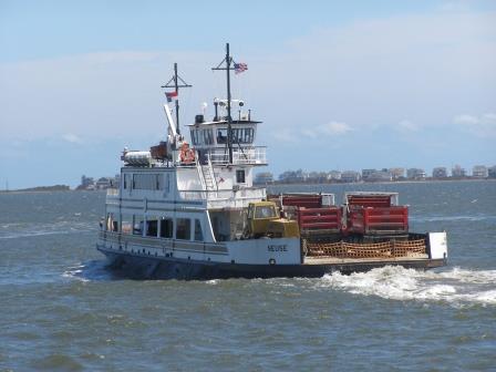
Of course, transportation includes more than roads. For example, North Carolina’s coast is known for its iconic ferries. Thus, projects for boats and landings are among the grand total of more than 1,100 STIP projects across the state, representing all modes of transportation.
The STIP includes construction of the Mid-Currituck Bridge to connect mainland Currituck County to Corolla. While the project did not meet the criteria at the statewide mobility level, the rural planning organization gave the project the maximum amount of support it could give to an individual project at the local level during the prioritization process. Because of this support, the project will be funded at the division level, thus reflecting local priorities.
DOT notes that the bridge will “address local needs by alleviating congestion on U.S. 158 and N.C. 12 and better connect the Outer Banks to the Hampton Roads region in Virginia.”
But the draft STIP did not include replacement of the U.S. 64 bridge over the Alligator River, a project that White considers critical in terms of safely meeting the volume of 18-wheelers and other traffic heading to and from the Outer Banks.
“We all understand the changes in the funding formula,” White notes, adding that he continues to talk with DOT officials and local leaders to consider potential options for that project.
Along the central coast, projects include improvements to the causeway linking Morehead City and Beaufort, as well as completion of the Gallant’s Channel Bridge to Radio Island.
In the southern coastal area, projects include an expansion of the I-140/U.S. 17 corridor known as the Wilmington Bypass, as well as widening of N.C. 211 in Brunswick County that will ease beach season congestion and improve a key storm evacuation route.
For the complete draft 2016- 2025 STIP, go online to www.ncdot.gov/strategictransportationinvestments/.
A 25-Year Vision
Last fall, McCrory released his “25-Year Vision for North Carolina: Mapping Our Future,” which identifies 22 solutions for meeting current and projected transportation needs in four regions across the state.
Those include improvements for highway connectivity and rail service.

The coastal recommendations also include working with the U.S. Army Corps of Engineers to deepen and widen shipping channels “to support movements of the newest generations of shipping vessels.”
Inlets also receive attention in the recommendation for a long-range plan “providing important opportunities for industry and improved reliability for our vital ferry routes.”
And what to do with the sand moved in such projects? The governor calls for coordination with local, state and federal partners “to develop and implement a proactive, long-range plan for sustainable beach nourishment to protect infrastructure.”
The vision document notes the high costs involved with infrastructure improvements. It cites the need to explore new financing alternatives, such as public-private partnerships, and the necessity of taking advantage of the low interest rates currently available for bonds.
“The Governor’s 25-Year Vision provides a roadmap for long-term strategic investment that ensures we are making the most of our limited resources and proactively addressing the demands on our state’s transportation infrastructure over the next quarter century,” Tata says.
For more information and to view the Governor’s 25-Year Vision, visit .
This article was published in the Spring 2015 issue of Coastwatch.
For contact information and reprint requests, visit ncseagrant.ncsu.edu/coastwatch/contact/.
- Categories: