Healthy Ecosystems: How Much Ocean Floor Off the Southeast Coast Do Natural Reefs Occupy?
And how much more territory belongs to natural reefs than to artificial reefs?
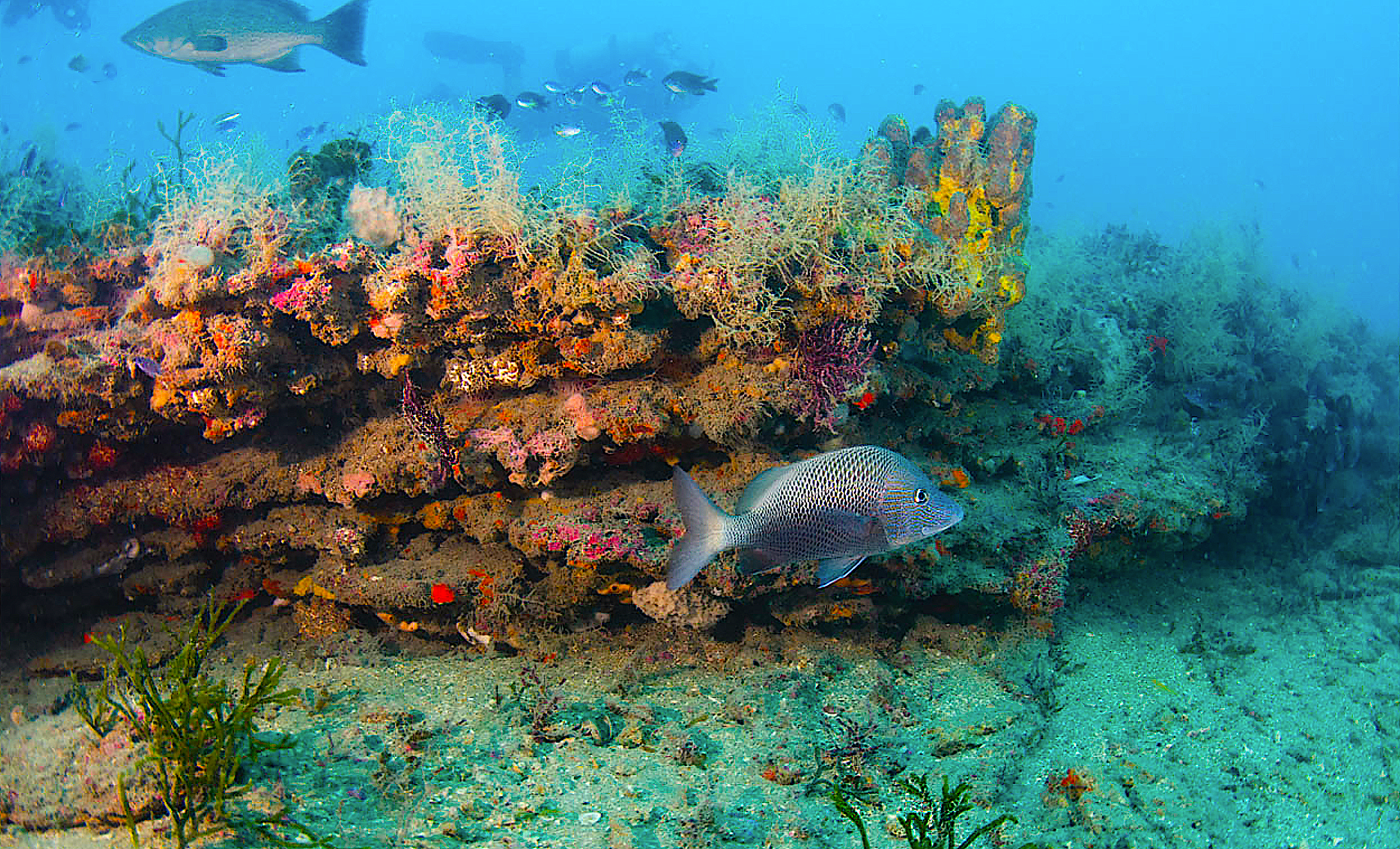
Natural Reefs – often referred to more inclusively as “hard bottom” – are important habitat for Finfish, invertebrates, and other environmentally and economically important fauna. In fact, hard bottom is one of six types of habitat worthy of protection under the NC Coastal Habitat Protection Plan.
Natural reefs include anything from true coral reefs to patches of rock — in other words, something other than the ubiquitous sand and mud that covers most of the Atlantic Ocean seafloor.
Previous estimates of hard bottom coverage in the Southeast’s waters are inconsistent and range from 3% to 30%. However, managers need accurate estimates to help with ocean planning (think offshore wind farms) and natural resource management (think fisheries).
A THREE-PRONGED APPROACH
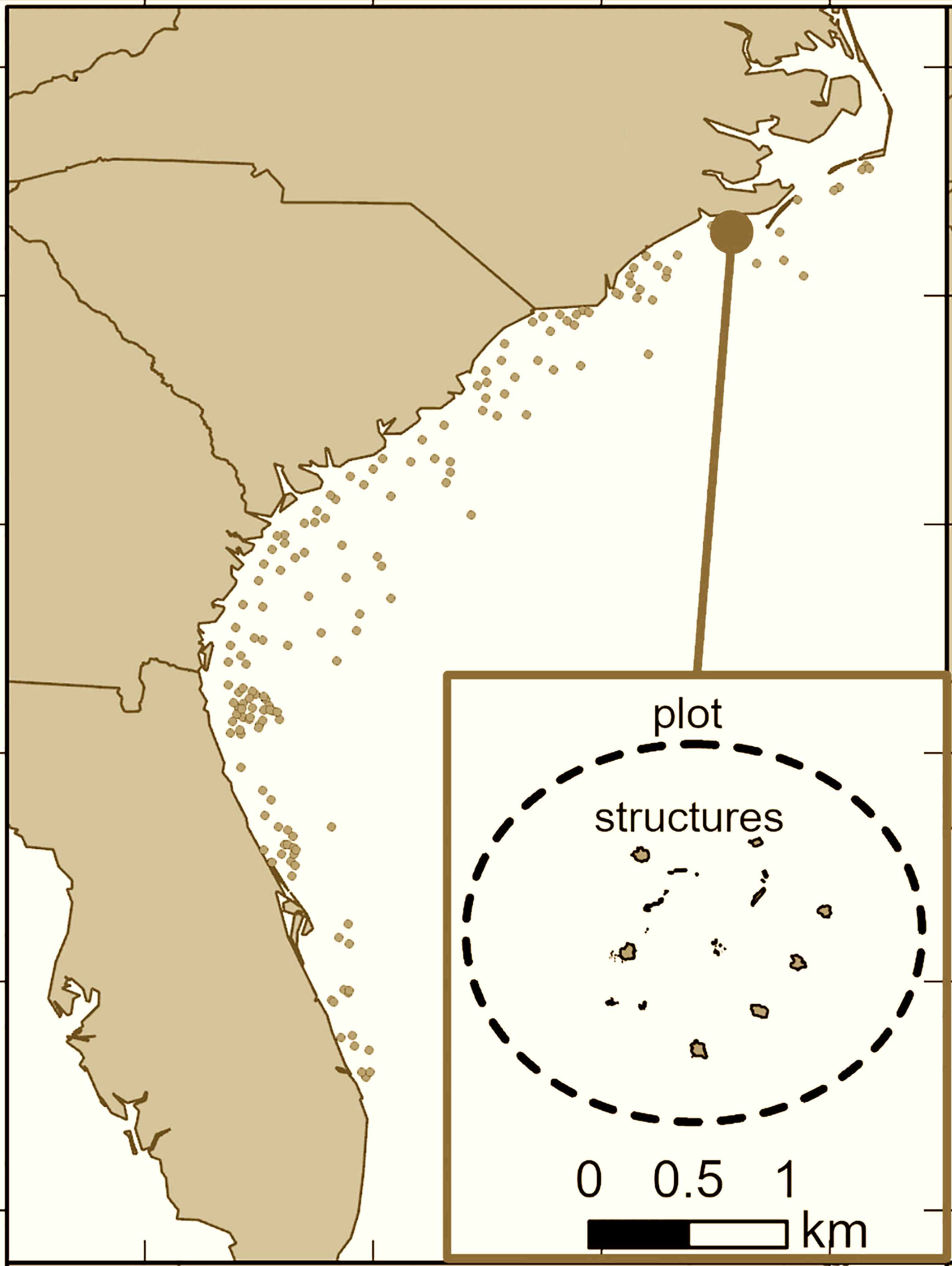
NOAA’s Avery B. Paxton and a multi-institutional team used several techniques to estimate the extent (spatial coverage) of natural and artificial reefs from offshore waters 33 to 650 feet deep — from Cape Hatteras, North Carolina, to Port St. Lucie, Florida. This comprised more than 64,000 square miles of ocean bottom.
The research team developed three separate coverage estimates of natural reefs using 1) existing survey data, sonar imagery, and information from fishers, 2) previously published habitat classification maps developed by The Nature Conservancy, and 3) a predictive computer model developed by scientists at NOAA Coastal Ocean Service.
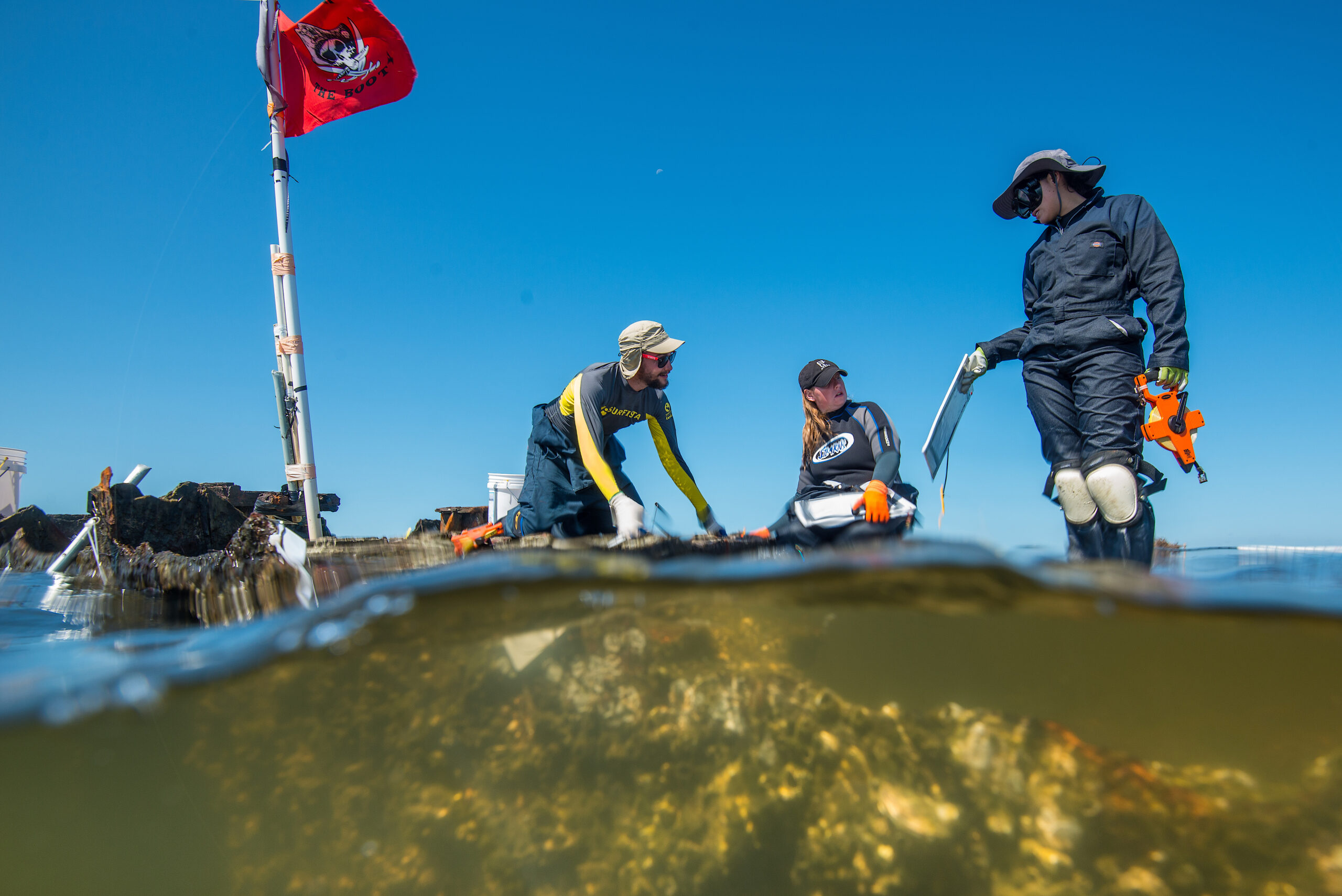
Determining the coverage of artificial reefs was a little more difficult, because North Carolina was the only state of the four in the study that kept detailed records of reef materials and used sonar imagery of each artificial reef as it sits on the bottom. This sonar imagery is critical for estimating the physical footprint of the reef. In fact, the team used the detailed North Carolina data to estimate the size of other states’ reef materials, because many of the reef materials were similar.
NATURAL REEFS VS. ARTIFICIAL REEFS
On average, natural reefs occupy 885 times more space than artificial reefs in the 64,000 square-mile area. Specifically, natural reefs accounted for 1,649 square miles of habitat and artificial reefs for 1.9 square miles. In other words, natural reefs accounted for 2.57% of the ocean bottom, and artificial reefs accounted for less than 0.01%.
Most artificial reefs offshore in the Southeast are in waters less than 200 feet deep, and reef materials, from most to least common, are concrete pipe, medium-size metal ships and barges, trains and containers, small concrete modules, and long-lived metal vehicles.
OUR STATES ARTIFICIAL REEFS
North Carolina maintains 43 ocean artificial reefs. The North Carolina Division of Marine Fisheries Artificial Reef Program hosts the Interactive Reef Guide that provides general information, coordinates, and even side-scan imagery of each reef.
In North Carolina waters, the measured footprint of the artificial reef permit area was 105 times larger than the study’s sonar-derived areas of actual artificial structures.
THE BOTTOM LINE
The study is unique in that it provides a baseline estimate of artificial reef coverage and also provides support for an estimate of natural reef coverage closer to 3% (rather than previous higher estimates). Because resource managers, recreational fishers, and researchers all like to know about artificial and natural reefs, it’s important to understand how much reef habitat is offshore.
Scott Baker is a fisheries extension specialist with North Carolina Sea Grant and co-curator with Sea Grant’s Sara Mirabilio of the award-winning Hook, Line & Science series, which originally published this story: HookLineScience.com.
lead photo credit: Dave Sybert/©the original study authors/Frontiers in Marine Science/CC BY.