NATURALIST’S NOTEBOOK: Silver Spawners: Restoring Shad to the Cape Fear
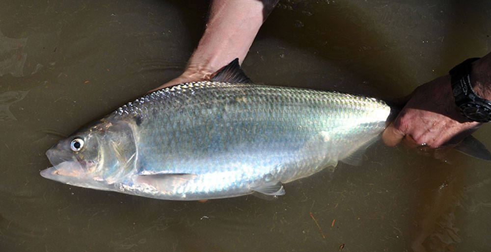
Ocean-dwelling American shad face daunting obstacles each spring when they try to reach historic spawning grounds on the middle Cape Fear River in southeastern North Carolina.
For nearly 100 years, three U.S. Army Corps of Engineers, or USACE, dams between Fayetteville and Wilmington have blocked migrations of shad and other fish, sharply reducing their populations, according to studies by various state agencies.
But the silvery shad, a favorite of anglers, should find the Cape Fear a bit more welcoming these days. Returning spawners will discover fish-friendly improvements advanced by the Cape Fear River Partnership — a coalition of 23 state and federal agencies, municipalities and conservation groups.
First, as shad come upstream from the Atlantic Ocean, they will no longer bump against the inclined wall of Lock and Dam No. 1, which is 39 miles north of Wilmington.
Instead, they can swim up a staircase of channels formed by a designed array of rocks to get over the dam. The $13-million rock arch rapids fishway, or a path over the dam, was completed in 2012.
Next stop on the river is 33 miles away at Lock and Dam No. 2 at Elizabethtown. There, just below the dam, arriving shad will find a newly placed, enhanced spawning habitat of underwater gravel beds.
Within the next few years, Locks and Dams No. 2 and No. 3, the partnership hopes, will get their own fishways. These would let legions of shad — and striped bass — return to optimum spawning grounds upstream in Harnett County and boost now-depressed fish numbers.
That reconnection could transform the river into one that teems with migratory fish. Biologists say more eggs might hatch, causing more young fish, called fry, to swim downstream to the ocean. Anglers could catch more shad and more stripers in more places; birds, catfish and turtles could feed on carcasses of adult shad that die after spawning; young shad could be forage for prized saltwater fish such as flounder, spotted seatrout and red drum; and fishing-related businesses in the lower Cape Fear region might see an economic boom.
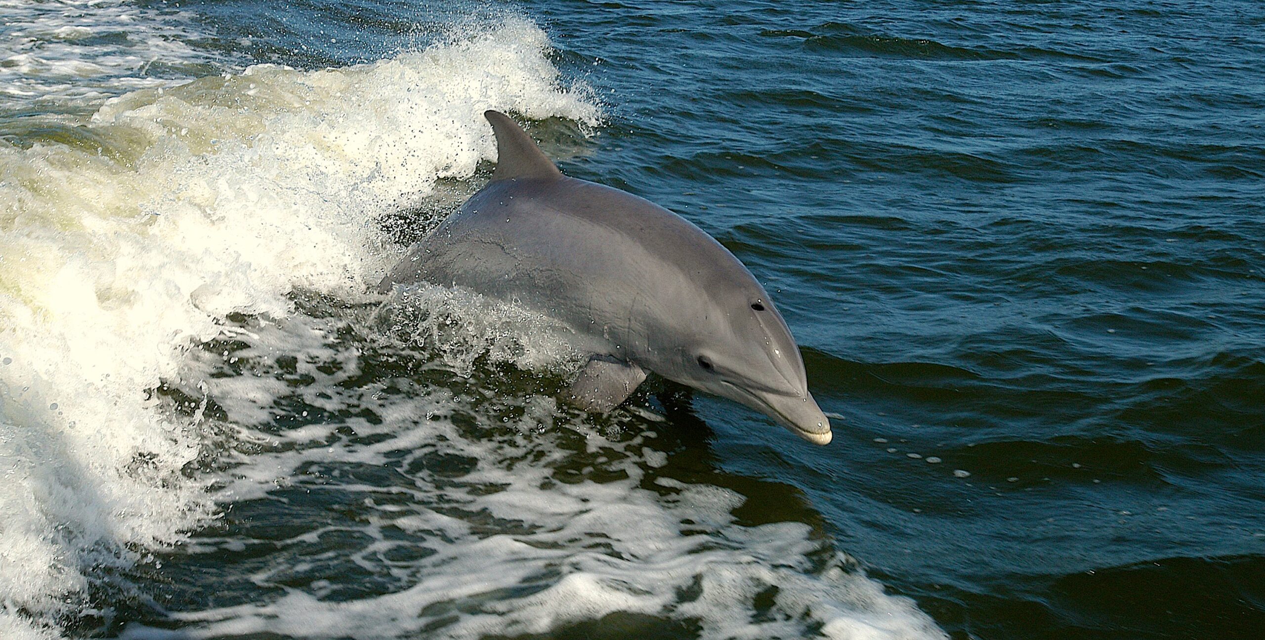
“I think you’re going to see ecosystem benefits,” says Kemp Burdette, Cape Fear Riverkeeper. “Having a healthy shad fishery would benefit towns up and down the river” — as would the winter striped bass fishery.
The proposed fishways and the spawning beds are major elements of a comprehensive plan to restore populations of shad, striped bass, river herring, and Atlantic and shortnose sturgeon in the Cape Fear. The Cape Fear River Basin Action Plan for Migratory Fish, drawn up by the Cape Fear Partnership, seeks to reopen river reaches by installing fishways or by taking down dams. Their plan also seeks to decrease nutrients that cause oxygen-robbing algal blooms, reduce the amount of toxic metals such as mercury and chemicals that are harmful to fish, and improve spawning and nursery habitats by rehabilitating or enhancing riparian buffers.
“The actions in this plan are important for Cape Fear residents who rely on improved fish access, water quality and habitat to support fisheries, tourism and recreation,” the action plan notes, “as well as provide clean drinking water.”
The ambitious plan gives no overall cost or timetable for achieving restoration but it likely will add up to millions of dollars and could take more than a decade.
DAM DISRUPTION
The main problem is dams. They block or disrupt 40 percent of the remaining historic spawning habitat in the basin. That includes habitat in the Deep and Haw rivers and other tributaries. The entire watershed, which extends above Greensboro, contains 1,100 dams. Among them are the USACE dams erected from 1915 to 1935 so commercial vessels could ply the river. The barriers force most shad and stripers to spawn in inferior habitat in the lower Cape Fear, producing fewer fry.
Fish do get beyond the dams — and have been doing so since 1961. The USACE uses the locks to move fish upstream on their spawning runs. Lockmasters open the locks three times a day, five days a week from mid-March through mid-May. Locking cycles take about three hours.
Fish locking ceased at Lock and Dam No. 1 last spring with the completion of the fishway. It continues at the two upstream dams. As the result of lockages, studies show an estimated 35 percent of the shad and 25 percent of the stripers have gotten past all three dams in recent years. Fishways, of course, have the potential to let fish through 24/7.
After Lock and Dam No. 3, it’s 46 miles to the Smiley’s Falls section near Erwin in Harnett County. Biologist Mike Wicker of the U.S. Fish and Wildlife Service says if the bulk of shad and stripers reach Smiley’s Falls, nearly 150 miles from the ocean, productivity would increase exponentially. This reach of river consists of rock ledges and gravel bottoms. Small rapids enrich the water with oxygen so more fry can survive. They can hide from predators in rock crevices. Wicker rates Smiley’s Falls as an optimum spawning and nursery habitat — a 10 on a 10-point scale.
Now, shad and stripers that don’t get upriver spawn on the muddy bottoms in the lower Cape Fear. He rates that habitat as a 1 or 2 on the 10-point scale. “They’re having to make do in a suboptimal environment,” Wicker says.
Shad, stripers, herring and sturgeon are anadromous fish, living in saltwater and returning to fresh water rivers to spawn. Once they were plentiful. At the beginning of the 20th century, the Cape Fear was one of the state’s most productive rivers for shad. Sturgeon were so abundant in the 1870s that their presence could “preclude the possibility of drift-fishing in the month of April,” wrote H.C. Yarrow in an 1874 report to the U.S. Commissioner of Fish and Fisheries in Washington, D.C.
Revitalizing the river by building fishways, removing dams and cleaning up the water could boost fish populations to historical levels, according to the action plan. Wicker, who co-leads the fish passage team, believes the populations could rebound tremendously. “After 10 years, or less, you will see noticeable increases,” he predicts.
Potentially, the river could support 447,000 shad, 100,000 striped bass, 2.3 million river herring, 8,700 Atlantic sturgeon and 31,000 shortnose sturgeon, based on historical records. Current shad and herring populations aren’t known. Researchers say the river has about 10,000 stripers, while fewer than 300 Atlantic sturgeon and fewer than 50 shortnose sturgeon remain.
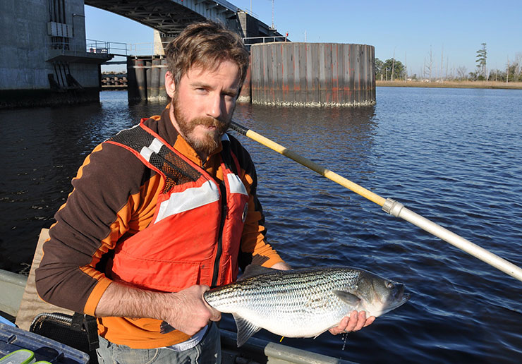
Harvest of all the listed fish but shad is banned. Rebuilding fish stocks could lift moratoriums, reviving sport and possibly commercial fisheries. Since 2010, the N.C. Wildlife Resources Commission, or WRC, has stocked 625,000 juvenile striped bass from Cape Fear brood stock in the river. The runs of shad already draw dozens of boats below the dams with anglers trying to hook “the poor man’s tarpon.” Adding a winter striper season would benefit guides, tackle shops, restaurants, motels and campgrounds.
Such a resurgence can boost the economy of a community. The restoration of striped bass in the Roanoke River-Albemarle Sound in northeastern North Carolina generates a spring fishing industry for Halifax County. The local convention and visitors bureau promotes Weldon as “the rockfish capital of the world” for the famed spawning runs of stripers, locally called rockfish. Anglers can catch and release up to 100 fish a day. A 2007 WRC study showed that fishing provided an economic impact of $2.5 million for the entire Roanoke River, of which stripers accounted for 56 percent.
From a low in the mid-1980s of about 195,000 stripers, the overfished Roanoke population rebounded to about 2 million, contracting to 700,000 fish today. The rebound was the result of harvest restrictions and better timing of flows from dams to aid reproduction. The Roanoke’s capacity for stripers is larger than that of the Cape Fear.
NEW FISHWAY
The showpiece of the recovery plan is the rock arch rapids fishway at Lock and Dam No.1, paid for with $13 million in federal stimulus money. The fishway was mitigation for the potential harm to the federally endangered shortnose sturgeon from the blasting of rock in the deepening of Wilmington harbor in 2002 to 2004.
The fishway, with water spilling around the rocks creating rapids and pools, looks like a natural shoal. It’s the first of its kind on the East Coast, though similar fishways have been built in the Midwest.
But whether substantial numbers of shad and stripers made use of it last spring isn’t clear yet. A study of tagged fish showed half of the shad and 20 percent of the stripers got over.
Joshua Raabe and Joseph Hightower of North Carolina State University and Chip Collier of the N.C. Division of Marine Fisheries monitored tagged fish in the Cape Fear River this past spring.
The researchers detected 32 tagged American shad in the water below the fishway.
Of those, 16 passed over Dam No. 1, 14 got up to No. 2 at Elizabethtown, with five going through the lock. All five passed through Lock and Dam No. 3’s lock.
Of 43 tagged stripers, just nine got over the rock arch rapids, and seven passed through the locks of the two upstream dams.
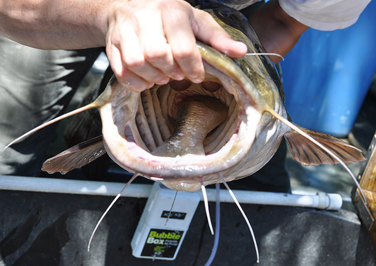
Ironically, 80 percent of tagged flathead catfish, a nonnative species that can prey on shad, successfully swam over the rock arch rapids.
Frank Yelverton, USACE district biologist in Wilmington, says it’s too early to draw conclusions about the effectiveness of the rock arch rapid until another round of monitoring in 2014. “It is passing fish,” Yelverton acknowledges. “It is not passing as many as we had hoped. We had set a goal of 80 percent passing.” Last year, 65 percent of tagged shad swam through the lock at Lock and Dam No. 1.
If the 2014 study again finds low passage rates, the USACE will make changes in the rock arrangement, perhaps by widening the channels or altering flows. “We’re confident we can tweak it, modifying the structure in some way,” he adds.
But an electrofishing survey and fishermen’s reports suggest fish went up the ramp like gangbusters. WRC biologists captured more shad last spring below the two upstream dams than the year before — 489 in 2013 compared to 346 in 2012.
“Our survey data suggests the successful passage of American shad over the structure at Lock and Dam No. 1,” writes WRC regional fisheries supervisor Chad Thomas in an email, citing “the good numbers collected.”
Sport anglers reported more shad at the two upper dams as well, says Tom Charles, USACE park ranger for all three dams.
PROJECT FUNDING
Meanwhile, the Cape Fear River Partnership is pushing three projects for the upper two locks and dams.
The first enhances underwater spawning beds below Lock and Dam No. 2. The $372,559 project, with the help of 60 volunteers and Maritech Dredging of Hampstead, will spread 1,150 tons of crushed stone on the river bottom. Two grants — $95,000 from the National Oceanic and Atmospheric Administration and the Southeast Aquatic Resources Partnership, and $50,000 from the U.S. Fish and Wildlife Service and the Atlantic Coastal Fish Habitat Partnership — would help pay for the work. In-kind services, support from the Cape Fear River Watch, donated rock and volunteer work would cover the rest of the cost. The beds are expected to be ready for the 2014 spawning run.
The next project is a partial fishway for Lock and Dam No. 2. “The highest priority of the partnership is construction of a fish passage for No. 2,” says Dawn York, a coastal scientist for Dial Cordy and Associates, a Wilmington firm, who leads the funding team for the action plan.
The proposed $9.7 million fishway would open up 68 river and tributary miles. The partnership applied for $7.4 million in federal money from NOAA. York says the project didn’t make the cut for fiscal year 2013, although the request remains active. The project would be a partial rather than full fishway because a deep scour hole below the dam would require filling and would drive up the cost to between $13 million and $15 million.
The remaining $2.3 million would come from state or local matching money. The partnership also has applied for a $586,000 grant for the engineering design and environmental permits for the fishway through North Carolina’s Coastal Recreational Fishing License Grants Program.
Farther into the future is a full fishway for Lock and Dam No. 3, which would cost $8.1 million. Of that, $6.1 million would come from federal money. York acknowledges that funding for the last fishway may not be available before 2020.
A side benefit to the city of Fayetteville is that a fishway would help stabilize the wall of the dam, which forms a pool for water intake for the city. Pools behind the other two dams provide water for the Wilmington area. Thus, because all three dams function as reservoirs, it’s not practical to demolish them for fish passage.
Above Smiley’s Falls lies another 16 miles of prime spawning habitat along Raven Rock State Park, capped by the Buckhorn Lake Dam in Lee County, another potential site for a fish ramp.
Reviving migratory fish in the Cape Fear will be a complex and long-term challenge. It will turn on the long-term commitment of the partnership and the availability of federal and state monies.
“I think it takes a full watershed effort,” York says, “and I think we’re getting there.”
This article was published in the Holiday 2013 issue of Coastwatch.
For contact information and reprint requests, visit ncseagrant.ncsu.edu/coastwatch/contact/.
- Categories: