Sunny with a Chance of Floods
Researchers and the Carolina Beach community work together to address chronic flooding.
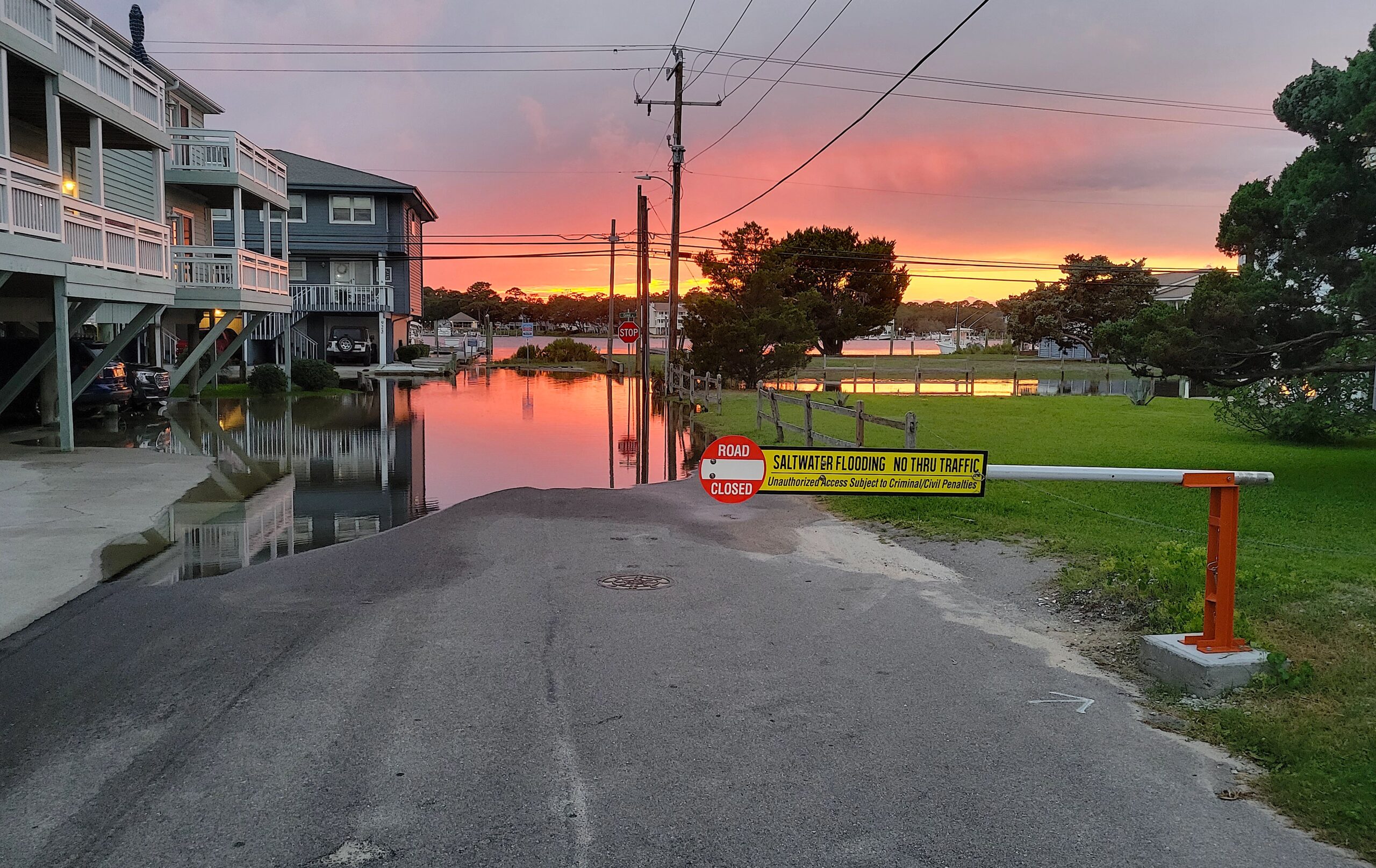
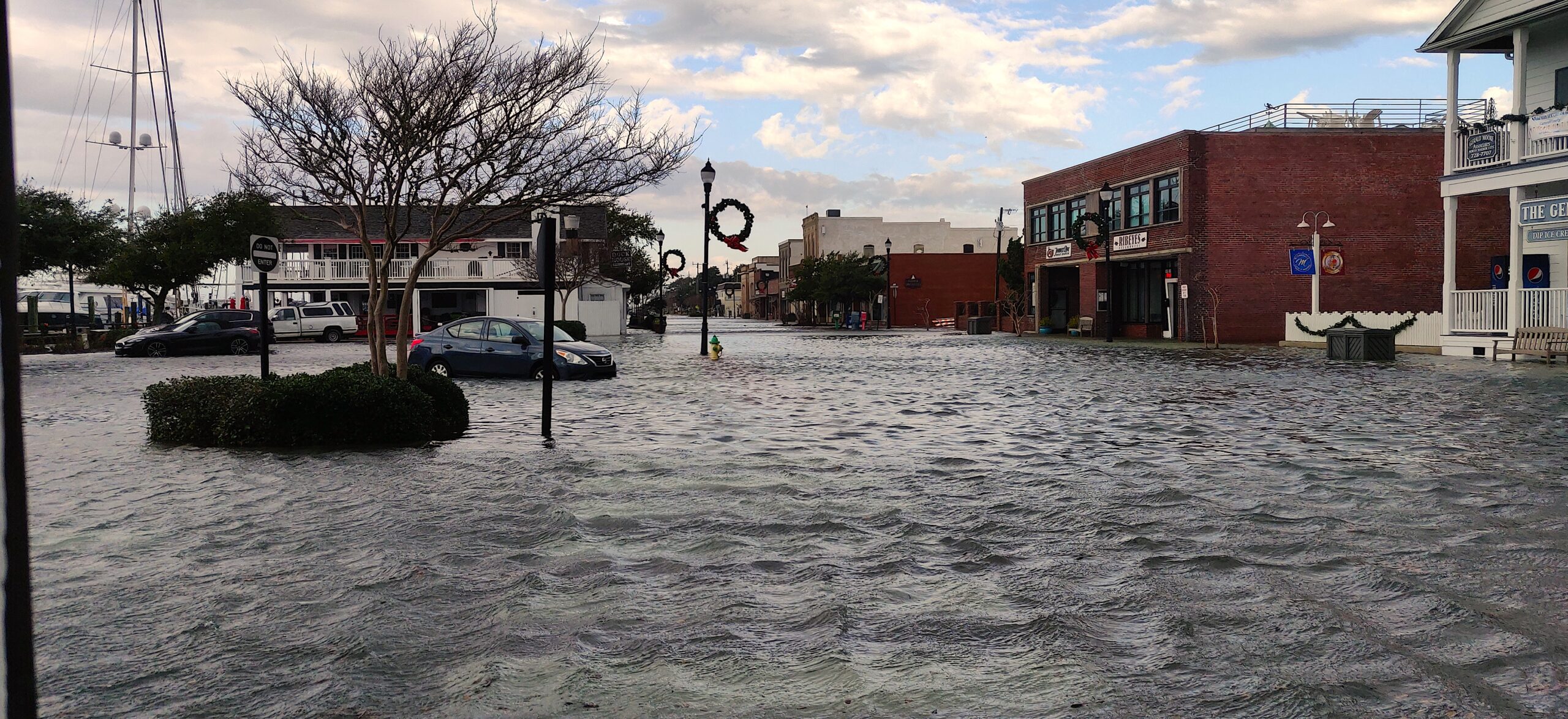
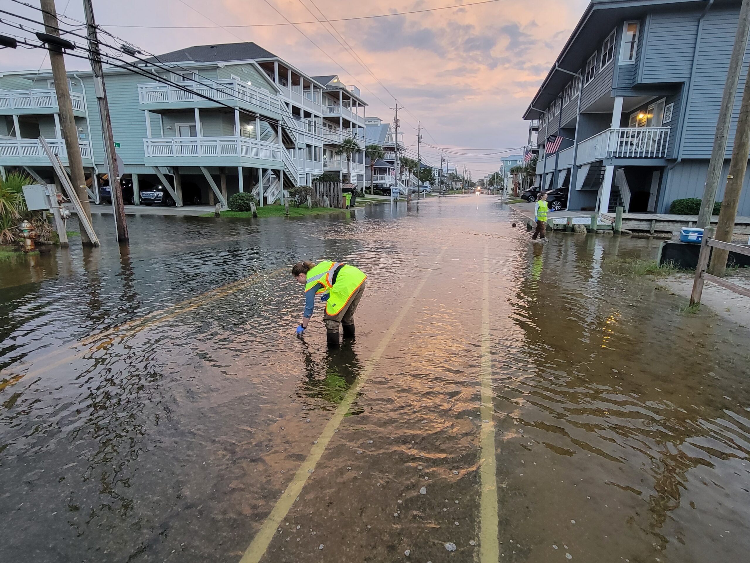
When people see photos of Carolina Beach’s flooded Canal Drive, they might assume those waters lapping against the doorways of a residential neighborhood mean the area had just experienced a severe storm or hurricane. Locals know, however, it is just as likely the deluge was not related to a storm at all but rather an example of “nuisance” flooding.
“Sunny day” flooding — also called “nuisance,” “king tide,” or “high tide” flooding — is one of many challenges climate change poses for coastal communities.
This event occurs when water levels temporarily exceed an area’s drainage threshold, unrelated to storm surge or riverine influence. As sea levels continue rising, this flooding will happen more often in susceptible locations, including developed areas like Canal Drive.
In 2021, NOAA reported that high tide flooding happened twice as often as in 2000 — and that by 2050, some areas could experience up to 75 days of sunny day flooding per year. However, these predictions only reflect ocean drivers and not local factors (such as rain). As such, they may not accurately forecast flooding, and some places do experience more flooding than projections suggest.
An increase in this sunny day flooding will present even more problems for residents of Carolina Beach, as inundated streets already have forced them to close businesses, adjust routes, or even wade through water to reach their front doors.
“The challenges with flooding include trying to mitigate property damage and infrastructure impacts that overwhelm storm drains, deteriorate roads, and monitor saltwater intrusion in town utilities,” says Jeremy Hardison, the planning and development director for Carolina Beach.
“Are they going to leave places because climate change is making them so hazardous that they can’t live there anymore?”
Consequently, local leaders and state researchers are committed to bolstering the community’s flood resiliency. A Sea Grant team from North Carolina State University and the University of North Carolina at Chapel Hill have been working alongside Carolina Beach and other communities to document flooding and offer resources to residents through the Sunny Day Flooding Project.

“My research originally began around this question of ‘Are people going to move away?’” says the project’s Miyuki Hino, an environmental social scientist from UNC Chapel Hill. “‘Are they going to leave places because climate change is making them so hazardous that they can’t live there anymore?’”
These questions required measuring the frequency and severity of flooding, which led Hino to Katherine Anarde, a coastal engineer and geomorphologist with NC State.
“Miyuki’s idea was measuring flooding where people actually live,” says Anarde. “And I like tough measurement problems.”
In Anarde’s previous work, she measured waves during tropical storms, but looking at water levels and flooding in developed landscapes meant finding ways to collect data that would not disrupt residents. They partnered with the town of Carolina Beach to develop a research plan that would work for everyone.
Sensing in Communities
Hino says local knowledge is essential in determining where researchers should focus their attention.
“In all the places we’ve installed anything, the first thing we’ve done is met with residents and local officials to understand where their problems are,” she says. “Based on their input and the requirements of our sensors, we can work together and figure out what we can monitor and what makes the most sense.”
Once the research team determines a location, they collect data, maintain the sensors, and ensure the accessibility of the information they gather.
“Our original approach was Let’s try to get everything in real-time, so we don’t lose data,” Anarde explains. “And what we found is that these communities really like the real-time data and camera images. So, as we’ve expanded, it’s been more than just monitoring flooding, but actually serving as a hazard communication platform.”
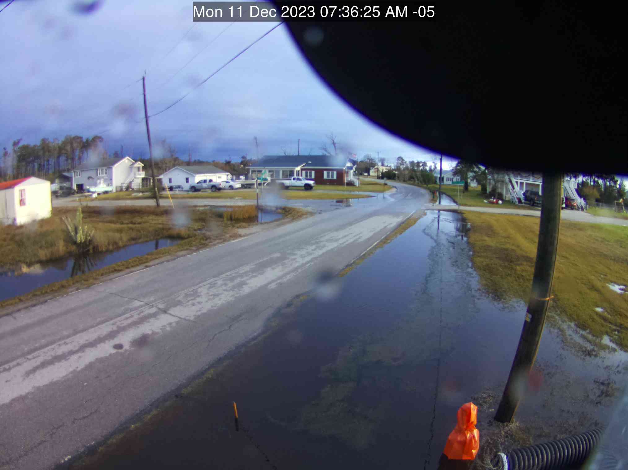
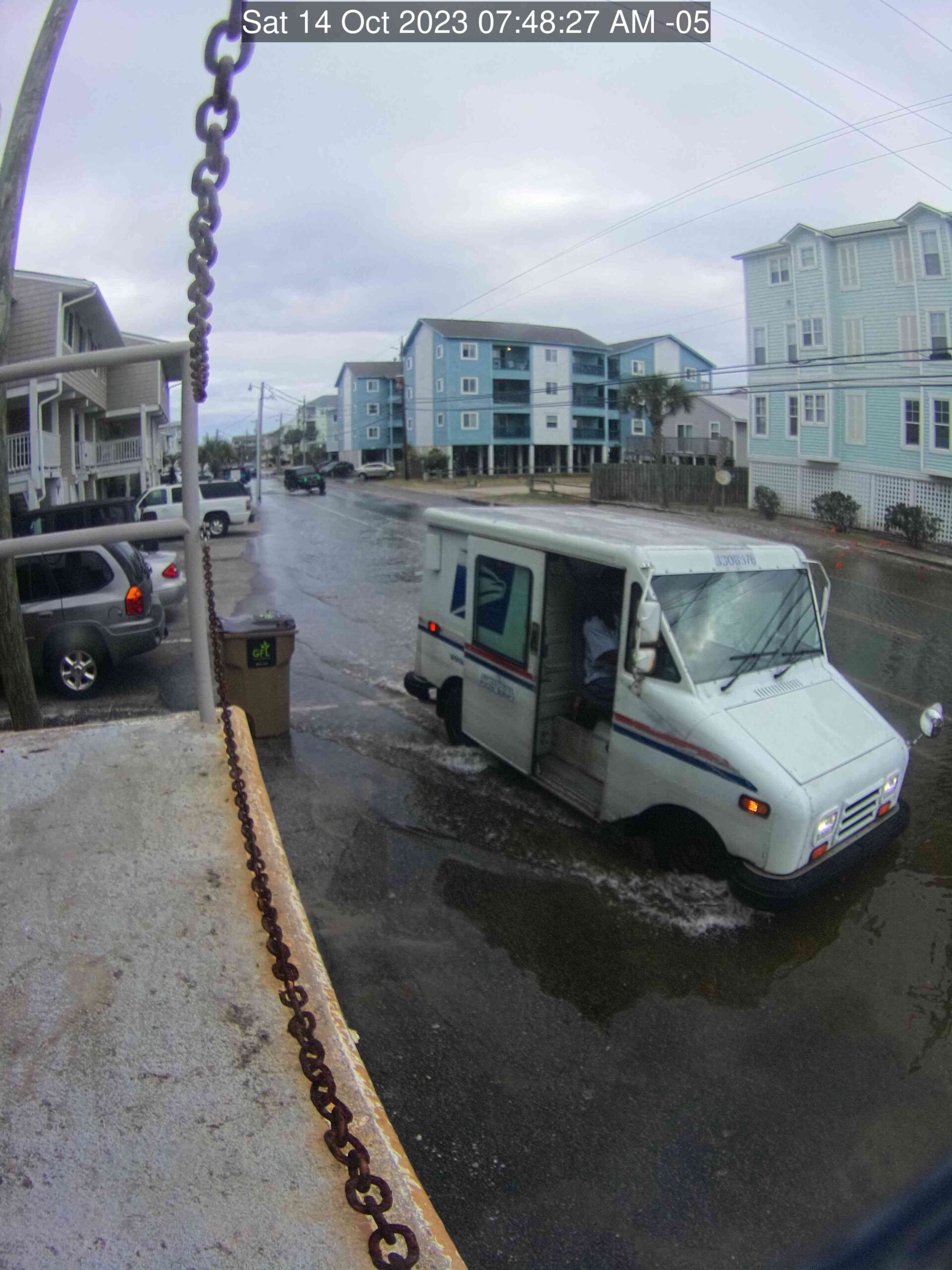
They deployed sensors that measure current water levels and take photos of the area, which assist in long-term data collection and monitoring of conditions. This enables residents to prepare for flooding by viewing real-time data as water levels rise, while also documenting information that will inform a path toward realistic and sustainable long-term solutions.
The cameras transmit photos every six minutes. However, once floodwaters reach a certain level, the sensors go offline temporarily.
“If the sensor is underwater, we lose communication with it,” says Anarde. “So you might be on the web app and see that there’s no data, but once the water goes down, we’ll start to get that data again and fill in the gaps.”
Sensors still provide information about rising waters before contact is lost, though, and the team works to send out flood warning emails for each community they cover.
“Every storm drain brings its own challenges — and eels”
Sometimes, floods bring more than a disruption to coverage.
Anarde recalls one surprise when she was checking a sensor. “One time, we saw a dead eel attached to the end of one of our sensors,” she says. “Every storm drain brings its own challenges — and eels.”

Same Ingredients, Different Recipe
Sea level rise exacerbates sunny day flooding, as do other factors like inadequate stormwater networks, marsh degradation, precipitation, and riverine discharge.
And wind.
“I was really surprised how much wind matters,” says Anarde. “We found that wind is often the driver of unexpected flood events in this region. It pushes water into this narrow bay behind Carolina Beach, and that piling up of water overtops the low-lying shorelines and pushes water up through the stormwater network.”
Stormwater systems themselves can also influence flooding. Duckbill valves — backflow prevention devices in the drains — require cleaning and maintenance every few months to work correctly. Additionally, groundwater can enter these systems, leaving very little room for excess rainwater to be stored.
The Cape Fear’s riverine influence was surprisingly less influential than tides, rainfall, wind, and stormwater systems. However, the degree to which each factor plays a role varies by location.
“It’s not that the ingredients are necessarily different everywhere,” says Anarde. “It seems like the ingredients are consistent across communities. It’s the recipe.”
This means that a solution to chronic flooding is not one-size-fits all, and afflicted communities must tailor a response to their unique “recipe” of factors.
One-Size Doesn’t Fit All
To Hino and Anarde, the disruptions that locals report to their daily routines point to the often-neglected impacts of climate change.
Most people are aware of increasing storm severity, but fewer consider situations such as sunny day flooding in coastal communities or other effects on quality of life.
“Those types of impacts represent one of the real hallmarks of climate change,” says Hino.
Problems with nuisance flooding also extend beyond Carolina Beach. “We’ve had people reach out to us from up and down the East Coast, in New Jersey, New York, Maryland, Virginia, and the Gulf,” she says. “It’s a widespread problem, but the solutions will be very local.”
Just as the causes differ by location, strategies, and solutions for one community might not work for another. Furthermore, changes often require altering the landscape or existing infrastructure.
“One of the big challenges in adapting to climate change is that it involves many other changes,” Hino says. “And the ways that people are going to be comfortable with their communities changing are going to be very different place to place.”
Resiliency in Carolina Beach
Anarde, Hino, and NC State Ph.D. student Thomas Thelen surveyed Carolina Beach residents earlier this year about chronic flooding, hoping to see its influences on daily life and gauge support for potential flood mitigation strategies, such as raising bulkheads and roadways. Thelen has led the development of a high-resolution flood model for Carolina Beach, which the team will combine with information from survey responses.
“As physical scientists, we typically come up with all these brilliant engineering solutions that may or may not have local support”
“What we’re going to do with that information is try to model some of the strategies — alongside future scenarios of sea level rise— to see how good the different approaches are at managing each of these ingredients of flooding,” Anarde says. “With that, we can start a conversation between community members and the town government on what sequence of flood mitigation strategies may be most desired.”
Anarde notes a tendency for this process to work in reverse.
“As physical scientists, we typically come up with all these brilliant engineering solutions that may or may not have local support,” she says. “We’re trying to get a sense of what the communities are interested in even doing first.”
The team’s decision to place Carolina Beach and its needs first is at the heart of finding and implementing solutions for the different recipes that result in sunny day flooding — regardless of the approach the town chooses.
“These are places that are trying to find solutions,” says Hino, emphasizing the resiliency of Carolina Beach. “They’re taking these steps to come up with a path forward that works well for them and their residents. They’re not unique in the problems they face, and there will be more and more towns with this problem.”
The Path Forward
In addition to Carolina Beach, the Sunny Day Flooding Project currently has systems in place in North Carolina at Beaufort, Down East, and New Bern. Additionally, the team is in the early stages of planning to expand its research to Hawaii, another area facing sunny day flooding.
Moving forward, they hope to turn their attention to more rural areas along our state’s Inner Banks, noting that research on the severity of the problem is lacking in these areas. With North Carolina’s vast networks of river basins and estuaries, many communities farther inland from the coast are also becoming more susceptible to chronic flooding.
“It’s important that we turn our eyes towards these areas and focus our efforts on more rural spaces that are underserved by our monitoring networks to try and understand what’s happening there,” says Anarde. “Not just flooding, but also other impacts from sea level rise, such as saltwater intrusion and marsh migration. The burden on these communities is largely unknown.”
“In the background are these slow-moving changes that also have a meaningful effect on the people who live there.”
Climate change also is more likely to have a more detrimental socioeconomic impact in rural areas, where residents have fewer resources and often find it more difficult to recover from major flooding events. Climate change’s “minor” but more frequent impacts, such as sunny day flooding, add additional weight to an already unwieldy load.
“We can’t just focus on the hurricanes,” Hino says. “We can’t just focus on these big, catastrophic events. They’re important, of course, and we can’t ignore them. But in the background are these slow-moving changes that also have a meaningful effect on the people who live there.”
Safety Tips and Resources for Sunny Day Flooding
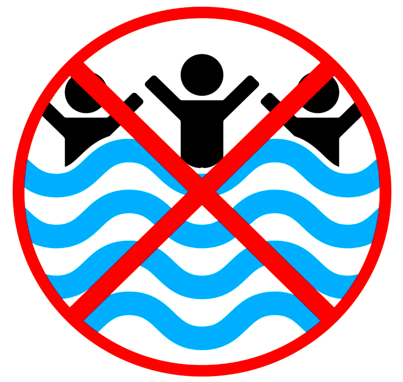
Waterfront properties and low-lying roadways are most likely to experience tidal or “sunny day” floods. If you encounter tidal floodwater, minimize or avoid contact with it.
Because floodwaters from tidal or storm flooding may contain biological and chemical contaminants, the CDC suggests the following:
- If you have an open wound, avoid exposure to floodwater.
- If you have an open wound and have already been exposed to floodwater, wash the wound well with soap and clean water, and cover it to reduce the chance of infection. If the open wound develops redness, is painful, or appears to be swelling or oozing, seek immediate medical attention.
- If you have been in contact with floodwater, wash your hands with soap and water as soon as possible. Also, be sure to wash children’s hands, particularly before consuming food.
- Do not allow children to play in floodwater. Similarly, do not allow children to play with toys that have been exposed to contaminated floodwaters and not then disinfected.
- Consider replacing soil, mulch, sand in sandboxes, and wood chips around outdoor playground equipment if they have been flooded.
Additional safety guidance from the CDC:
Anticipating Sunny Day Flooding
Local public officials may issue alerts and guidance related to tidal flooding, which may be available on websites, social media, or local news. The following national and state resources can also help you anticipate tidal flooding and/or learn the current status of tidal flooding in your community.
- For monthly and seasonal predictions of tidal flooding at locations near tide gauges, refer to NOAA’s “Monthly High Tide Flooding Outlook.”
- For real-time advisories on tidal flooding, refer to the National Weather Service’s “Coastal Flood Threat” tool.
- For an annual calendar of predicted “king tide” events in North Carolina, refer to the North Carolina King Tides Project.
- To see real-time information and webcam images of tidal flooding in select communities in North Carolina, refer to the Sunny Day Flooding Project.
Adapted from a fact sheet from North Carolina Sea Grant, NC State University, and UNC Chapel Hill.
More
Marlo Chapman is a science communication intern with North Carolina Sea Grant and a graduate student in rhetoric and composition at NC State University.
- Categories: