Sea Science: XBeach Model Predicts Storm Impacts on Beaches and Dunes
New research looks at how to connect predictions of beach and dune erosion to community-wide flooding.
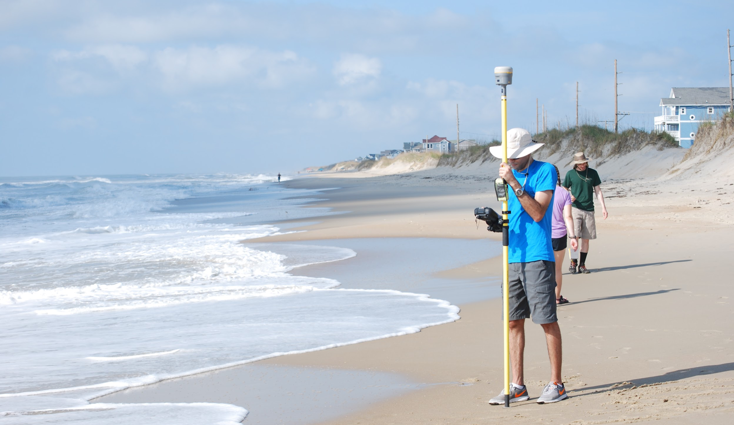
Alireza Gharagozlou (above) is a doctoral student in the Department of Civil, Construction, and Environmental Engineering at NC State University. He studies how to connect predictions of beach and dune erosion to community-wide flooding and serves with Casey Dietrich on NC State’s Coastal & Computational Hydraulics Team. North Carolina Sea Grant has supported their work.
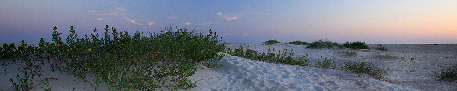
During storms, strong waves and currents can erode beaches and dunes and create low-lying areas vulnerable to flooding. We use field surveys and a computer model called XBeach to predict this erosion, as well as to understand its interactions with storm-driven flooding of larger regions.
Computer models allow us to see how the storm surge and waves impact the beach over time, and which locations are vulnerable to large-scale damage. Good predictions of such storm impacts help emergency managers take better-informed measures to protect coastal areas. Understanding vulnerabilities also instructs highway access design and residential area planning.
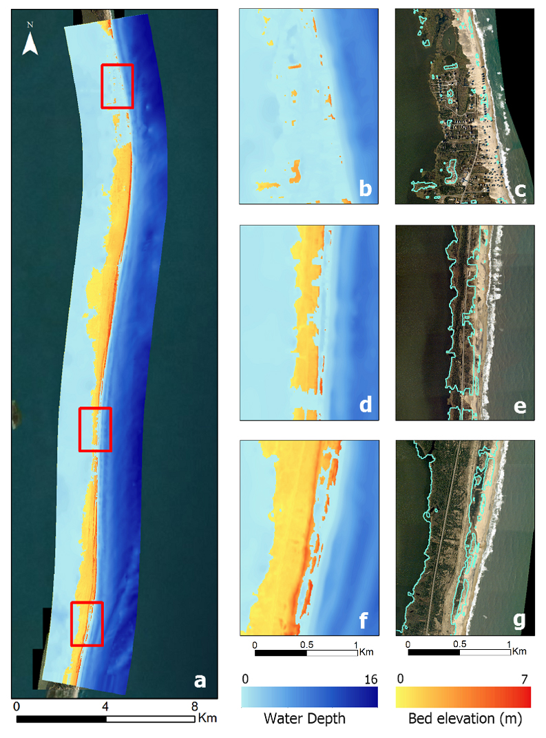
We used the XBeach computer model on more than 30 kilometers of Hatteras Island between Avon and Rodanthe to explore how to connect erosion predictions to larger areas. Could XBeach cover more of the island, yet still provide good erosion predictions at beach and dune scales? And how could we connect erosion predictions to other models for storm surge and flooding?
Hurricane Isabel’s Effect on Erosion
Hurricane Isabel made landfall on September 18, 2003, on the Outer Banks with Category 2 wind speeds, 8-meter-high waves, and a storm surge 2 meters above mean sea level. The hurricane devastated the region, causing flooding, dune erosion and overwash at many locations along the barrier islands.
Although Isabel occurred more than 15 years ago, the storm provides a great test case because of available observations of coastal erosion. High-resolution datasets depict beach and dune topography two days before and three days after the storm.
These datasets tell us a lot about the storm’s effects on erosion in Hatteras Island. The largest erosion event was the creation of the “Isabel Inlet,” which was 500 meters wide and remained open for more than a month.
Significant erosion also occurred all over the island. Storm surge and high waves washed away the dune, pushed the sand back into infrastructure, and closed highway NC-12. Between the towns of Avon and Rodanthe, more than 20 major erosion and overwash events resulted in sand deposits extending 80 to 200 meters from the shoreline. At Buxton and Frisco, the storm deposited sand inland 400 to 500 meters from the shoreline. Residential communities at Rodanthe experienced severe storm impacts that included damage to the main road and buildings.
How Did XBeach Modeling Perform?
To explore XBeach’s performance, we applied it to the 30-kilometer stretch of Hatteras Island from Avon to Rodanthe. The model captured major dune erosion events very well.
For example, aerial photos showed a closure incident to the south of Salvo, where sand covered the road (Figure 1, below). XBeach “predicted” the dune erosion and flooding at the same location. The model also predicted the elevation change in the dune crest and the amount of beach erosion with accuracy that was very close to post-storm observations.
Such predictions are very encouraging. They told us how the storm surge cut through the dunes, and where and when those events had happened. These findings allow us to use the model confidently for future storms to estimate impacts before landfall.
In addition, larger storm surge and flooding forecast systems can incorporate information from such models. Scientists and researchers run a large-scale ADCIRC model to predict flooding and water levels along the coast, but large-domain models like ADCIRC neglect erosion and breach events.
However, by connecting XBeach to ADCIRC, we can improve the flooding prediction. In our ongoing work, we are tightening these connections.
Field Observations of Erosion after Florence
Hurricane Florence impacted coastal North Carolina in September 2018. The storm made landfall near Wrightsville Beach and caused considerable dune erosion and flooding along the barrier island from Hatteras to Nags Head.
After the storm, I participated in a field survey that NC State University’s Beth Sciaudone led. We surveyed the beach profiles at locations where we could observe major erosion events. The elevation of these points was measured from the dune to the shoreline with a Real Time Kinematic GPS device. (See the lead photo).
This survey information can help us evaluate the erosion volume and assess the extent of storm impacts on the beach. It tells us where the dune system prevented flooding and where the beach was vulnerable and eroded.
These findings also can be fed into numerical computer models to improve prediction accuracy. Similar to how the detailed surveys in Isabel helped our previous modeling study, these new surveys during Florence will help to validate the performance of the model in capturing coastal processes.
More information about funding opportunities from North Carolina Sea Grant
Lead photo: Alireza Gharagozlou surveys the beach profile near Hatteras, North Carolina, with RTK-GPS after Hurricane Florence
- Categories: