The 2024 NC Coastal Conference in Review
A Look Back at the Biggest NC Sea Grant Gathering to Date
The 2024 North Carolina Coastal Conference took place on November 13-14 in New Bern, North Carolina, and brought coastal enthusiasts of many different careers for insightful presentations and discussions about the future of North Carolina’s coast.
Over the course of two days, the conference provided a rich environment for participants to engage with important topics such as coastal communities, infrastructure, management, and technology. Similarly to the participants’ backgrounds, the diverse presentations and discussions showcased a wide range of coastal topics for consideration.
Conference Sponsors:
Day 1
Welcome and Opening Panel
Moderator: Susan White, North Carolina Sea Grant
Alyson Wilson, Interim Vice Chancellor for Research, NC State University
Jon Pennock, Director, NOAA National Sea Grant College Program
Fabien Cousteau, Founder of Proteus Ocean Group
Brian Helmuth, Chief Scientific Officer, Proteus Ocean Group
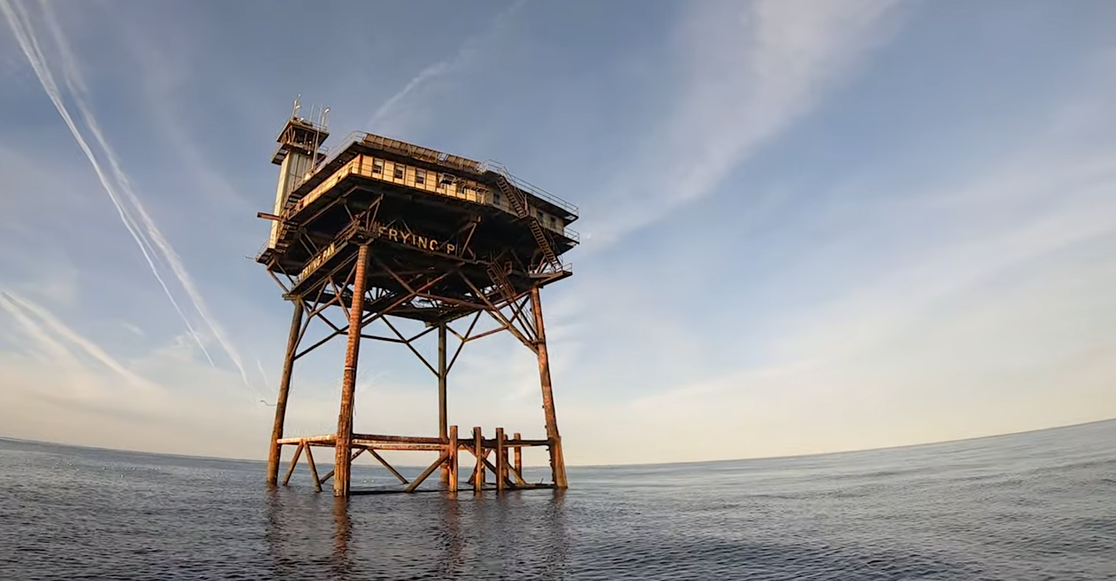
PROTEUS is Fabien Cousteau’s vision for the next generation of ocean science center. This sea-floor observatory and research platform will serve scientists, innovators, and others in the search for solutions to critical concerns, such as food sustainability and climate impacts, as well as opening new avenues to medical discoveries and other advances.
The Shape of the Coast Legal Symposium
50th Anniversary of the Coastal Area Management Act
Mary Lucasse, Environmental Division, North Carolina Department of Justice
Coastal Insurance Update
Don Hornstein, UNC School of Law
Oceanfront Houses on the OBX
Julia Youngman and Liz Rasheed, Southern Environmental Law Center
Wetlands at the Coast: Panel Discussion
Moderator: Amy Wang, Ward and Smith, P.A., New Bern
Justin McCorcle, US Army Corps of Engineers, Wilmington District
Samantha Hamilton, Davis, Hartman, Wright, New Bern
Christian Preziosi, Davey
Heirs Property: Panel Discussion
Moderator: Scott Schang, Wake Forest School of Law
Charlotte Noel Fox, Craige and Fox, PLLC
Mavis Gragg, Heir Shares
Wilson Greene, Land Loss Prevention Project
Jesse Williams, Campbell University Law
Hot Topics in Coastal Law: Three Mini-Sessions
Sand Wars: Allocation of Sand Resources for Beach Nourishment
Todd Roessler, Kilpatrick Townsend – Raleigh
Offshore Wind Update
Jennifer Mundt, North Carolina Department of Commerce
Real Estate Disclosure Forms Update
Christine Goebel, North Carolina Department of Environmental Quality
Policy 101: Where Have We Been and Where Are We Going?
Moderator: Amanpreet Kohli, NC Sea Grant
Chris Dumas, UNCW
Property Easements for Beach Maintenance — Variety, Trends and Impacts on Property Values
Many factors affect coastal waterfront property values…
…
…including aspects of the economy (such as interest rates and the unemployment rate), environmental variables (such as distance to the water, beach condition, and recent hurricane activity), and features of the property itself (such as lot acreage, structure size, and distance to the nearest inlet). Inlet distance may affect the value of waterfront properties in at least two ways: inlet proximity might increase property values if property owners value quick access to ocean boating and fishing opportunities, but inlet proximity might decrease property values if such proximity is associated with increased erosion, storm surge or flooding risks. We examine the net impacts of inlet proximity on coastal waterfront property values (while controlling for other factors that affect property values) using an extensive time-series cross-section dataset of 475,000 Multiple Listing Service (MLS) property sales transactions that spans 23 years (1999-2021) and all NC coastal counties.
Adam Gold, Environmental Defense Fund
How Wet Must a Wetland Be to Have Federal Protections? Estimating a Range of Potential Impacts from Sackett v. EPA
More
In 2023, the Supreme Court’s majority opinion in Sackett v. EPA created an unclear requirement that federally protected wetlands must have a “continuous surface connection” to federally protected waters. This study estimates the potential impact of interpretations of the ruling on federal wetlands protections, using wetland flooding frequency as a proxy for the new requirement. An estimated area from 17 million acres (19%) to nearly all 90 million acres of non-tidal wetlands in the conterminous US could be without federal protections, and variability in state protections creates hotspots of risk. The high-level estimates provided here represent a first step towards understanding the potential extent of the impact of Sackett v. EPA on federal wetlands protections and highlight the uncertainty introduced by the ruling.
Jessica Weinkle & Anna Poston, UNCW
Evaluation of the Advisory Mechanism to the NC Marine Fisheries Commission
More
Expert advice plays an important role in supporting the democratic legitimacy of policy and regulatory decision making. Historically, the North Carolina fisheries regulatory process suffers from lack of public trust. In more recent years, legal action, legislator intervention, and a lack of morale among advisors and user groups suggest another decline in the perceived legitimacy of the Marine Fisheries Commission. This research provides an evaluation of structure and function of the Commission’s extensive expert advisory mechanism. We examine how advice is requested and provided, and how committees are formed using three case studies of regulatory controversy: 1) area closures to shrimp trawling, 2) southern flounder fisheries management plans, and 3) development of shellfish aquaculture. Preliminary results of our analysis indicate a lack of clarity about the advisory mechanism as a channel for stakeholder input or as means of clarifying the state of knowledge and broadening scope of regulatory options. Moreover, the dual role of commissioners as advisory committee members taints the independence of advice. We provide recommendations to improve the structure and function of the fisheries advisory mechanism so as to bolster the legitimacy of fisheries regulation decisions.
Sam Boyce, UNCW
North Carolina Wetland Management and Flooding: Analyzing Permit Effectiveness on Flood Mitigation
More
The United States has converted over 50% of its wetlands in the past 300 years, a trend exacerbated in North Carolina by climate change and development pressures that are further contributing to a decline in wetlands across the state. As critical wetland functions are lost or degraded, so are the ecosystem services they provide to communities. Federal frameworks like the Clean Water Act (CWA) are intended to regulate the management of surface water resources including wetlands. However, the impact of these frameworks on coastal wetland ecosystem services is complex and understudied. Despite an increased understanding of the ecosystem services and benefits that wetlands provide, there is limited information on if and how permitting influences these processes.
We begin to address this knowledge gap by comparing the flooding impacts of Hurricane Florence (2018) in southeastern North Carolina on parcels with CWA 401 and 404 permits. We determined that having a permit did not protect the integrity of wetland flood mitigation ecosystem services. Parcels with permits had significantly more converted wetland and parcels with permitted alternations experienced significantly more flooding than on parcels without a permit. Although 401 and 404 permits may be effective at protecting other wetland ecosystem services, they are not effective at protecting the flood mitigation benefits of wetlands, thereby presenting a gap in the regulatory effectiveness of wetland management.
Robert Andrew Branan, NCSU
Heirs Property Challenges and Resolution in Coastal Resilience
More
Presentation will provide an overview of real property fractional interest ownership (a/k/a heirs’ property) challenges to coastal resilience programs, including potential challenges in drainage maintenance access and assessment collection, as well as progress in federal program accommodation of heirs property in disaster relief. Presenter will also overview on-going awareness and resolution education program collaboration between NCSU and NCA&T, as well as efforts to build a network to assist landowners in unifying title for more efficient participation in present and future coastal resiliency programs. Briefly included will be overview of Branan’s current research efforts concerning North Carolina’s 1909 Drainage Act, with its drainage petition process and allocation of easement rights for maintenance in areas of heirs property ownership. This work has been spurred by an increasing awareness and concern among agricultural and residential communities in Eastern North Carolina that this drainage district system is poorly understood with no coordination and sharing of best practices, yet may be a vital component in balancing coastal resiliency and agricultural production. Such best practices include these drainage systems’ role in flood control, nutrient load and salt water intrusion.
Communication and Community Engagement Across Scales
Moderator: Rebecca Jones, NC Sea Grant
Featuring:
Jacob Boyd, North Carolina Coastal Federation
The North Carolina Salt Marsh Action Plan: Marshing Forward in North Carolina and the South Atlantic Region to Protect, Restore, and Facilitate the Migration of Salt Marshes
More
The South Atlantic Salt Marsh Initiative (SASMI) launched in 2021 aiming to unite leaders from four states (NC, SC, GA, FL) to pool collective resources and expertise and pursue opportunities for protecting, restoring and conserving the expansive 1 million acres of salt marsh spanning the South Atlantic region. With contributions from over 400 partners, the regional salt marsh plan, entitled Marsh Forward: A Regional Plan for the Future of the South Atlantic Coast’s Million-Acre Salt Marsh Ecosystem (SASMI Plan), was launched in May 2023. The SASMI Plan delineates crucial strategies, objectives, and actions aimed at realizing the goal to ensure no net loss of the ecosystem services these salt marshes provide. While action at the regional scale holds significance, the majority of implementation occurs at the state and local levels. To accomplish this, the NC Salt Marsh Action Plan (NC SMAP) was developed and launched in May 2024 detailing a five-year strategy with the overall goal to protect, restore, and facilitate migration of salt marshes in North Carolina to ensure no overall loss of function, benefits, and acreage through 2050 and beyond. The NC SMAP brings together local, state, and federal stakeholders from academia, governmental agencies, communities, and non-profit organizations to prioritize actions and make the best use of available resources. Implementation of the NC SMAP is highly collaboratively and seeks to further other efforts aimed at protecting the coastal environment and to include actions that increase carbon sequestration and resilience of salt marshes and communities across North Carolina’s coast.
Jermaine McNair, ECU
Engaging Marginalized Populations and Building Resilience at the Community Level with the ONE Carolina Approach
More
This session will explore the challenges associated with conducting engaged research in vulnerable communities that often face a multitude of poverty-related issues and barriers to participation and offers the ONE Carolina engagement model as a developing solution to address these challenges. ONE Carolina is guided by 10 years of sociology field practice and is being implemented under East Carolina University’s NSF Coastlines and People Project to support community collaboration in decision making and environmental justice in Eastern North Carolina. While this model is in the implementation stage, presenters will share the theoretical concepts that are guiding its development along with some early findings from their efforts and solicit discussion and feedback from the attendees.
ONE Carolina offers an equity engagement model that leverages the partnering power of academia, activism, area nonprofits, and anchor institutions for a whole-system approach to building community resilience. This initiative builds partnerships across organizations and across systems by highlighting at the local level that the community resilience needed to stand against environmental issues is the same community resilience that empowers a community to reduce healthcare disparities, educational and economic disparities, and all other population disparities alike, altogether supporting the need to come together for one collaborative approach towards one community resilience – ONE Carolina.
Samantha Mosier, ECU
Storm Paths and Community Impacts – A StoryMap of Major Storms in the Tar-Pamlico
More
This presentation will highlight the development of an ArcGIS StoryMap for public audiences that highlights major storms impacting the Tar-Pamlico River Basin and the subsequent adaptations communities make after each storm. Hurricanes and major offshore storms shape the coastal and coastal plain communities of eastern North Carolina. However, the impacts of one storm are not universally felt across the region thus resulting in time and context specific adaptations. Moreover, communicating how difficult policy decisions are made and the need to proactively address future issues is paramount as the region contents with the impacts of climate change.
By leveraging the interactive mapping capabilities of ArcGIS StoryMaps, this presentation will offer audiences a dynamic exploration of the spatial distribution of storm impacts, adaptation measures, and community responses. This StoryMap features Hurricane Dennis (1999), Floyd (1999), Irene (1999), Isabell (2003), Irene (2011), Matthew (2016), Florence (2018), and Dorian (2019). Each storm was noted during interviews with key community leaders from 2021-2022 with significant variation in how each storm has altered each community’s identity and development potential. This presentation will highlight ArcGIS StoryMap as a powerful alternative to disseminating academic research data. Integrating maps and multi-media content, StoryMap provides an engaging and informative platform to illustrate the complex relationships between extreme weather events and community response.
Nicole Goddard, North Carolina Office of Recovery and Resiliency
Applying Research to Building Resilience: Moving Community Resilience Forward with Applied Research and Partnerships
More
The field of climate resilience benefits from research that follows the needs of practitioners. The North Carolina Office of Recovery and Resiliency (NCORR) will share its experiences connecting communities with scientists and experts to advance both community resilience and applied research. NCORR has worked with communities across the state to identify climate vulnerabilities and plan for and prioritize projects to build their resilience. Some of the issues these communities face require data or tools that are not in a planner or engineer’s toolbox. In these cases, NCORR is able to bring biologists, public health professionals, climatologists, geologists and other scientists to the table to generate applied research opportunities and develop creative and viable solutions. These efforts have had wider impacts than just the communities experiencing specific impacts or hazards. They have led to region-wide learning opportunities around the impacts of and solutions for Harmful Algal Blooms and a statewide toolkit for developing community-level extreme heat action plans. Through these two case studies, we will present how our work is advancing novel approaches to resilience-building and opening new collaboration opportunities across NC. As NCORR continues its work to support local resilience planning efforts, new issues are emerging that local communities are struggling to address. We will continue to bring North Carolina’s scientific community together with community partners to co-create future innovations in community resilience.
Ryan Ellis, NWS
Merging Service Equity and Science in the National Weather Service
More
Across the National Weather Service (NWS), efforts to incorporate service equity into science have been increasing over the last several years. Locally, here in Morehead City, these efforts were started with a project to map out various vulnerabilities across eastern North Carolina and resulted in a county-by-county atlas that forecasters can use to incorporate these findings into daily operations. These included weather-related risks such as heat and coastal flooding, but also began to take into account socioeconomic vulnerabilities such as lack of vehicle and internet access. NWS Morehead City was then able to build a customized outreach plan based on these results.
These efforts have now expanded regionally and nationally across the National Weather Service with the creation of the NWS Eastern Region (NWSER) Service Equity Team and the creation of a Social, Behavioral and Economic Sciences Division staffed with social scientists at NWS Headquarters. Service equity goals are now a part of the NWSER’s Annual Operating Plan for every office, and a GIS mapping tool is being created on a national level to document outreach and interactions with vulnerable communities, allowing offices to track not only where they have been in the past but also where they should go next when planning outreach efforts. These efforts will truly allow the NWS not just to put out a weather forecast but to help bring timely information to the people that need it most.
Technologies and Strategies in Resilience
Moderator: Kaitlin Tucker, NC Water Resources Research Institute
Rick Savage, Carolina Wetlands Association
The Work of the Carolina Wetlands Association
More
The work of the Carolina Wetlands Association has reached citizen scientists and vulnerable communities who are suffering flooding along our Coastal riverways and how restoring their wetland could mitigate flooding.
Our Volunteer Wetlands Monitoring Program is an EPA Wetlands Program Development Grant partnering with NC State University and RTI International. We are using volunteers to monitor three wetlands collecting hydrology data, water quality data, and amphibian and plant surveys. We are also doing invasive species mapping and soil analysis. We have also received another EPA Wetland Program Development Grant to expand the volunteer monitoring program to four new sites, two of which will be in South Carolina. This grant also partners with NC State University with the Citizen Science initiative joining in the partnership to help evaluate the program.
We have received three Land and Water Fund planning grants and two Duke grants from NC ORR to work with communities who are flooding along our coastal riverways. They are in Harnett Co., Pitt Co. and the Lumbee Tribe in Robeson Co. We use these grants to engage the communities in the planning process. We do a detailed site assessment of measuring water levels to understand the flood regime, collect water quality samples, and perform hydrological modeling to illustrate the flood regime and to simulate mitigation alternatives. We also work with the communities to add a recreational and educational component to the project. Our final reports will include a conceptual design of wetland restoration, flood control, co-benefits, and community resilience.
Joanne Halls, UNCW
Innovation + Community Collaboration = Buoying Solutions to Flood Resiliency
More
The goal of this session is for a variety of perspectives on coastal flood resiliency to be presented through a combination of academic and local and regional community organizations. It is through these varying lenses that we will explore innovative ideas from instrumentation through real-time data visualization. Importantly, we will discuss what has been successful, those that have been less optimal from both a research and community engagement perspective and ultimately ideas we think are worth exploring in the near future.
Lauren Kolodij, NC Coastal Federation & Annette Lucas, McAdams
Coastal Stormwater Solutions Program
More
The Coastal Stormwater Solutions Program, conceived by the NC General Assembly in summer 2023, is a vital initiative to support stormwater permit holders across the 20 Coastal Counties. S.L. 2023-0134 earmarks $5 million, managed by the NC Coastal Federation, to establish a stormwater retrofit pilot cost-share program to assist communities and businesses in monitoring, upgrading, and maintaining their stormwater systems permitted under North Carolina’s coastal stormwater program.
This presentation will explore the program’s progress, including the following key components:
Public Private Partnership Formation: The team includes key experts from both the public and private sector who are leading development of the stormwater retrofit pilot cost share program. The team is working collectively to develop the cost share program and is currently field- testing demonstration projects as phase I of program development.
GIS Tracking Dashboard Development: The team has developed an interactive web map that tracks stormwater permit data to identify and prioritize eligible permit holders that may be prime for stormwater system retrofits.
Pilot Project Development: The team is field-testing demonstration sites to showcase what a cost-share program could accomplish and creating an approach that is replicable for other projects. This pilot phase includes engaging permit owners and establishing a strategy for state authorization of stormwater system upgrades .
Innovative Solution Implementation: The team is showcasing a range of innovative solutions designed to provide support to permit holders. Our efforts aim to foster sustainable and nature-based practices that benefit both communities and the environment.
Philip Bresnahan, UNCW
Expanding Flood Sensor and Alert Networks with Low-Cost and Open-Source Technologies
More
As sea level rises, hurricanes intensify, and sunny day/chronic flooding becomes more pervasive and frequent, there is a clear and growing need for improved access to hyper-localized real-time water level data and alerts. Many products exist to meet this need, but the vast majority are expensive and proprietary. In order to effectively serve communities impacted by coastal flooding, transparency in alert network design and thoughtful community engagement are paramount. Open-source technologies facilitate reproducibility and straightforward adaptation to meet a community’s specific needs and are collaborative tools by design. This talk describes several open-source and low-cost water level sensors, flood detectors, and open data portals that have been developed in parallel by multiple research teams across North Carolina, what scenarios they are designed for, their strengths and room for improvement, and how they are being used in community-engaged research.
Chris DeWitt, VHB & Sandy Cross, Town of Duck
Driving Resilience: A Multi-Faceted Approach to Flooding in the Town of Duck
More
N.C. Highway 12 (NC 12) is a vital lifeline through the Town of Duck, an idyllic vacation destination within the Outer Banks. As the only north-south route throughout the town and north to Corolla, this major thoroughfare is facing frequent flooding and shoreline erosion from heavy rain and storm surge. This not only causes disruptions to daily life but becomes an obstruction for emergency evacuations off the barrier island when needed.
In response to these challenges, the Town has proactively embarked on an initiative—the Living Shoreline and Resiliency project to safeguard the continuous functionality of NC 12. As a recipient of numerous grants, including a $1.85 million Building Resilient Infrastructure and Communities (BRIC) grant, the mitigation solutions will allow for ease of daily traffic, pedestrians and bicyclists, emergency vehicles, and storm evacuations. In this session, attendees will learn about the town’s numerous strategies for resiliency that will make their community more adaptable to changing environmental forces. The combined nature based and engineering solutions, such as a new living shoreline, pedestrian and bicycle infrastructure, an elevated roadway, and drainage improvements, will work together to maximize resiliency. In addition to hearing about grant opportunities for funding, attendees will gain insight into how this holistic approach is poised to be a blueprint for coastal communities seeking sustainable solutions for a more secure future.
Networking Lunch
Featuring:
Miriam Sutton, Science by the Sea
A Year in a North Carolina Coastal Reserve: A Photo-Based Journey
More
The Rachel Carson Estuarine Research Reserve, one of 10 coastal reserves in North Carolina, is featured in this 12-month review of the seasonal changes observed in an estuarine ecosystem along the North Carolina coast. Variations in the flora and fauna that inhabit the terrestrial and aquatic ecosystems within the Reserve are highlighted with captivating images and video clips that immerse participants into a virtual field trip through the wonders of the Reserve. North Carolina’s 10 coastal reserves will also be introduced during this presentation.
Lightning Talks 1
Moderator: Christy Perrin, NC Water Resources Research Institute
Featuring:
Alexis Longmire, UNC Chapel Hill
Does Landscape Composition Impact the Functionality of Intertidal Horseshoe Crab (Limulus polyphemus) Nurseries?
More
Landscape ecology (and its marine counterpart “seascape ecology”) uses habitat heterogeneity to explain processes over spatial and temporal scales. Nurseries are juvenile marine habitats separate from adult habitats. We applied seascape ecology principles to explain Atlantic horseshoe crab (Limulus polyphemus) nursery dynamics in North Carolina. We asked whether the broader landscape composition, specifically the presence of large intertidal oyster reefs seaward of sandflat nurseries, would affect horseshoe crab nursery functionality. We hypothesized that seaward reefs improve juvenile density, growth, and survival by lowering wave energy and precluding aquatic predators from flats (relative to shorelines lacking reefs). We also hypothesized that seaward reefs increase prey density for juveniles. We surveyed 8 intertidal flats with and without seaward oyster reefs in August 2022 and June-October 2023, collecting data on juvenile size and density, prey and predator densities, and environmental characteristics like elevation and grain size. Reefs do positively impact nursery functionality, but it depends on both the metric and time-of-year. Reefs improve juvenile density (particularly of smaller/younger juveniles) only during summer months but have greater clam densities (i.e., juvenile prey) in the fall. This work shows how imperative it is to include multiple nursery metrics collected over different time periods to better elucidate landscape-scale impacts on nurseries.
Henry Sun, Duke
Using Generative Artificial Intelligence to Improve Training Data for North Atlantic Right Whale Detection
More
The North Atlantic right whale (Eubaleana glacialis) is a critically endangered migratory species found in North Carolina coastal waters species, with little over 300 individuals remaining in the wild. Right whales experience fatal wounds from ship strikes or entanglement with fishing lines, and an accurate system for rapid detection and monitoring of these animals is therefore crucial for informing conservation efforts. Presently, attempts to use machine learning models for whale detection in remote sensing data are trained on sub-meter satellite images and other aerial photographs. However, high-quality images of the remaining right whales are rare due to their limited surface time, cloud cover and other variables. However, high-quality images of right whales are few in number, as right whales are rare, and can only be accurately photographed during the limited time they spend surfacing. Additionally, cloud cover and other variables often make species identification extremely difficult from satellite imagery. My research uses low-rank augmentation (LoRA) generative artificial intelligence algorithms to create “deepfake” right whale whale images in order to improve the quantity, availability, and accessibility of right whale training data for machine learning detection models. LoRA models significantly reduce the number of trainable parameters, allowing rapid training of large language models for a specific task, such as generation of satellite whale images. This data augments conventional training data sets, such as expensive and unreliable satellite images or and downsampled aerial images from drones and occupied aircraft. Ultimately, an improved right whale detection model would go a long way towards everything from allowing ship captains to reduce the potential for collisions and better allowing lawmakers to enact protective legislation for right whale habitats. Furthermore, this project represents the first application of generative AI towards marine conservation biology, demonstrating the potential for this tool to be positively leveraged in a plethora of other manners.
Joshua Himmelstein, UNC Chapel Hill
The Role of Natural Levees in Controlling Salt Marsh Sedimentation
More
Salt marshes are increasingly recognized for their natural resilience to rising sea levels, provided they have sufficient sediment supply and hydraulic connectivity to accrete into newly formed accommodation space. Despite this, long-term monitoring of North Carolina’s marshes suggests that most are failing to vertically pace sea levels, while many subtidal creeks that feed them are accreting at much faster rates. Elevated levees, which form adjacent to sediment-supply conduits, may play a role in separating infilling subtidal channels from sediment-deprived marshes. These features may have become more prominent due to sediment loading driven by land-use changes in small coastal watersheds. Indeed, systems with higher sediment supplies are modeled to build larger levees, though the effects on interior marsh sedimentation remain unknown. To address the role of levees in marsh topographic evolution and creek-marsh connectivity, we develop detailed records of sediment and mass accumulation rates between the marsh levee and interior using spatially dense age-depth modeling. We then contextualize these rates by relating them to patterns of land use and shoreline change determined from remote imagery within their coastal plain watersheds. Then, to determine whether present-day gradients in suspended sediment mirror long-term sedimentation rates, we incorporate arrays of turbidity sensors arranged in shore-normal transects. On a finer scale, these measurements test a correlation between levee prominence and sediment attenuation on sub-tidal timescales. This study aims to quantify connectivity across marsh micro-topography, ideally informing management efforts such as regulating sediment flows, levee breaching, or thin-layer placements.
Theo Jass, SECOORA
Web Cameras and Water Levels: Collaborative Coastal Data for Decisions
More
The Southeast Coastal Ocean Observing Regional Association (SECOORA) works collaboratively with organizations in the southeast to provide ocean and coastal data for decision support. Recently, SECOORA has installed web cameras and water level sensors for a range of coastal management and research needs.
The 10 active cameras in the NC web camera network provide imagery for coastal monitoring and management applications, including shoreline change and rip current monitoring. Partners include Jennette’s Pier, Currituck County, ECU, UNC Wilmington, NOAA National Weather Service, and the US Coast Guard.
SECOORA partners with NC Sea Grant to facilitate water level sensor installation in historically under-resourced/underserved communities. NCSG developed a matrix of potential communities and the flooding and data challenges they face. This resulted in two water level sensor installations in Beaufort County in March 2024 in partnership with the County emergency management department and the Town of Belhaven – bringing the number of NC water level sensors to 17. Moving forward, this matrix will inform sensor placement and potential partnerships.
Web cameras and water level sensors can work in tandem to give context to observed water levels and flooding impacts. In Beaufort, a web camera is co-located with an NWLON station in collaboration with NOAA and the Duke University Marine Laboratory to provide imagery that can be synchronized with water level observations during flooding events. SECOORA has partnered with USGS and NWS to validate total water level models and identify timing and frequency of beach wave runup.
Andrew McMains, ECU
Diel Movement Behavior and Residence Time of Juvenile Sheepshead (Archosargus probatocephalus) Associated with a Commercial Oyster Lease
More
As oyster aquaculture continues to expand in the eastern United States it is important to understand how structure-oriented species will use lease installations as habitat; the addition of a lease converts a previously unstructured environment into a densely structured one. Sheepshead (Archosargus probatocephalus) are an economically important species that are known to depend on highly structured habitat throughout their life. To address the question of oyster leases serving as habitat, we installed an Innovasea (VEMCO) acoustic receiver array (VPS) on a floating bag oyster lease in Cedar Island Bay, North Carolina and surgically tagged 27 juvenile sheepshead (103mm – 193mm) with acoustic transmitters in order to track their movements at fine spatial scales from July through November 2020. Juvenile sheepshead were detected significantly more frequently in the lease than in the surrounding embayment when the results were standardized by area. Tagged individuals frequently left the lease area to move along a mudflat or marsh edge and returned to the lease later in the same day. Sheepshead showed particularly high residency during nighttime hours as they rested in and around the refuge of the lease. Both sheepshead home-range and home-range overlap with the oyster lease varied seasonally. These results show that juvenile sheepshead are frequently associated with oyster leases; lease habitat appears to provide refuge from predators and access to prey items associated with oyster communities. These data and analyses will provide insight into the amount of available habitat for juvenile sheepshead and the ecological benefits of oyster aquaculture.
Simon Gregg, Kris Bass Engineering
Restoration and Resilience within the Dynamic Coastal Barrier System
More
The Rachel Carson Reserve (RCR) is approximately 2,350-acre protected estuarine system south of the historic town of Beaufort, NC. It provides hazard mitigation benefits including the ability to regulate storm surge and tidal flows and the mitigation of wind and wave energy. The natural benefits provided by the RCR appear at risk by the effects of climate change and sea level rise which erode the island and its habitat slowly over time, and episodically during large disturbance events such as hurricanes and nor’easters. The Town of Beaufort has participated in Phases 1 and 2 of the Resilient Coastal Communities Program (RCCP) and through those efforts the protection, restoration, and enhancement of the RCR Bird Shoal area was identified by the public as a priority project. This presentation will discuss the historical and geomorphic context of the RCR and Beaufort inlet and propose a series of restoration concepts developed through an understanding of the natural processes shaping the environment and the unique ecologies it sustains. The core function of these concepts is to reduce erosion and increase sediment capture and sequestration on Bird Shoal, thereby enhancing the shoal’s ability to recover, adapt, and support critical ecosystems and mitigate natural hazards.
Eve Eisemann, UNC Chapel Hill
Evolution of Upper Estuary Oyster Reefs Under Sea Level Rise and Land-Use Change Conditions
More
In high salinity environments oyster reefs avoid marine pressures by occupying the intertidal zone. With sea-level rise (SLR), reefs accrete to maintain their optimal position in the intertidal zone. In the upper estuary, marine predation is not limiting due to freshwater pulses and reefs can live subtidally to maximize feeding time. Intertidal reefs also occur in upper estuaries, but many are currently encroached upon by marsh. Why these reefs occupy intertidal rather than subtidal positions and the drivers for marsh encroachment are not understood. This is important to address for reef restoration and living shorelines applications in low-salinity areas. Here we present a new data-supported conceptual model for the transition of upper estuary subtidal reefs to intertidal reefs and subsequent colonization by marsh. Vibracores taken along reefs in three NC estuaries reveal that they accreted more rapidly than SLR due to upper-estuary sedimentation, moving from subtidal to intertidal, followed by more rapid accretion corresponding to anthropogenic SLR acceleration. In estuaries where major land use change contributed increased fine sediments to the system, accretion continued until reefs entered the vertical range for marsh encroachment. Where no major land use change occurred, reef surfaces reached an equilibrium with mean water level. This new data suggests that on millennial timescales subtidal reefs either accrete faster than SLR to become intertidal or persist as subtidal reefs eventually becoming buried in estuarine mud when salinities increase with SLR. Additionally, sedimentology shifts due to land-use changes can drive reefs to continue accreting into marsh vertical range.
Rebekah Flick, UNC Chapel Hill
Saving Two Birds with One Stone? Quantifying Waterbird Utilization of Coastal Living Shorelines
More
Anthropogenic-climate change is resulting in unprecedented losses of coastal habitats. In response, coastal communities utilize various stabilization techniques to protect and restore shoreline habitats to maintain their ecosystem services. Living shorelines are a widespread restoration technique in which an engineered breakwater structure designed to facilitate oyster growth (i.e., sill) is installed seaward of an eroding marsh with a mudflat zone in-between. The sill reduces shoreline erosion by dissipating incoming wave energy and increases intertidal elevation via its own structure and sediment accumulation. Living shorelines provide habitat that is functionally equivalent to natural marsh shorelines for juvenile fishes and crustaceans, but less is understood about how these human-modified habitats function for larger, upper-level consumers in the coastal ecosystem. This study aims to fill this knowledge gap using waterbirds (e.g., herons, egrets, and shorebirds) as model organisms. We are quantifying waterbird abundance and diversity at four living shoreline sites and four paired, reference shorelines in coastal North Carolina using a combination of preliminary in-person observations and wildlife camera monitoring from fall 2023 to fall 2024. Potential drivers of avian utilization patterns such as site elevation, tidal stage, marsh quantity, and landscape setting are also being investigated at each shoreline site. Preliminary results from in-person, low tide observations during fall of 2023 indicate comparable waterbird abundance and diversity between living shorelines and reference shorelines. Results of this study will determine if living shorelines provide viable habitat for waterbirds and further understanding of how waterbird utilization of intertidal habitat is influenced by ecosystem features.
Kelly White-Singleton, ECU
Resiliency by Design: Navigating Ecosystem Services, Ecological Planning, and Power Dynamics in Vulnerable Communities
More
The US Department of Agriculture defines ecosystem services as benefits provided to humans directly or indirectly by an ecosystem, encompassing provisions such as food and water, flood or erosion regulation, wildlife habitat, and sociocultural services like tourism and recreation. Consequently, the generation of these benefits hinges upon the health, sustainability, and resiliency of the respective ecosystem. Ecological planning aims to safeguard ecosystem resources through strategic policies and developmental decisions. However, in rural and economically distressed communities, eco-centric planning is often underutilized, exacerbating vulnerability to economic or environmental stressors. This study evaluates the relationship between ecological planning, municipal-level ecosystem services, and resiliency in vulnerable communities. It examines how ecosystem service benefits may be leveraged or enhanced through strategic planning. Furthermore, the study investigates contributing factors in developmental decision-making for rural, coastal municipalities, aiming to identify potential barriers to the adoption of eco-centric developmental processes and policies. The goal is to amplify economic and ecological resilience through well-informed decision-making entities. Beaufort County, North Carolina serves as the study site, with a specific focus on planning practices for local ecosystem benefits within three of the county’s five municipalities: Washington, Bath, and Belhaven. Community and stakeholder engagement are integral components of the research, utilizing citizen surveys and focus groups of municipal-level decision-makers. Secondary data utilized includes tourism impact reports, environmental quality reports, population and census demographics, and ecological impact statements.
The NC Resilient Coastal Communities Program: Success Stories, Case Studies, and Lessons Learned
Moderator: Sarah Spiegler
Featuring:
Sarah Spiegler, NC Sea Grant & Kasen Wally, NC Division of Coastal Management
More
Introduction and RCCP Overview
Lynn Davis, Town of Belhaven & Jamie Heath, Mid-East Commission
Success Stories and Case Studies
Julia Laine, Kleinfelder
Lessons Learned, RCCP Phases 1 – 2
Gordon Marsh, RK&K
Lessons Learned, RCCP Phases 3 – 4
Panel Discussion
Kasen Wally, NC Division of Coastal Management
Future Opportunities and Wrap-Up
In 2020, the NC Resilient Coastal Communities Program (RCCP) was initiated by the NC Division of Coastal Management (DCM) and received $830,000 from the NC State Legislature and $1.1 million from the National Fish and Wildlife Foundation’s Emergency Coastal Resilience Fund. RCCP partners, including NC Sea Grant, the Nature Conservancy, and the NC Office of Recovery and Resilience, have assisted DCM in program development and implementation since the start of the program.
The RCCP aims to facilitate a community-driven process that builds local capacity for a proactive, sustainable, and equitable approach to coastal resilience planning and implementation. The program is organized into four distinct phases: 1) Community Engagement and Risk and Vulnerability Assessment; 2) Planning, Project Identification, and Prioritization; 3) Engineering and Design; and 4) Project Implementation and Construction.
Since its inception, the RCCP has witnessed significant growth and increasing support, underscored by a recent investment of $10 million from the North Carolina State Legislature and a supplemental $3 million grant from the National Fish and Wildlife Foundation. Since 2020, over 40 communities have participated in the RCCP and the program has nearly completed a full cycle; multiple communities are participating in a second round of Phases 1-3, and several communities are poised to conclude Phase 4, marking a critical milestone in the program’s development. The 2024 NC Coastal Conference will be an opportune time to showcase success stories, case studies, and lessons learned from the RCCP and how it is helping to build a more resilient North Carolina coast.
Spurring Growth of Resilient Coastal Economies and Ecosystems through Workforce Development and Collaborative Research
More
Moderator: Frank Lopez, NC Sea Grant
Featuring:
Paige O’Neill, UNC Wilmington Center for Marine Science
NC EcoTech overview
David Cerino, Carteret Community College
Ecosystem Technology Applications
Eric Wade, East Carolina University
FEED Innovation
Lisa Jackson, NC East Alliance
Workforce Development
Lavonda Daniels, Array CDC
Blue Economy Business Development
Coordinating Science with Policy and Regulation – Panel Discussion
More
Moderator: Frank Lopez
Rod Kirk, Carteret County Economic Development
Lisa Jackson, NC East Alliance
Lavonda Daniels, Array Community Development Corporation
Ben Reading, NC State University (virtual)
Amy Allison, NC Department of Commerce
Lightning Talks 2
Moderator: Sara Mirabilio, NC Sea Grant
Featuring:
Alyssa LeClaire, CSS Inc. Contracted to NOAA NCCOS
Variability in Nutrient and Carbon Cycling of Created Marshes in Beaufort, NC
More
Coastal wetlands are subject to rapid erosion as a result of coastal development, hurricanes, accelerated sea level rise, and other stressors. To combat these stressors, living shorelines are being implemented as an alternative to hardened structures, like bulkheads. Despite the increased use of living shorelines, not much is known about the variability of ecosystem services provided as these created marshes mature and function in comparison to naturally occurring marshes. This study focuses specifically on created fringing marsh shorelines constructed around Pivers Island in Beaufort, North Carolina. Study sites include three created shorelines that range in age from ~1 to 44 years old and a natural marsh used as a reference site. Monthly monitoring of these sites was conducted between April 2023 to May 2024. Monitoring efforts include measurements of porewater constituents (dissolved ammonium, orthophosphate, and hydrogen sulfide) vegetative biomass, vegetation density, elevation, and sediment carbon dioxide and methane gas flux. Differences among sites were evaluated with respect to site age to determine how these parameters changed as the created marshes mature compared to natural fringing marshes. Our results will contribute to a better understanding of the ecosystem services provided by living shoreline marshes and how those services change over time.
Helena Garcia, UNC Chapel Hill
Mapping Repetitive Damage Hotspots in North Carolina: Insights from 78 Flood Events (1996-2020)
More
Reconstructions of exposure from previous flood events have primarily focused on the largest events in the historical record. While less damaging, exposure from smaller and more frequent floods can lead to negative outcomes from via disruptions and compounding economic and social impacts. This study leverages high-resolution geospatial data and address-level National Flood Insurance Program (NFIP) claims and policies information to reconstruct flood exposure from 78 events in North Carolina (NC) between 1996 and 2020. Employing a random forest machine learning approach, we produce maps of predicted flood extent for each event at a 30m resolution. Using this record of historical flood exposure, we map hotspots of repetitive flood damage, and investigate the geographic and socioeconomic characteristics of these places. Specifically, we investigate how residence inside FEMA’s 100-year floodplain (‘Special Flood Hazard Area,’ SHFA) and property value relate to the number of times a property is predicted to have flooded across the 78 events in our record. Our results demonstrate the effectiveness of machine learning methods in reconstructing historical flood exposure and the added value of high spatial and temporal resolution flood exposure information. Creating this spatial record of previous flood exposure enables the identification of households and communities who have experienced repetitive flooding outside of the largest events in the historical record. This information is important for understanding how previous exposure shapes current vulnerabilities to flooding and for informing strategies for recovery, mitigation, and adaptation.
Chloe Gabriel, ECU
A Comparison of Black Gill Detection Methods in Penaeid Shrimp to Determine Spatial and Temporal Patterns in Prevalence
More
Black gill disease is the melanization and inflammation of shrimp gill tissue as a result of a parasitic infection. In the southeastern United States, this infection is commonly caused by the parasitic ciliate species Hyalophysa lynni. H. lynni is assumed to be native to the Gulf of Mexico, but has expanded its range northward as climate change results in more favorable conditions at its northernmost ranges. With the recent appearance of black gill disease in North Carolina, it is imperative that detection methods are accurate as to avoid underestimation of black gill impacts on the shrimp population. Three methods of detection (“on the boat”, microscopy, and genetics) are compared to determine which method or methods are most dependable and accurate. These methods are applied to determine spatial and temporal trends in black gill prevalence in Pamlico sound, NC.
Natalie Nelson, NCSU
Sonde-based Enterococci Nowcasting in Estuarine Waters
More
State regulatory offices use counts of Enterococci, a group of fecal indicator bacteria, to assess the safety of estuarine waters for recreational use. Enterococci are measured through grab sampling and subsequent lab microbial culturing, causing the time from when a sample is collected to when data are produced to span over 24 hours. To provide real-time information that can be used for risk assessment while awaiting regulatory data, water quality sondes, which capture data continuously and in real-time using a suite of sensors, could provide data for models that predict or “nowcast” Enterococci concentrations at high frequencies. Already, programs like How’s The Beach implement nowcasting approaches, demonstrating the feasibility of such a system. However, research is needed to identify the conditions in which sonde-based nowcast methods are effective, and how the composition of the training dataset influences model performance. In this study, our objectives were to: (1) collect sonde and Enterococci data from multiple sites and over multiple field campaigns spanning baseflow and storm flow conditions, (2) train models with different combinations of predictors and observations, and (3) assess model performance. Data were collected from Calico Creek, Gallants Channel in the Newport River Estuary, and Bald Head Creek, and included a wide range of Enterococci concentrations. Multiple linear regression models were trained with different combinations of predictor variables and observations, and model performance was assessed using hold-out data. Findings from this study support the development of strategic sonde placement for Enterococci nowcasting in coastal waters.
Grace Loonam, ECU
Biodiversity and Reef Characteristics as Indicators of Community Assembly Following Oyster Reef Restoration
More
While anthropogenic ecological degradation has posed significant challenges on a global scale, human-induced changes to habitats and communities provide opportunities to not only investigate the resilience and recovery of communities following disturbance, but also how they assemble and shift over time. Habitat restoration offers a way to study these changes while also providing a mechanism for restoring lost ecosystem function and services following human disturbance. Two restoration approaches were implemented in 2018 in the Rachel Carson Reserve in Beaufort, North Carolina: a traditional shell bag approach, and a novel biodegradable substrate, OysterCatcherTM. My project compares these approaches to each other and with nearby natural reefs to examine measures of habitat complexity and community composition five years post-restoration. I use established protocols to characterize habitat complexity including oyster reef parameters (live oyster densities, oyster sizes, reef dimensions). Community succession and diversity are assessed using passive samplers that recruit reef-resident organisms and their parasites. I also use the trematode parasites of eastern mud snails (Ilyanassa obsoleta) as surrogates of biodiversity, as parasite diversity is often an indicator of trophic structure and complexity. This work will illustrate the applicability of restoration as a tool for studying ecological succession.
Candice Andre, VHB
Cape Hatteras National Seashore Strengthens Resilience to Climate Change
More
The National Park Service (NPS) issued a Sediment Management Framework and Environmental Impact Statement (EIS) for Cape Hatteras National Seashore on the Outer Banks of North Carolina, an important destination experiencing ongoing coastal erosion due to rising sea levels. With more than two million visitors a year, this area includes preserved historic sites and lighthouses, residential properties, and sensitive wildlife habitats that span 67-miles of ocean-facing seashore. VHB led a team, alongside Coastal Science & Engineering (CSE), that prepared the 20-year Sediment Management Framework and EIS to evaluate potential impacts and mitigation measures to protect this dynamic landscape as it faces future challenges from sea level rise.
In compliance with the National Environmental Policy Act (NEPA), the EIS evaluated multiple alternatives to determine the best course of action for managing sediment activities by assessing how each alternative would impact the natural and human environments. VHB led the preparation of the Sediment Management Framework and EIS providing environmental planning services, community engagement and information collection, preparation of an environmental review document for public review, and preparation of a decision document.
As the Seashore continues to flux from the everchanging shift in natural ecosystem processes and human forces, VHB is helping the NPS remain proactive in planning for the future by addressing infrastructure needs, tourism growth, and disaster management. The Sediment Management Framework and EIS establish a strong foundation to strengthen, prepare, and recover quickly from future challenges that may arise.
Megan Carr, NCSU
Evaluating Causes of Fecal Contamination in Tidal Floods
More
Tidal flooding occurs when high tides submerge drainage infrastructure, overtop low lying shorelines, and overflow onto roadways. As tidal waters flow through stormwater infrastructure, they may become fecally contaminated from exfiltrated sewage, biofilms, or sludge. We documented elevated concentrations of enterococci (ENT), a fecal indicator bacteria used to assess the safety of marine waters for recreational uses, in four tidal floods in Carolina Beach, NC, from August through October 2024. In this study, our goal was to estimate the amount of exfiltrated sewage entrained in the floodwaters to cause the measured levels of contamination. We mechanistically simulated the propagation of the tidal floods using a coupled hydrodynamic and stormwater model (ADCIRC and 3Di), and ran an uncertainty analysis with a simple mass balance model to identify a potential range of volumes of sewage that may have contributed to the floodwater volumes. Spatial variation in floodwater ENT concentrations were also compared to infrastructure and other site-specific characteristics. This analysis provides a key step in evaluating the extent of drainage infrastructure failures that can facilitate fecal contamination in tidal floods. Our findings highlight the need for improved infrastructure resilience and mitigation strategies to protect coastal communities from pollution-related health hazards.
Madeline Payne, UNC Chapel Hill
Economic Valuation of Fisheries Production Enhancement from Seagrass in a Temperate Estuary
More
Coastal foundation species, such as seagrasses, serve as nursery areas for nekton (i.e., fishes and mobile invertebrates). While scientists and stakeholders recognize the need to quantify seagrasses’ ecosystem services for informing coastal management, studies on the ecological and economic value of their nursery role are notably scarce. Quantifying nekton enhancement by nursery habitats can be challenging due to ontogenetic shifts in habitat use and the stochasticity of nekton populations. In this study, we address this gap by utilizing species’ density, age-class composition of catch, and relevant life history parameters to calculate the expected lifetime enhancement of nekton production (i.e., biomass gained over time) attributable to the presence of seagrasses in North Carolina relative to unvegetated seafloor. Production enhancement from seagrass has the potential to reach 1 to 2 orders of magnitude greater than mudflats for many economically significant species. Our approach calculates the value per hectare of seagrass by multiplying the fishery-extracted biomass with average dockside prices, applying a 3% discount rate. We anticipate that this comprehensive valuation, expressed in dollars per hectare, of estuarine nursery habitats will offer valuable insights into the economic contribution of seagrass to commercial fisheries, enabling informed decision-making in coastal conservation and fisheries management.
Yasamin Sharifi, UNC Chapel Hill
Long Term Blue Carbon Findings in NC Seagrass Deep Cores
More
Seagrass beds may account for 25-30% of the global blue carbon sink, but existing estimates of their carbon burial capacity face two limitations: (a) overreliance on surficial sediment sampling, and (b) lack of globally representative data reflecting seagrass species diversity and geographic distribution. Estimating stocks using surface sampling neglects a process-wise understanding of carbon accumulation necessary for developing carbon budgets. Likewise, North Carolina (NC) remains unexamined in the literature despite containing the largest seagrass areal extent on the North Atlantic east coast. Our work addresses these gaps by age-dating and assessing the sedimentary facies of deep sediment cores in temperate North Atlantic seagrass ecosystems, thereby revealing long-term patterns of carbon accumulation and sedimentation. We collected 1-m length sediment cores (N=25) from Zostera marina and Halodule wrightii seagrass meadows representing the range of surface carbon concentrations in high-salinity back-barrier estuaries in NC, USA. Using radiocarbon dating, we report ages of carbon stocks and carbon accumulation rates (CAR) calculated using the inventory approach since initial colonization of seagrass to present. We found assessing carbon stocks via surface sampling significantly overestimates carbon stock measured over the entire sedimentary unit. Carbon stocks over the past 700 years since initial seagrass colonization show long-term resiliency of carbon stores in seagrass ecosystems but slow CAR indicate that temperate North Atlantic seagrass beds likely do not bury carbon on timescales effective for climate change mitigation via carbon crediting.
Haven Cashwell, NCSU
Experiences from Internships with the Down East, North Carolina Community
More
The coastal community of Down East is located within the Crystal Coast in Carteret County, North Carolina. Down East encompasses 13 unincorporated communities: Atlantic, Bettie, Cedar Island, Davis, Gloucester, Harkers Island, Marshallberg, Otway, Sea Level, Stacy, Straits, and Williston. Undergraduate and graduate students from universities in both North and South Carolina participated in a Summer 2024 internship with the Core Sound Waterfowl Museum and Heritage Center. The group of interns was led by a community member, who also serves as the director of the museum. Upon completion of their summer internship, exit interviews were conducted with each of the interns to gain an understanding of how their experiences were in Down East and the types of research and interactions that occurred. From these interviews, recommendations were made for future interns regarding how to effectively work with their community partners and interact with the larger community itself. This work shares some of the insights and recommendations that were discovered from these exit interviews and by working with the community partner on how to best facilitate an internship with a community. The goal of this work is to develop a framework and guidance for conducting and structuring an internship with a community partner in order to best benefit both the students and the participating stakeholders.
Coastal Resilience in Action: Transformative Research and Gamified Learning
More
Moderator: Cayla Cothron, NC Sea Grant
Featuring:
Erin Seekamp, Coastal Resilience and Sustainability Initiative, NCSU
Resilience in Focus: Connecting Research, Education, and Engagement
Rebecca Ward, Coastal Resilience and Sustainability Initiative, NCSU
Georgina Sanchez, Center for Geospatial Analytics, NCSU
Kyle Smith, Jones County North Carolina
Jack Voight, Environmental Engineering, NCSU
Coastal Community Resilience Immersive Training Program – Year One: Curricular, Research, Community, and Student Reflections
Max Cawley, Museum of Life and Science
FutureScape: Forecasting Exercise for Human Decision-Making
Adapting to Changes in Natural Resource and Infrastructure Management
More
Moderator: Mariko Polk, NC Sea Grant
Featuring:
Daniel Wiebke, McAdams
Leveraging Existing Right-of-Way to Improve Stormwater Quality
Mariko Polk, NC Sea Grant
Forecasting to Inform Adaptive Management Strategies in the Lower Cape Fear River
Evan Ferguson, Cape Hatteras Secondary School of Coastal Studies
Cape Hatteras National Seashore and Yellowstone National Park Dynamics
Katie Peek, Western Carolina University
Assessing the Vulnerability of National Park Service Infrastructure to Coastal Hazards
Poster Session
Development of a Short-term CHAB Forecast System for the Albemarle Sound
Carter Beaulieu and Qianqian Liu
More
The prevalence of cyanobacteria harmful algal blooms (CHABs), exacerbated by global warming and urban expansion, pose significant risks to aquatic ecosystems worldwide. Albemarle-Pamlico Sound (APS), a vital lagoonal estuarine system with a protracted water residence time of approximately 45 days, is vulnerable to escalating CHAB occurrences and microcystin toxin production. Available studies suggest that CHAB distribution can be affected by physical processes. To study CHABs spatial and temporal variations driven by physical processes, we are developing a short-term CHAB forecast system for the Albemarle Sound, using the Lagrangian Particle Tracking model, which is initialized from satellite images and driven by hydrodynamic modeled currents and diffusivity. Such a predictive capacity is crucial for informing stakeholders and enabling proactive measures to safeguard public and ecosystem health in the face of escalating CHAB threats.
Assessing the Influence of Sea-Level Rise Induced Salt Intrusion and Associated Circulation Change on Southern Flounder (Paralichthys lethostigma) Recruitment Processes in Albemarle-Pamlico Sound
Katherine Boot, Qianqian Liu, Fred Scharf, Yizhen Li
More
Albemarle-Pamlico Sound (APS) is a lagoonal estuarine system in northeastern North Carolina and serves as a key nursery habitat for southern flounder (Paralichthys lethostigma) – one of the state’s most valuable fishery. In the past decade, southern flounder populations and associated fishery revenue have declined due to overfishing and poor recruitment, which may be linked to environmental changes in APS. Through statistical analysis, based on available studies, we found that southern flounder recruitment in APS was influenced by physical processes including seasonal river discharge, salinity and temperature fluctuations, estuarine connectivity, flow exchange with the Atlantic Ocean, Gulf Stream interannual variability, and sea level rise. This research is focused on assessing the relative influence of these physical processes on the abundance of southern flounder juvenile life stages in APS by building a statistical model informed by historical trawl survey data and observational meteorological and oceanographic data collected during the period 1987 – 2021. In addition, through hydrodynamic simulation using the Semi-Implicit Cross-Scale Hydrodynamic System Model (SCHISM), we will investigate the regime shift in physical process under sea level rise, providing implications for southern flounder recruitment under the changing climate. We have implemented the SCHISM model for APS and the adjacent coastal ocean. Preliminary model-observation comparisons demonstrated the model’s fidelity in representing salinity, temperature, and tides in APS and the surrounding coastal ocean. Our scenario-based sensitivity experiments revealed how the sea level rise in the ocean would affect the temporal and spatial variations of salinity, temperature and sea level within the sound.
Sea Level Rise and Saltwater Intrusion Drive Marsh Vulnerability in Pine Island Sanctuary: Implications for Managing the World’s Most Important Wetlands
Sean Charles
More
As sea level rises and saltwater intrudes, coastal wetlands are increasingly vulnerable to the negative impacts of climate change and simultaneously play an outsized role in coastal resilience. Pine Island Sanctuary in Currituck Sound is both incredibly valuable (top 2% most valuable climate stronghold for habitat) and highly vulnerable. Marsh Islands in Currituck Sound are experiencing rapid SLR and have a low capacity to build elevation due to low sediment availability, minimal astronomic tides to deliver sediment and enhance plant productivity, and saltwater intrusion that can be particularly damaging in low-salinity wetlands. To quantify vulnerability, we used satellite imagery and existing local knowledge to identify stable and vulnerable wetlands and establish transects in 1) a relatively stable wetland, 2) a lower-energy wetland experiencing interior ponding and 3) a high-energy wetland experiencing coastal erosion. In each wetland area, we established transects to quantify trends in vegetation (species, structure and biomass), physical setting (topography, bathymetry, wind, fetch) and hydrology (depth and salinity) on short-term surface sediment deposition, long-term sediment accretion (Cs-137; Pb-210), elevation change and lateral erosion. Overall, stable sites exhibited long-term accretion rates equivalent to rates of SLR from the recent past (but lower than current rates), while drowning and eroding sites displayed deficit in long-term elevation. Our findings suggest that in order to increase resilience in the critical habitats of Pine Island Sanctuary, restoration may be essential to 1) subsidize elevation in drowning marsh interiors and 2) reduce erosional energy while maintaining sediment supply along eroding marsh coasts.
Alleviation of Phytoplankton Light Limitation by Salinity Intrusion in a CDOM Rich, Oligohaline Estuary
Mingying Chuo
More
Oligohaline zones of estuaries are often subject to harmful algal blooms. In recent summers, toxigenic cyanobacterial blooms have threatened the Chowan River-Albemarle Sound, an oligohaline, eutrophic estuary in northeastern North Carolina. Typically, salinity is very low (0-2 psu). However, intrusions of saltier bottom water (4-8 psu) occur episodically during summer and fall when river flow is low. High concentrations of colored dissolved organic matter greatly reduce light penetration in the water column. With such strong light attenuation, periodic salinity intrusion events that create a shallower mixed layer might be important for alleviating light limitation. We measured photosynthetic rates under different irradiances to determine the light limitation status of phytoplankton and investigated the influence of a salinity intrusion event on light limitation. Phytoplankton production was light-limited even in summer when incident solar radiation was high. The salinity intrusion resulted in a 51% decrease in mixed layer depth and a 59% increase in mean irradiance within the mixed layer, thereby partially alleviating light limitation. The dominant algal genus changed from dominance by the high-light adapted cyanobacteria, Dolichospermum, during the salinity intrusion to the low-light adapted cyanobacteria, Pseudanabaena, after the salinity intrusion ended. Phytoplankton growth rates following the salinity intrusion were higher than during the salinity intrusion indicating that the effect of reduced light in the absence of salinity intrusion was offset by higher photosynthetic efficiency of the shade-adapted taxa. Understanding these community-level phytoplankton responses to physically-forced changes in light availability will help explain bloom dynamics and increase the predictability of blooms.
Quantification of Stormwater Dilution in Wastewater Treatment Plants Influent Using Organic Matter Fluorescence
Sara Cornejo
More
Wastewater treatment plants (WWTPs) receive residential and industrial sewer flow as influent. Inflow and infiltration (I&I) are generally caused by excess stormwater and fresh and saline groundwater that percolate into sewer systems after heavy precipitation (or from tidal inundation). Extreme precipitation events are increasing in frequency and intensity in North Carolina and coastal zones are more susceptible; hence I&I are expected to increase, adding stress to sewer systems, especially in underserved communities. Treatment efficacy drops with this increased flow, creating extra costs for utilities and their customers. Therefore, detecting and quantifying I&I is a major concern for wastewater utilities and the communities they serve. The goal of this project is to provide a product to WWTP operators and storm- and wastewater managers that will determine the dilution of influent by I&I. The product will be a web-based model (“FMiie”) that estimates the percentage of I&I in influent using organic matter fluorescence. Two years (phases) are proposed to collect samples of influent, rainwater, stormwater, and groundwater and to conduct calibration and validation experiments to create the FMiie model. Moreover, collaboration with a network of collaborators in the coastal zone of North Carolina, including wastewater treatment plants in Greenville and Jacksonville, is aimed at enhancing our understanding of the implications of I&I within these targeted regions. A linear regression method underlies the model and is readily used with measurements collected on widely available instrumentation. The FMiie model will be freely available as a Google Colaboratory site.
From Shores to Shipwrecks: Investigating Sand Tiger Sharks’ Use of NC Coastal Habitats
Holly Doerr, Madeline Marens, and Carol Price
More
Sand tiger sharks (Carcharias taurus) are a popular species highlighted in zoos and aquariums around the world. Historically found in many of the world’s coastal oceans, their global populations have declined significantly in recent decades. Known to occupy both demersal and pelagic ranges, these sharks are frequently observed at artificial reefs, including shipwrecks, along North Carolina’s coastline – a behavior that is seemingly unique to this geographic range. Applying a variety of research approaches, we are investigating occupancy and residency patterns, site fidelity, habitat use and ecology in context of life history stages. Our field research combines Spot A Shark USA (SAS), a community-science driven program that identifies sand tiger sharks via unique photoidentification software, with telemetry technology that uses acoustic tags and receivers to track individual movement patterns over several years. SAS has catalogued over 2500 individual sand tiger shark encounters, with more than 130 sharks reencountered across multiple dates. Additionally, the telemetry of 27 sharks has yielded over 2 million data points that span 5 years and detail migrations between New York and Florida. When combined, these data indicate “hot spots” at several shipwrecks off Cape Lookout, NC, especially for mature and pregnant females, indicating the increasing importance of these habitats to the sharks’ reproductive ecology. Collectively, our research provides detailed information on and a better understanding of the integral role of North Carolina habitats in sand tiger shark conservation.
Tipping Points and Changing Wetlands in North Carolina’s Outer Coastal Plain
Kristie Gianopulos
More
Wetlands everywhere hold tremendous value to humans and wildlife, economically, ecologically, culturally, and recreationally. In North Carolina, the majority of our wetlands are located in the Coastal Plain ecoregion. Wetlands in the Outer Coastal Plain, especially freshwater wetlands, face challenges with sea levels rising and potential storm surges from hurricanes increasing. To assess on-the-ground changes and trends in these wetlands, we analyzed historical and resampling vegetation data from 78 wetlands of various types across the Outer Coastal Plain of North Carolina. Freshwater and transitional salinity wetlands changed in a larger number of vegetative community aspects than brackish wetlands. Overall, wetland sites assessed in this study lost floristic quality, gained brackish tolerant species and coverage by those species, and lost shrub and tree cover while gaining herbaceous species. Forested wetlands showed the most changes in plant communities, particularly in terms of greater invasion by nonnative taxa and decreases in vegetation compositional quality (mean C). We used data on the entire wetland plant community to predict a community changepoint threshold based on soil sodium. The threshold was correlated with shallow groundwater salinity and specific conductivity, which could potentially be used as proxies for soil sodium. Freshwater vegetative communities are potentially able to tolerate exposure to salinities between about 0.3 and 0.5 ppt, but our threshold analysis suggests that at a minimum, chronic exposure above 0.5 ppt can precipitate changes in the understory community in freshwater wetlands, where certain species clearly decrease in frequency of occurrence and certain other species increase.
Effects of Oyster Reef Sanctuaries on Fish Abundance in Pamlico Sound
Charlotte Grimes
More
The value of restoring oysters to enhance natural water filtration is well-established, but the habitat value of restored reef habitat has been less studied. The state of North Carolina has established 14 oyster sanctuaries within Pamlico Sound as part of its shellfish restoration efforts. These subtidal oyster sanctuaries are considered artificial reef and are established with a variety of substrates including natural oyster cultch, reef balls, and rip-rap marl. Acoustic imaging sonar of eight different oyster sanctuaries in Pamlico Sound was undertaken from June 2022 to October of 2023 with the goal of comparing fish abundance and size structure on these reefs to adjacent areas without artificial substrate. Fish abundance observed on the reef was greater than the surrounding area by a factor of three, and abundance declined to background levels within 25 m of the sanctuary boundary. Abundance of all length classes of fish were greater within the sanctuaries, including small schooling-prey fish and large structure oriented species. Within the sanctuary boundaries, there was no significant difference in fish abundance or length among the three major categories of reef bottom (reef balls, rocky, bare). This enhanced understanding of the value and habitat function of oyster sanctuaries to fish in Pamlico Sound helps provide justification for the funding and implementation of similar restoration efforts.
Climate Change Exacerbates Flooding from Recent Tropical Cyclones
Lauren Grimley
More
Tropical cyclones (TCs) generate substantial damage raising concerns about how climate change may amplify their impacts. However, linking changes in TC climatology to shifts in flood hazards and exposure, particularly due to the interaction of multiple flood drivers, is challenging. In this study, we use a chain of highly resolved physics-based models (e.g., atmospheric, storm surge, flood inundation) to investigate how potential changes in mean sea level and storm climatology in a climate that is 4 degrees Celsius warmer would alter flooding in North and South Carolina for Hurricanes Floyd (1999), Matthew (2016), Florence (2018). We attribute peak flooding to coastal, runoff, and compound processes in the present and future. Our results demonstrate that while the relative increase in the total aerial extent of flooding is small, flood depths increase more than a meter on average and the area exposed to compound flooding increases by more than 30%. Shifts in the distribution of dominant flood processes in a future climate underscores the importance of understanding the dynamic interactions between flood drivers and processes.
Quantifying the Effects of Vessel Wakes on Battery Island, North Carolina
Samuel Krovetz, Ryan Mieras, and Benjamin Middour
More
Battery Island is located near the mouth of the lower Cape Fear River in southeast North Carolina. Battery Island is a vital habitat for many species of wading birds, with 10% of all North American white ibises nesting on the island. The majority of the nesting habitat is in the uplands on the southern portion of Battery Island (Southern Colony; Figure 1a), protected by narrow sandy beaches that are exhibiting rapid erosion (Figure 1b). The island is relatively protected from swell waves emanating from the Atlantic Ocean. The dominant wave signals are vessel wakes from the Bald Head Island (BHI) ferry passing twice per hour, seven days per week, as well as occasional shipping vessels transiting to and from the Port of Wilmington. Tidal and river outflow hydrodynamics may also play a key role. A preliminary field campaign was conducted in February 2023, where three RBR solo D |wave16 pressure loggers were deployed around the island, to characterize the wake environment. A more robust field campaign is planned for summer and fall of 2024, which will include Real Time Kinematic (RTK) GPS walking surveys carried out every three months, supplemented by an annual fixed-wing drone survey. The goal of the field campaign is to better measure the rate of erosion and identify erosion hotspots, as well as the driving force(s) causing the erosion. Geomorphic observations will be coupled with hydrodynamic and sediment transport observations via deployment of pressure loggers, acoustic Doppler velocimeters (ADVs), and optical backscatter sensors (OBSs).
Marsh Organ Experiments: A Systematic Review of Existing Methods to Improve Experimental Implementation
Taylor Reid Mattioli
More
Marsh organs, structures designed to represent sea level rise predictions in real time, present a promising avenue for understanding how coastal environments will respond to global change. Experiments using marsh organs can inform critical coastal management decisions aimed at building long-term ecological and community resilience. However, despite the vast potential of marsh organ experiments, they remain largely underutilized. Here, we aim to increase the accessibility of marsh organs by creating reproducible guidelines that can be adapted to address diverse ecological questions across dynamic coastal environments. Specifically, we conduct a systematic literature review to synthesize common themes in current marsh organ studies and identify practices used to implement marsh organs. Further, we utilize a local case study to evaluate these methods and inform recommendations for future studies. To this end, we provide recommended practices for evaluating potential marsh organ sites, methods and resources to increase transparency and accessibility of marsh organ construction and installation, and structural guidance for utilizing marsh organs in high-energy coastal systems. We recommend that studies using marsh organs clearly report site evaluation methods, building materials, construction methods, and installation techniques. To facilitate this reporting, we provide a methods reporting template, a structural blueprint for an adaptable marsh organ design, and a site-suitability model for determining optimal marsh organ placement. We believe these resources will enhance the quality, interpretability, and reproducibility of marsh organ studies, and thus help bridge the gap between research and action in this emerging field.
Assessing Perceptions of Salt Marsh in Coastal Residential Lawns
Mary-Margaret McKinney
More
Salt marshes provide a variety of ecosystem services, including but not limited to habitat, food and raw materials, recreation, flood storage, and erosion control. However, many residential landowners make landscaping decisions that remove fringing marsh from their lawns, inadvertently leading to the loss of these ecosystem services. Understanding individual and shared perceptions of salt marsh in the residential landscape across regional scales and the complex drivers of those perceptions could inform future efforts aimed at encouraging salt marsh retention and restoration by appealing to shared cultural values, beliefs, and norms. To this end, we are conducting a mixed-methods study of residents of and visitors to Carteret County, NC to assess their perceptions of salt marsh and salt marsh in the residential lawn, their environmental attitudes, and their knowledge of the ecosystem services salt marshes provide. The results of both qualitative and quantitative analyses performed to date will be presented.
Drivers of Species Community Dynamics in Pamlico Sound: a Multivariate Approach
Caid Menzel
More
Myriad forces from rising water temperatures to increased fisheries pressures can alter community assemblages in estuaries. These complex systems are characterized by dynamic interactions among both biotic and abiotic factors. To effectively manage estuaries, a better understanding of the intricate factors driving community dynamics is necessary. Unlike other major estuarine systems, the aquatic community of the Pamlico Sound has not been described using multivariate approaches, which serve to digest the massive amounts of data available, in both numbers of variables and length of the time series. Such analyses provide novel understanding of the most important drivers of community change. Principal components analysis (PCA) and non-metric multidimensional scaling (NMDS) were used to compare annual and seasonal communities across time and identify factors most important in regulating species assemblages. Large changes have been seen across the time series, which resulted in notably different communities.
Trophic impacts of Invasive Blue Catfish in the Albemarle Sound, NC
Cambria Miller
More
Aquatic invasive species can wreak havoc on ecosystems by outcompeting or consuming native species, reducing biodiversity, and eventually causing economic impacts to fisheries. Blue catfish (Ictalurus furcatus), native to the Mississippi River Basin, were introduced into Atlantic coast drainages by state agencies to enhance recreational fishing. Their populations have since expanded in many areas, becoming invasive. This study will provide essential insights into the extent of this invasion and quantify the effects on native organisms in the Albemarle Sound and its tributaries. Dietary habits are being investigated through analyzing stomach contents of blue catfish caught by gill netting and electrofishing. Also, we combined routine-annual data from a long-term fisheries independent survey with gill net sampling data from the present study to discern patterns in spatial distribution over time, habitat preferences, and seasonal changes. Blue catfish are among highestrank the fourth most captured species (N=257) in our gill net survey after white perch, Atlantic menhaden, and longnose gar. Blue catfish have ranged from 164 to 732 mm in total length. They have been found across salinities from 0 to 9.1 ppt. Preliminary diet analysis of over 1000 blue catfish stomachs shows that filter feeding bivalves, including two species of clams (Corbicula fluminea and Rangia cuneata) and mussels, are primary prey, which could be indirectly impacting water quality and may be partially responsible for the uptick in harmful algal blooms in the Albemarle Sound in the last decade. Economically important species such as blue crabs, shrimp, and river herring have also been observed in their diet.
Landfill Leachate as a Source of Biologically-Available Nitrogen for Estuarine Phytoplankton
Ella Moore
More
Excessive nitrogen (N) loading supports eutrophication and harmful algal blooms in North Carolina’s (NC) estuaries and organic forms of N such as dissolved organic nitrogen (DON) have been increasing in coastal watersheds, raising concern that this additional N source could exacerbate water quality declines. With over 1,000 landfills (active and closed) across NC, leachate is generated in landfills at high levels. DON in landfill leachate after treatment is historically overlooked, but of growing importance to downstream N-limited waters in eastern NC. In this project, we studied the effects of landfill leachate DON on the growth of phytoplankton in 7-day incubations using water from a mesohaline location of the N-sensitive Neuse River Estuary (NRE) in eastern NC. Leachate was subjected to three different light conditions, including total light, total darkness, and UV light. Leachate was added to water samples from the NRE and phytoplankton growth on leachate DON was evaluated against controls with no additional nutrients added. The fluorescence properties of DON from leachate were tracked during these experiments to determine the fate of landfill-sourced DON after exposure to estuarine phytoplankton and associated microbes. Exposure to sunlight of photoreactive DON from landfill leachate proved to be an important step in its degradation process. UV and light treatment of landfill leachate are an effective means of making DON unreactive, and therefore may help decrease eutrophication in the future.
Observation-Based Assessment of Wave Energy along Northeastern North Carolina: Integrating Novel ICESat-2 Satellite and Buoy Wave Measurements for Cost-Benefit Analysis
Jacquelyn Moore
More
The Intergovernmental Panel on Climate Change (IPCC) emphasizes the necessity of limiting global temperatures and promoting renewable energy, including wave power. Despite its potential, accurately assessing regional wave characteristics remains a significant challenge, impeding the broader adoption of wave energy technology. This study aims to address this limitation by integrating observational data and advanced algorithms to provide precise wave assessments and evaluate the economic viability of wave energy in Northeastern North Carolina.
Wave parameters such as significant wave height, period, and direction are traditionally measured with in situ offshore buoys. However, NASA’s ICESat-2 (Ice, Cloud, and Land Elevation Satellite-2) offers a groundbreaking method for wave observation, providing regional quantifications of available wave energy. ICESat-2, equipped with the Advanced Topographic Laser Altimeter System (ATLAS), delivers high-resolution surface height measurements, including sea surface height changes.
In this project, we leverage data from numerous Waverider buoys in the Coastal Data Information Program (CDIP), which archive and disseminate wave observations. By developing an observation-based algorithm, we aim to integrate point measurements from Waverider buoys with ICESat-2 data, enabling regional estimations of directional wave spectra and Levelized Cost of Energy (LCOE) within the ICESat-2 swath. We will then compare these results with existing financial incentives for solar and wind energy. Additionally, we will apply a social cost of carbon framework to assess the economic viability of wave energy in Northeastern North Carolina. This integrated approach promises to enhance scientific understanding and support the adoption of wave energy as a viable renewable resource.
Enhancing Coastal Community Resilience in North Carolina: Monitoring Erosion and Nature-Based Solution Efficacy on a Fetch-Limited Barrier Island
Sarah Pettyjohn
More
Fetch-limited barrier islands protect low-lying coastal communities like eastern North Carolina. They are natural barriers against powerful waves and storm impacts. However, coastal storms can subject barrier islands to elevated water levels and forceful waves, overwhelming their resistance to ongoing erosion. Sugarloaf Island in Morehead City, North Carolina has undergone noticeable and rapidly progressing changes in its physical and ecological features, linked to recent storms. This exemplifies a critical need for restoration measures on the island. To increase the resiliency of downtown Morehead City, a restoration committee was created to protect Sugarloaf Island from continued erosion by implementing an innovative approach that combines nature-based solutions with engineered structures. While this approach is innovative, there is an urgent need to support the Sugarloaf Island restoration project thorough assessments of the island’s resilience before and after storm events, as well as an evaluation of the efficacy of these innovative nature-based solutions. To support the committee and understand the dynamic changes occurring on the island, we employ on-demand small Uncrewed Aircraft System (sUAS) remote sensing devices alongside survey-grade Real-Time Kinematic Global Navigation Satellite Systems (RTK-GNSS) and use innovative geospatial workflows to quantify seasonal erosion. This project will facilitate seasonal surveys throughout the year to gain insights into the short-term impacts of storms and coastal restoration efforts. The results of this study will improve the assessment of erosion concerns, and our understanding of the effectiveness of nature-based solutions in enhancing the resiliency of a coastal community in North Carolina.
Assessing the Efficacy of a Peroxide-based Algaecide for the Targeted Suppression of Cyanobacteria in a Large-Scale Before-After Control-Impact Experiment
Mary Kate Rinderle
More
Cyanobacterial harmful algal blooms (cyanoHABs) are expected to increase globally as waters warm, nutrient inputs rise, and growing periods lengthen. Hydrogen peroxide (H₂O₂) has been suggested to selectively kill cyanobacteria and is increasingly being used to treat cyanobacterial blooms. Lake Guard® Oxy, a novel H₂O₂-based algaecide, has been developed by BlueGreen Water Technologies which claims to maximize the benefits of H₂O₂ algaecides via a slow-release capsule. While culture experiments, micro- and mesocosm experiments and non-controlled field applications provide evidence for the efficacy of H₂O₂-based algaecides, no study has quantified their impacts in a large-scale, controlled field experiment. We are conducting the first Before-After-Control-Impact experiment of a H₂O₂-based algaecide in Lake Mattamuskeet, NC. High phytoplankton biomass (~100 μg Chl a L⁻¹) with year-round dominance by filamentous cyanobacteria (Raphidiopsis and Komvophoron) creates steep light attenuation that prevents re-establishment of once abundant submerged aquatic vegetation. The experiment uses eight cove areas of the lake (four treatment, four control) totaling 307 hectares. Over a year of “before” data has been collected to compare with treatment impacts, which will begin July 2024. Impacts will be assessed by comparing pre- and post-treatment levels of total cyanobacteria biomass, eukaryotic phytoplankton populations, and dominance by specific cyanobacterial strains. By analyzing the physical, chemical, and biological properties of the lake, we will identify the factors driving phytoplankton diversity and abundance to better understand how LakeGuard® Oxy influences phytoplankton dynamics. Results of this study will inform future management decisions on the most effective methods to combat cyanoHABs in lake environments.
Opportunities for Nature-Based Stormwater Management in North Carolina: Three Cities Case Study Exploration
Demitra Sperelakis
More
Living with coastal and climate hazards is a reality for North Carolina communities, but as the state continues to get hotter, wetter, and more humid in a changing climate, there is the need for tailored information, guidance, and support for communities to manage and reduce risk from current and future impacts. Local governments across North Carolina have identified a gap in resources on advancing green infrastructure and stormwater best management practices, including nature-based solutions and low impact development. To meet this need, North Carolina Sea Grant collaborated with Dr. Jennifer Biddle’s Spring 2024 graduate students to conduct research on how leaders in North Carolina are approaching green infrastructure and best practices in stormwater policy, guidance, and implementation. This project focuses on the feasibility of prioritizing nature-based solutions to address compound flooding and water quality issues in the face of increased population density and weather events in three cities in North Carolina: Charlotte, Raleigh, and Wilmington. Data was collected through focus-group interviews with professionals in each city using a semi-structured interview guide. Qualitative data was analyzed using an inductive coding process that identified themes from the interviews, which were quantified to identify key areas of exploration. Based on our analysis, we derived recommendations for integrating nature-based solutions into stormwater management practices in North Carolina.
The Ecological Impacts of Beach Nourishment in the Outer Banks
Thi Tran
More
This study investigates the ecological impacts of beach nourishment along North Carolina’s Outer Banks, specifically focusing on two locations along Hatteras Island where sand replenishment occurred in 2022. With regulations limiting hard structures, beach nourishment is a primary response to chronic erosion in the area. The research aims to assess ecological changes resulting from sand placement, comparing pre- and post-nourishment conditions over a 24-month period. By examining beach morphology, sand characteristics, and biological composition, the study seeks to understand the recovery trajectory of ecosystems post-disturbance. This study provides an initial assessment at each site, contrasting change before and after sand placement relative to a control site.
Evaluating North Carolina Coastal Bridge Vulnerability to Coastal Storm and Sea Level Rise
Zhangping Wei and Chase Davis
More
There are more than 1100 bridges in the 20 coastal counties of North Carolina. These bridges are vital as they connect various transportation routes, crucial in emergency response, economic activity, and access to essential services in coastal regions. However, many bridges are vulnerable to coastal storms, damaging waves, and rising sea levels due to their proximity to coastal waters. This study aims to quantify the vulnerability of North Carolina’s bridges to the current level of coastal storms and coastal storms exacerbated by sea-level rise in the next 100 years. The study is conducted by calculating and comparing the wave loads on the bridge superstructure and the dead weight. Wave loads will be calculated by considering three sea level rise scenarios and five return periods for each scenario. This study will provide critical data for the North Carolina Department of Transportation and its stakeholders to enhance coastal resilience and guidelines for coastal hydraulic design. Additionally, it will support the North Carolina Department of Transportation in making informed decisions for infrastructure planning and development in the coming decades to adapt to climate change.
Place-Based Education: Highlights of 5 Sea Grant Agencies Across the Country
Erika Young
More
Sea Grant educators have a unique opportunity to transform any space into a learning atmosphere. Participants of the 2024 Sea Grant Academy cohort summarized each program to highlight their place-based education efforts. Each educator described the partnerships, modes of funding, application, and evaluating process of designing and implementing these experiences. The goal of these opportunities is to inspire and empower our audiences from K- gray and to form a meaningful connection with all aquatic environments around them through place-based educational programming.
Day 2
The second day opened with a panel discussion on African American participation in the North Carolina seafood industry including Ashley Armstrong of Forsyth Seafood in Winston-Salem, Nate Ellison of Commercial Fisherman in Merrimon, Barbara Garrity-Blake of NC Catch in Gloucester, Virginia Hardesty of Forsyth Seafood in Winston-Salem, John Mallette of NC Catch/Southern Breeze Seafood in Jacksonville, and Chef Ricky Moore of Saltbox Seafood Joint in Durham.
Oysters and Scallops and Parasites, Oh My!
Moderator: Jennifer Dorton, SECOORA
Featuring:
Julia Buck, UNCW
A Newly Discovered Trematode Parasite Infecting the Bay Scallop, Argopecten irradians, in North Carolina
More
Starting in 2012, bay scallops (Argopecten irradians) in North Carolina were observed to be infected by an unidentified macroparasite, and the same parasite has recently been observed infecting bay scallops on the west coast of Florida. Phylogenetic analysis of DNA sequence data from a nuclear 28S rDNA fragment indicates that the parasite is a trematode (fluke) in the superfamily Hemiuroidea, family Didymozoidae, genus Saccularina, and that it forms a well-supported clade with another member of the genus from Australia. Population genetic analysis using a fragment of the cox1 mitochondrial gene indicates a recent population expansion, supporting our hypothesis that the parasite is a recently introduced species. Nevertheless, the parasite is already well-established in North Carolina; our monitoring efforts through space and time found relatively high Saccularina sp. infection prevalence in both wild (max 18%) and cultured (max 22.4%) scallop populations. Dissection and histopathological examination confirm that the trematode is using the scallop as a first intermediate host, infecting and greatly distorting the afferent vessels of the host’s gill filaments. Laboratory experiments indicate that infection negatively impacts scallop clearance rates, growth, and fecundity. Thus, the newly discovered parasite represents a novel threat to an already-imperiled fishery, and as such, merits further investigation.
Natalie Nelson, NCSU & Whitney Knollenberg, NCSU
Partnering with Oyster Farmers to Expand Coastal Salinity Monitoring
More
Despite the importance of salinity for managing both natural and built environments, very little monitoring infrastructure exists to detect, report, and predict changes in salinity. The high cost of sensing equipment and necessity of frequently revisiting hardware for maintenance purposes (e.g., to remove biofouling) creates barriers to monitoring salinity levels. Oyster growers maintain operations in open estuarine waters and regularly visit their leases – providing opportunities for them to to integrate monitoring equipment maintenance in their routine operations. They also have incentive to collect salinity data, as salinity is directly related to oyster quality and a predictor of economic loss. While there are opportunities to expand salinity monitoring by partnering with oyster growers, prior research has not yet tested and evaluated the feasibility of the approach. Our study pilots a salinity monitoring program – “Sea Salt” – that engages oyster growers in generating near real-time salinity data. As part of the pilot program, we partnered with five oyster growing operations and installed industry-standard and low-cost monitoring equipment on their farms in summer 2024, and interviewed participants on their experiences and views of monitoring and data sharing. This presentation will outline the lessons we learned.
April Blakeslee, UNCW
Parasites as Biodiversity Surrogates in Oyster Reef Restoration
More
Parasites have been identified as key bioindicators of myriad conservation related questions, including serving as surrogate taxa for community biodiversity following oyster reef restoration. Here, we discuss the importance of including parasites in investigations of community biodiversity as well as their utility in demonstrating temporal changes in community assembly, species composition, and taxa diversity following oyster reef restoration. We provide examples from the Rachel Carson Reserve for how parasites can inform biodiversity assessments following the addition of novel habitat.
Eric Herbst, NC Sea Grant
North Carolina Mariculture Production, Capacity, Trends and Challenges Including Sudden, Unusual and Unexplained Mortality Syndrome (SUMS)of Farmed Oysters
More
Shellfish Mariculture has a long standing history of cultural, social and economic importance to North Carolina. In this talk, North Carolina Sea Grant’s Coastal Aquaculture Specialist, Eric Herbst, will provide a snapshot of North Carolina’s shellfish mariculture production, capacity and trends as well as an update on one of our industry’s most pressing challenges, Sudden, Unusual and Unexplained Mortality Syndrome in farmed oysters.
The Ins and Outs: Water Quality and Emerging Technology
Moderator: John Fear, NC Sea Grant
Doug Call, NCSU & Jeremiah Johnson, NCSU
Opportunities for Marine Carbon Dioxide Removal in North Carolina
More
In addition to cutting greenhouse gas emissions, removing these gases from the atmosphere can mitigate the dangers and damage caused by climate change. Much attention has been given to removing carbon dioxide from flue gases and directly from the atmosphere. The oceans are another means for removing carbon dioxide. When carbon dioxide is removed from the oceans, it is replaced by carbon dioxide in the air, which in turn reduces atmospheric concentrations. In this presentation, we will provide a detailed overview of marine carbon dioxide removal (mCDR), including a discussion of emerging technologies. We will explore the potential for mCDR in North Carolina, with a particular focus on opportunities, challenges, and future directions. We will also discuss a new mCDR technology developed at NC State that converts carbon dioxide from seawater into solid carbonate minerals. These minerals can be used to offset carbon-intensive materials that serve as ingredients in building materials such as cement and concrete, providing additional climate mitigation benefits. This carbon dioxide-to-cement pathway may provide opportunities for new, green industries along the coast. Ongoing research will address the potential environmental, economic, and social impacts of widespread deployment of this technology. Finally, next steps in mCDR development in North Carolina will be discussed, with a particular emphasis on the need to involve stakeholders in the co-creation of knowledge on the challenges, benefits, and needs in the future.
Michael O’Driscoll, ECU
Onsite Wastewater Treatment on North Carolina’s Barrier Islands: The Growing Influence of Climate Change and Tourism-related Stressors
More
Onsite wastewater treatment systems (OWTS) are a common wastewater treatment approach in coastal communities. For the majority of North Carolina’s (NC) barrier islands, OWTS are the primary means of wastewater treatment. These barrier islands contain fragile ecosystems and are dynamic systems that are constantly evolving over time. As a result, coastal storms can cause extensive erosion over short timeframes and these events may result in acute failure or reduced capabilities to treat wastewater. As these islands are growing in population, and anthropogenic structures, they are becoming more vulnerable to changes associated with sea level rise and the potential for increasing intensity of coastal storms. The longer-term effects of sea level rise can result in rising groundwater tables. This talk will focus on the effects of sea level rise, intense rainfall, and water use on onsite wastewater infrastructure for 2 NC barrier island systems, the Outer Banks and Bogue Banks. Long-term sea level and groundwater level data trends from the 1980s to present suggest that changes in groundwater depth are causing reduced vertical separation distance (distance between drainfield and groundwater table). Rising water tables can result in reduced onsite wastewater treatment capacity increasing the risk for nutrient and microbial contamination of water resources. Increased water use associated with coastal tourism also have resulted in increased wastewater discharge to the surficial aquifer over time. In low-lying coastal settings experiencing rising groundwater tables, there is a growing need to develop and implement adaptation strategies for onsite wastewater management.
Matthew Pendleton, NOAA
Landcover Data for All Scales of Water Management
More
The NOAA Coastal Change Analysis Program (C-CAP) has been an authoritative source for land cover data and change products for the coastal areas of our nation for decades. Over the last few years, NOAA has been working to establish an operational, higher resolution land cover product line, allowing for more site-specific, local applications through the production of higher resolution (1-meter) land cover data. Land cover is a foundational data set that provides valuable information for a range of applications, including floodplain and stormwater management, land use planning, disaster risk reduction, and climate adaptation, but land cover is expensive to develop and requires expertise to produce consistent and reliable data to ensure it is fit for intended uses.
C-CAP recently released over 1.5 million square miles of high resolution (1-meter) land cover data for the entire coastal zone, including Alaska and the territories. There will be two phases of product releases. The first phase included foundational layers including impervious, canopy, and water for the contiguous US, Alaska, and Pacific and Caribbean territories. The second phase involves updating these products to include the full C-CAP land cover classification scheme. This work has been possible because of the wealth of available imagery and lidar data, improved computing capabilities, and artificial intelligence classification techniques.
This presentation will provide an overview of the data, an update on the schedule for future releases, example applications (e.g., stormwater and storm surge modeling, Community Rating System mapping activities, risk analysis), and share opportunities to collaborate.
Jud Kenworthy, UNC Chapel Hill
Evaluation of Water Clarity Drivers for Protection of Submerged Aquatic Vegetation in North Carolina’s Estuaries
More
North Carolina’s submerged aquatic vegetation (SAV) habitats are declining and the suspected cause is decreased water clarity due to nutrient and sediment pollution. North Carolina’s Department of Environmental Quality has set water clarity targets to achieve 13% incident irradiance to a depth of 1.5 m for low salinity SAV, and 22% incident irradiance to a depth of 1.7 m for high salinity SAV. We used available data on optically active constituents (chlorophyll a (Chla), turbidity, and colored dissolved organic matter) as inputs to a bio-optical model to identify thresholds for Chla and turbidity that will meet these clarity targets. These Chla and turbidity thresholds were then compared to current North Carolina water quality standards to assess the standards’ ability to protect water clarity for SAV. For high salinity regions of APES, the bio-optical model indicated that threshold annual median values of 15 mg L-1 Chla and 5 NTU turbidity would generally meet the water clarity target. For low salinity regions of APES, an annual median thresholds of 10 mg L-1 Chla and 3 NTU turbidity would generally meet the clarity target. Current Chla and turbidity standards are 40 mg L-1 and 25 NTU assessed at the 90th quantile, respectively. These standards would need to be revised downward by 50-75% to achieve median Chla and turbidity levels that are protective of clarity for SAV. Results of this study provide evidence for developing science-based management strategies in North Carolina to address SAV protection and restoration through improvements to estuarine water quality.
Partnering in the Scuppernong River Watershed: Toolbox Tour of Equitable Community Engagement Practices to Improve Resilience
More
Moderator: Gloria Putnam, NC Sea Grant
Stacey Feken, Albemarle-Pamlico National Estuary Partnership
Whitney Jenkins, N.C Coastal Reserve & National Estuarine ResearchReserve
Lora Eddy, The Nature Conservancy
Cayla Cothron, NC Sea Grant
Meg Perry, SWCA Environmental Consultants
Woody Webster, N.C. Coastal Reserve
Katie Lokey, Kris Bass Engineering
Catch to Commerce: Trends and Practices that Enhance Seafood Quality and Safety
Moderator: Scott Baker, NC Sea Grant
Riley Lewis, Coastal Carolina Riverwatch
Water Quality for Fisheries – Research in Coastal North Carolina
More
The Water Quality for Fisheries Program (WQ4F) has been developed through collaboration with the coastal commercial and recreational fishing community, water quality researchers, and coastal water quality advocacy organizations. The WQ4F project intends to protect and support NC’s oyster and fishing communities by identifying threats that could deplete the harvests or turn off consumers due to pollution impacting fish and shellfish. To better understand the perceptions of commercial and recreational fishermen, CCRW with assistance from the East Carolina University Center for Survey Research completed a survey to identify and prioritize the top five shared water quality concerns of recreational and commercial fishing communities and used the expertise of an Industry Working Group (IWG) to expand on the issues.
The cumulation of the initial survey, Industry Working Group, and written assessment that makes up the first phase of the WQ4F project resulted in a Documentary Film “Tidal Alert: The State of Water Quality and its Impacts on Coastal Fisheries” and accompanying education materials that share the current status of the project and its findings with fishing and fishing sympathetic communities. The materials and short film continue to be disseminated along the coast to expand understanding and garner community support. Current research includes assessing the impacts of Concentrated Animal Feeding Operations, PFAS, Heavy Metals, and plastics on the White Oak River Basin and their fishable waters.
Lela Schlenker, ECU
Evaluating Long Term Shifts in Ecosystem Indicators and the Fisheries Seascape of North Carolina
More
North Carolina is a unique ecoregion that is bisected by Cape Hatteras, one of the most significant climate and biogeographic breaks in the world, and the Pamlico-Albemarle Sound ecosystem, the largest lagoonal estuary in the United States and a critical nursery habitat for ecologically and commercially important species. There is growing interest in the “status” of North Carolina’s coastal fisheries and ecosystems, but a comprehensive analysis of this broad and complex region is lacking. This study is examining how commercial and recreational fisheries landings and ecosystem parameters have shifted over the last several decades and evaluates likely drivers of ecosystem shifts. Using multivariate analyses, our results show that commercial fisheries landings have undergone large-scale shifts over time, with very few species groups that were harvested heavily in the 1980s remaining a primary target in recent years. In contrast, analyses of recreational landings largely show much more similar patterns across species groups over the timeseries, with increases in catches across nearly all species groups. Together, the composition of recreational and commercial landings indicates shifts in the early 1990s and 2000s that may suggest ecosystem transitions. Assessment of ecosystem indicators were conducted similarly and suggest linkages between increasing coastal populations, water quality, increasing temperatures, and North Carolina fish stocks. These results demonstrate the interconnectedness of ecosystem health, policy actions, and fisheries trends and highlights potential drivers of ecosystem and fisheries transitions in North Carolina (e.g., large-scale climate patterns and management actions) that will aid fisheries managers in determining climate-adaptive management strategies.
Alexander Chouljenko, NCSU
Development and Dissemination of a Sanitation and Safety Training Program in Spanish for Seafood Processing Workers
More
Improper sanitation practices are the most common type of violation discovered during food safety inspections of seafood processors. H-2B Visa Program workers often speak and/or understand little English, but make up a large portion of the North Carolina seafood processing workforce. The objectives of this study were to develop and implement sanitation and safety training videos for the Spanish-speaking seafood processing industry community, and to evaluate their effectiveness on workers’ practical knowledge and skills. The training was implemented in collaboration with a local North Carolina seafood processor, Pamlico Packing Co., Inc. To provide additional guidance for workers, informative pamphlets that contain relevant graphics and a condensed summary of the training content were designed and distributed. Employees who received the sanitation and safety training reported feeling more confident in performing job duties and improved their scores on a relevant knowledge assessment. Workers’ performance on the knowledge assessment was not necessarily indicative of performance in hands-on sanitation and safety behaviors. Because the observed hands-on sanitation and safety performance of workers was so high before the training (97-100% efficacy), there was not much room for improvement. Seafood processing workers who practice correct sanitation and safety behaviors at a lower baseline rate may see more of an increase in adherence to proper observed behaviors due to this training. Training implementation did result in more job-related confidence and knowledge for workers, which can potentially lead to greater economic gains for processors, as well as a lower risk of illness for workers and consumers.
Barry Nash, NC Sea Grant
Effects of High-Pressure Processing Technology on Shelf Life and Consumer Acceptability of Precooked Blue Crab Meat
More
The Atlantic blue crab processing industry is of significant culinary and economic importance in the Gulf and Mid-Atlantic states. The industry’s more popular product, fresh crab meat packed in plastic snap-lid cups, has a commercial shelf life of approximately seven to ten days. Domestic blue crab processors’ prime competition is fresh crab meat from Venezuela. In 2018, a multistate outbreak of Vibrio parahaemolyticus infections was linked to Venezuelan fresh crab meat, threatening imports to the U.S. In response, Venezuela processors developed a high-pressure processing method to treat their fresh meat. This process eliminated harmful microorganisms and extended shelf life to 21 days, making this inexpensive meat a more formidable competitor. High-hydrostatic pressure processing (HPP) is a non-thermal treatment that subjects food to pressures between 50 and 1000 MPa. The major advantage of HPP is it does not cause adverse changes to sensory and nutritional attributes. It has been applied to inactivate disease-causing and spoilage organisms in several foods such as oysters, fish, meat, and milk. Our research team purchased domestic blue crabmeat from three FDA-registered commercial processors in Maryland. The crabmeat was HPP-treated at 600 MPa for 3 minutes and was then transported and stored refrigerated and on ice for sensory evaluations in Louisiana, Maryland, and North Carolina. The microbiological and physicochemical characteristics were also evaluated. This presentation will show that HPP treatment extended the shelf life of blue crab meat to three weeks without affecting its physicochemical and sensory quality.
Expanding Horizons Through Education
More
Moderator: Erika Young, NC Sea Grant
Victoria Oliva, NWS
Messaging the Rip Current Threat from Distant Tropical Cyclones in the Carolinas
Allyson Ropp, NC Office of State Archaeology
NC Coastal Archaeology: Documenting Sites and Identifying Impacts to
Preserve Our Stories
Lori Davis, NC Coastal Reserve
Estuarine Science for All
Kim Jones, Brunswick Community College
Teacher on the Tower Experiences Applied
Water Quality Along the Pamlico River Estuary: State-of-the-Art Technologies and Community Partnerships
More
Moderator: Bethany Cutts, NCSU
Tal Ben-Horin, NCSU
Interannual Variation in Algal Freshwater Toxins in Oysters Cultured Across Coastal Sounds
Stephen Moysey, ECU
Working Together For a More Resilient Watershed Through the Tar-Pamlico’s Coastlines and People Program
Alex Manda, ECU & Rob Howard, ECU
Making Watershed Sensing Accessible Using Low-cost LoRaWAN Sensors
Michael O’Driscoll, ECU
Lightning Talk: Evaluating Saltwater Intrusion Along the Tar-Pamlico River
System
Astrid Schnetzer, NCSU
Lightning Talk: Approaches to Studying Harmful Algal Blooms and
Associated Toxin Dynamics in North Carolina Waters
Will McClure, NCSU
Lightning Talk: Monitoring Harmful Algae Using a FlowCytoBot
Dan Obenour, NCSU
Lightning Talk: Predicting HAB Risks Along the Freshwater Marine Gradient
of the Pamlico River Estuary
De Wata da We: Gullah/Geechee and Coastal Cultural Sustainability
More
Moderator: Dynestie Robinson, NC Sea Grant
Queen Quet L. Goodwine, Chieftess of the Gullah/Geechee Nation
Elder Carlie Towne, Gullah/Geechee Angel Network
Representative Glenda Simmons-Jenkins, Executive Director of the Gullah/Geechee Cultural Community Trust
Representative Anita Collins, Gullah/Geechee Nation Assembly of Representatives
Marsha Sirkin, NCSU
The Science House Presents – Making the Shift – Shifting to Modeling in the Classroom
More
Let’s Make a Shift!
So you are already doing great science/ STEM teaching in your classrooms, now what? How can we shift to incorporating more Science and Engineering Practices? Join us for a guided self-reflection time where we work on shifting lessons toward SEP implementation.
Participants will experience a traditional life science lesson and then work through a guided reflection process that demonstrates how to identify areas that can be enhanced to become more student-centered and minds-on. This is not a spectator session, participants will be active in learning protocols while gaining opportunities and tools to reflect and refine to make science lessons more engaging and student centered. They will leave with tools in hand and ideas to try out in their classroom when returning to school. They will also be connected with the New Science House Director of the Coastal Satellite Office, Marsha Sirkin, to use as a resource throughout the rest of the school year.
Community Responses to Chronic Flooding and Sea-Level Rise Impacts – Panel Discussion
More
Moderators: Ryan McCune, NCSU & Helena Garcia, UNC Chapel Hill
Alessandra Braswell, Senior Engineer, Geosyntec Consultants, Inc.
James Horne, Director of Emergency Management, Town of Surf City
Riley Lewis, White Oak Waterkeeper, Coastal Carolina Riverwatch
Avery Smith, Stormwater Superintendent, City of New Bern
Surface Elevation Trends in North Carolina’s Coastal Wetlands: A Cautionary Tale
Moderator: Cayla Cothron, NC Sea Grant
Jenny Davis, NOAA-National Centers for Coastal Ocean Science
A Statewide Analysis of Wetland Surface Elevation Trends ProvidesGuidance for Wetland Management
More
Surface Elevation Tables (SETs) are mechanical devices that provide an unequivocal record of change in wetland surface elevation. Because SETs detect change with mm-scale resolution, the same scale at which trends in sea level are measured, SET data allow for assessment of the extent to which wetlands are keeping pace with SLR. Over the past three decades, SETs have been installed throughout the coastal plain of North Carolina by a variety of organizations, to address their own specific data needs. In 2018, the NC SET Community of Practice (COP) was formed with the goal of first developing an inventory of existing SETs, and then working toward a coordinated synthesis of SET elevation trends across all installed devices in NC. To date, the NC SET COP includes 15 partner organizations representing academic, non-profit, and government sectors, all of which either operate SETs, or rely on SET data. This presentation reports the results of the first synoptic analysis of SET-measured elevation trends by the NC SET COP. Of 132 SETs installed across North Carolina (NC), 33 recorded net losses in elevation over the entire record of measurement. Among the 99 SETs that recorded positive elevation change, 79 (80%) did not build elevation fast enough to keep pace with the average rate of SLR over the past 30 years. These data provide a spatially explicit understanding of which wetlands are most at risk, and as a result, can help guide the use of restoration and protection efforts for maximum effectiveness.
Michelle Moorman, on behalf of NC SET COP
Will They Stay or Will They Go: The Future of Salt Marsh in NC
More
We provide an overview of the best available science we have on the status of salt marsh in NC. We will present the tools we currently have available to assess the vulnerability of coastal salt marshes in North Carolina. To be relevant for long-term decision-making, this information needs to be paired with interpretation, assessment, and application of up-to date projections on SLR and potential vegetation shifts such as migration space for wetlands on refuges throughout the NWRS. The NC SET COP network assesses the vulnerability of coastal wetlands, particularly marshes, to sea level rise with millimeter precision and provides estimates of accretion and subsidence. Recently, work in the southeast demonstrated, SET measurements correlated well with the recently developed unvegetated-vegetated marsh ratio (UVVR) derived from remote sensing, providing a refuge-wide map of horizontal vulnerability. As a result, the SET and UVVR data were combined into an online mapper that was co- developed with NWRs to provide easy access to this information. Co-development of this tool has led to the creation of a storymap for the Coastal NC NWR complex that demonstrates how SET-UVVR information in conjunction with projections of SLR and future wetland transformation scenarios can inform conservation decisions and evaluate restoration success.
Marcelo Ardón & Peter Lazaro, NCSU
Surface Elevation Trends in Natural and Restored Coastal Forested Wetlands
More
Sea level rise and increased frequency of storms are impacting coastal wetlands dominated by various types of vegetation. Surface elevation tables (SETs) have been used extensively to measure accretion and the resilience of marshes, but coastal forested wetlands have not received as much attention. We installed 18 SETs in one restored and two natural forested wetlands on the coast of North Carolina. From 2016 to 2022 we measured surface elevation change and used marker horizons to measure accretion. Rates of surface elevation ranged from -3.4 to 2.98 mm/yr, and accretion rates ranged from -0.27 to 4.16 mm/yr. None of the sites had surface elevation gains higher than the 30-year rate of local sea level rise (5-6 mm/yr). The restored site did not show higher rates of elevation gain or accretion compared to two natural forested wetlands. We also compared our results to other forested wetlands in North Carolina that were included in a synthesis by the NC SET Community of Practice (SET COP). Pocosin forested wetlands in NC were found to be losing elevation at higher rates than any other forested wetland, likely the result of ditching and drawdown of water tables. Our results support previous evidence that many coastal wetlands in the southeastern US will not be able to keep up with sea level rise and will experience ecological transformations in the coming decades.
Quentin Walker, CSS-inc. on contract to NOAA NCCOS
Measuring Restoration Performance with Surface Elevation Tables
More
Surface Elevation Tables (SETs) were installed at paired living shoreline and natural salt marsh sites to investigate the ability of marsh-sill living shorelines to mitigate threats to salt marshes from sea level rise (SLR). At each living shoreline and natural marsh site, one SET was installed no more than two meters landward of the lower edge of Spartina alterniflora distribution. A second SET was installed near the upper edge of S. alterniflora distribution. SETs behind living shoreline structures measured greater rates of elevation gain than SETs in the paired natural marshes at all sites and at both upper and lower marsh settings. Differences between living shorelines and natural marsh shorelines were greatest at the lower edge of S. alterniflora extent. And while living shoreline marshes gained elevation greater than natural marshes, neither living shoreline marshes nor natural marshes were able to keep pace with SLR. These SETs were installed in 2004 and represent a long-term time series demonstrating the ability of
living shoreline installations to build elevation greater than natural salt marshes.
Carolyn Currin, EA Engineering, Science, and Technology, Inc.
Taking SET Results Into the Future: What is the Big Picture for NC Coastal Salt Marshes, and How Can We Manage It?
More
Surface Elevation Table (SET) results from diverse NC coastal wetland habitats consistently demonstrate the failure of these wetlands to ‘keep up’ with current and future rates of sea level rise via increase of wetland surface elevation. Although SETs provide spot measurements distributed across a large coastal area, the results are consistent with both biophysical and spatial model predictions on the sustainability of NC salt marshes under current and projected SLR. The relatively small tidal range (<1 m) and low suspended supply (<20 mg/l) across most of the NC coast limit the capacity of marshes to increase surface elevation via sediment accretion to a maximum rate of about 10 mm/yr. Spatial modeling incorporating erosion and sediment accretion predicts that under an intermediate SLR forecast, by 2104 only a small percentage (less than 5%) of current salt marsh habitat will persist. Salt marshes provide vital ecosystem services, including nursery fish habitat, erosion protection, and maintenance of water quality. The development of management techniques to increase elevation capital (potentially via beneficial use of dredged material), and to preserve migration corridors, will be crucial to sustaining salt marsh and its ecosystem services into the next century.