New findings about ground elevations at the coast confirm that the battle between land and sea has become increasingly one-sided — and that an ecological transformation of coastal North Carolina has begun.
A couple of summers ago, I willingly ran off an alpine cliff roughly 7,000 feet above sea level and 3,000 feet above a small Swiss village. I was paragliding for the first time, floating on a cushion of air under a wing and with a pilot, “Veit,” who had grown up in Grindelwald, the town anchored so firmly (and distantly) below us.
Veit looked like he had just gotten his driver’s license. Of course, he actually had years of experience — as he had explained on the long cable car ride up — and he had navigated all the typically rigorous Swiss requirements that now allowed him to jump off cliffs with tourists. In short, there was little doubt I was safe.
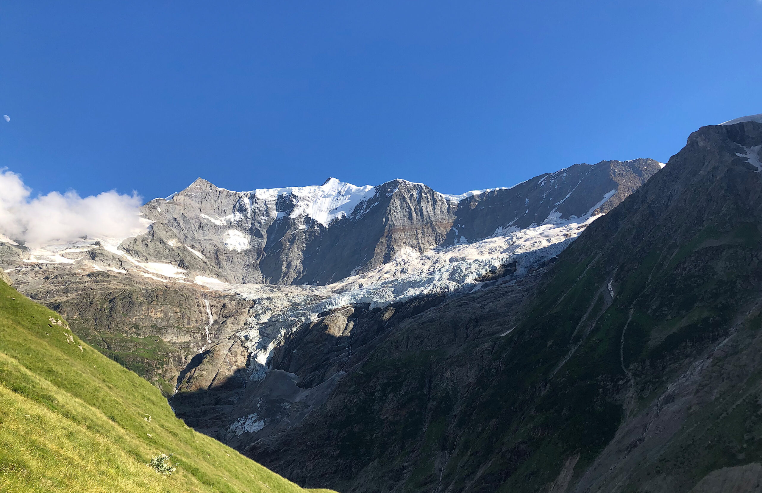
But knowing you’re safe and feeling safe aren’t the same thing. And one of the first surprises of paragliding was the absolute quiet as the air slips by and around you, leaving you alone with the stakes, and, in this case, an overwhelming panorama. The Eiger, the Mättenberg, and the Wetterhorn, three glacier-topped peaks across the valley, soared above us and served as sentries for two gorges that opened up to sun-sparked icy ridgelines.
At the same time, even though there’s always something higher than you are in the Alps, it still was impossible to forget our own altitude. When Veit caught a gentle updraft, below my dangling boots the tiny rooftops in Grindelwald began to shrink even more, and at about 3,500 feet above the cobblestone sidewalks I resorted to interviewing him.
We were gliding now at 17 m.p.h. toward the Pfingstegg gondola station, the upper stop on the Mättenberg that deposited hikers only a few hundred feet from a trailhead but with plenty of work left to do from there.

For locals, it’s an easy trek. For non-locals, it’s not. An hour’s cliffside ascent over a roaring gorge leads up to the Bäregg Hut, which sits with a wide deck on an overhang amidst an expansive, unforgettable view of the glacier-topped saddle. The upper and lower Grindelwald glaciers feed streams that flow into a small emerald lake, murky with scree below the overlook, and the pool funnels into the rapids booming down the gorge.
It seemed a good place to start my interview with Veit. “Have you hiked to Bäregg?” I asked over my shoulder.
“Of course,” he said, “many times.”
It had been five or six years since I had climbed to the Bäregg Hut before hiking it earlier that week. To my eye the glaciers seemed to have retreated in that short time — more evidence, I supposed, of the incremental effects of global warming. So, I asked Viet if the Grindelwald glaciers seemed different to him.
“Oh, yes,” he said. “At my parents’ house we have a photo of the glacier when it stretched down to where the parking lot is now.”
A photograph? Wait — these glaciers, now confined to the reaches above the upper end of the gorge — these glaciers once had stretched down into the valley far below during the age of photography?
They had, Veit said. And, he added, the very glacier ahead of us had shrunk more than 2 kilometers, 1.2 miles, since 2007 (which the Swiss Glacier Monitoring Network confirms).
This wasn’t incremental.
“In many of the highest elevations, the glaciers change less,” he added. “The story is in these middle glaciers.”
It’s difficult to explain hearing and seeing this, in that place, absorbing its beauty and its impermanence at once, but my heart, which had been thumping along at 120-plus beats a minute, actually calmed with the immensity of it. The vast number of widely available studies that confirm climate change take on even greater meaning when you’re flying into an equally vast panorama, eye-to-eye with a source of sea level rise.
Sources of Sea Level Rise
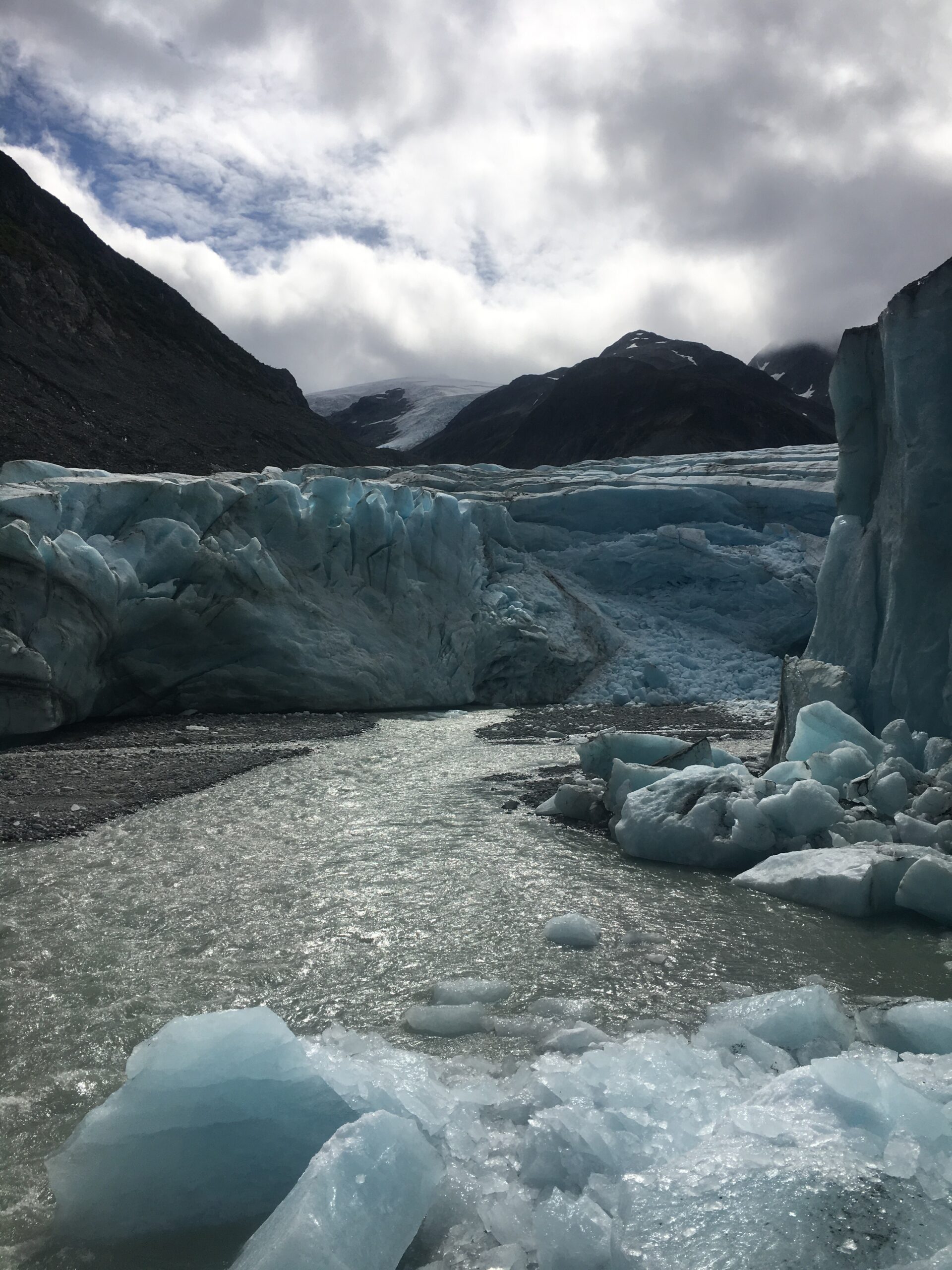
Over 2,000 glaciers once wound through Switzerland’s highest topography. Of those, only 1,500 remain, and Swiss scientists suggest at least 1,300 of these will vanish by the end of the century. Here, a few thousand feet over Grindelwald, was only one glacial vista amidst a multinational sprawling range of Alps with thousands more glaciers, on a planet with many more tremendous stretches of frozen terrain clinging to its mountains and blanketing its polar reaches — much of it already melting and feeding waterfalls, lakes, gorges, rivers, and, of course, our oceans.
The World Glacier Monitoring Service reports that melting glaciers in Alaska and thawing ice fields in Patagonia contribute even more to sea level rise than the Alps. NASA’s satellite monitoring also “unambiguously” shows that the ice sheets in Greenland and Antarctica are melting and shrinking, too.
The sheer volume of water that climate change potentially can unlock is staggering, especially because warming ocean water in and of itself also takes up more space. According to NASA, if all the world’s ice melts, seas will rise more than 195 feet.
That much sea level rise isn’t likely for millennia, but a very small percentage of that 195 feet causes substantial challenges. Last year, UN Secretary General António Guterres said he expected a billion people would suffer the impacts of sea level rise, creating “a mass exodus of entire populations on a biblical scale.” Several studies have forecasted mass migrations, including one from Cornell projecting the cumulative effects of climate change will displace up to two billion people worldwide by 2100.
But what does all this mean for us here in North Carolina?
As we reported in the last issue of Coastwatch, NOAA’s Sea Level Rise Technical Report includes updated scenarios, including one in which oceanwaters will rise on the East Coast by seven more feet within the next 80 years. On a more immediate timescale, NOAA forecasts 10 to 14 additional inches of sea level rise for the East Coast within the next 30 years.
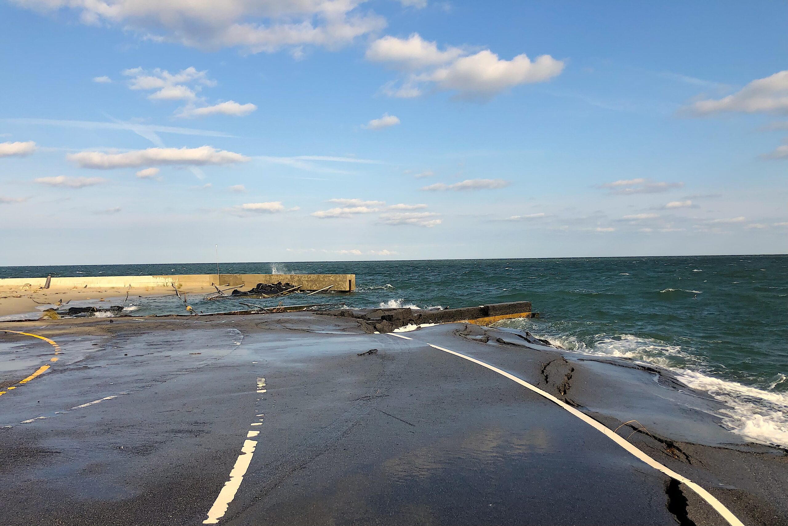
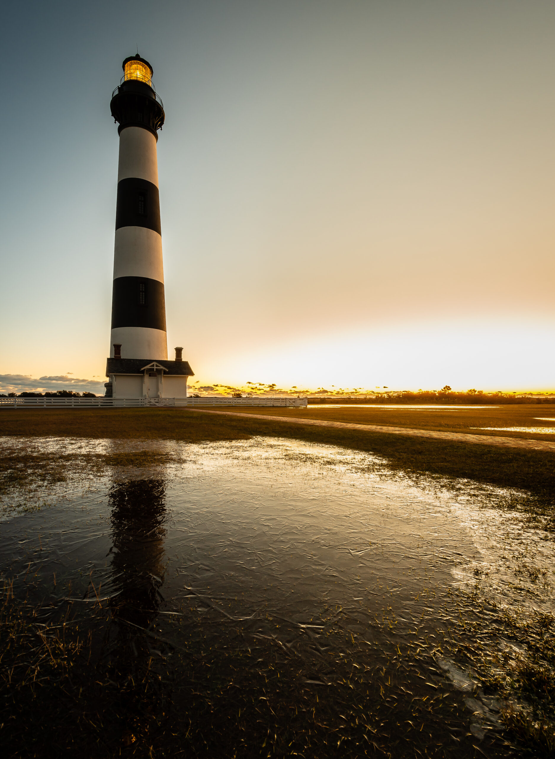
North Carolina includes over 12,000 miles of ocean and estuarine coastline — teeming habitats and ecosystems essential for plants, animals, coastal communities, and the economy. While melting glaciers and ice sheets continue to buoy the world’s oceans, our own coastal terrain and ways of living will face significant changes.
Now, new findings from the network of scientists who monitor North Carolina’s “surface elevation tables” are providing important clues about how the rising Atlantic will imperil our coast.
Land vs. Sea
Piedmont North Carolina is slowly eroding into the Coastal Plain and the Atlantic. Run-off finds streams and rivers that carry sediment across the plateau, over the Fall Line, and into coastal N.C., where intertidal saltmarshes trap much of it. As sediment accumulates at the coast, this process of accretion provides a buffer, to some extent, against both sea level rise and “subsidence,” the slow sinking that characterizes coastal land in North Carolina (as well as on much of the East Coast).
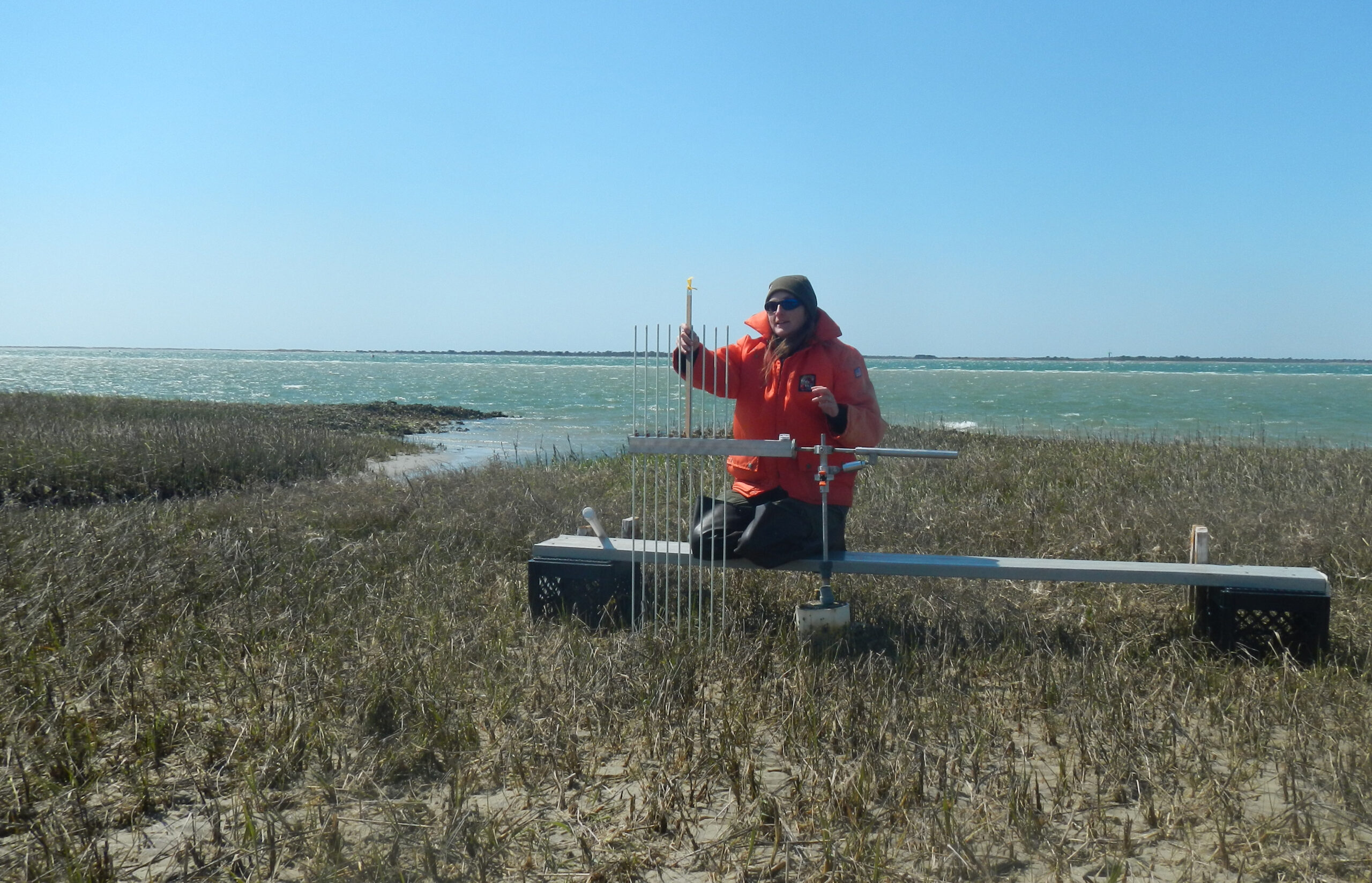
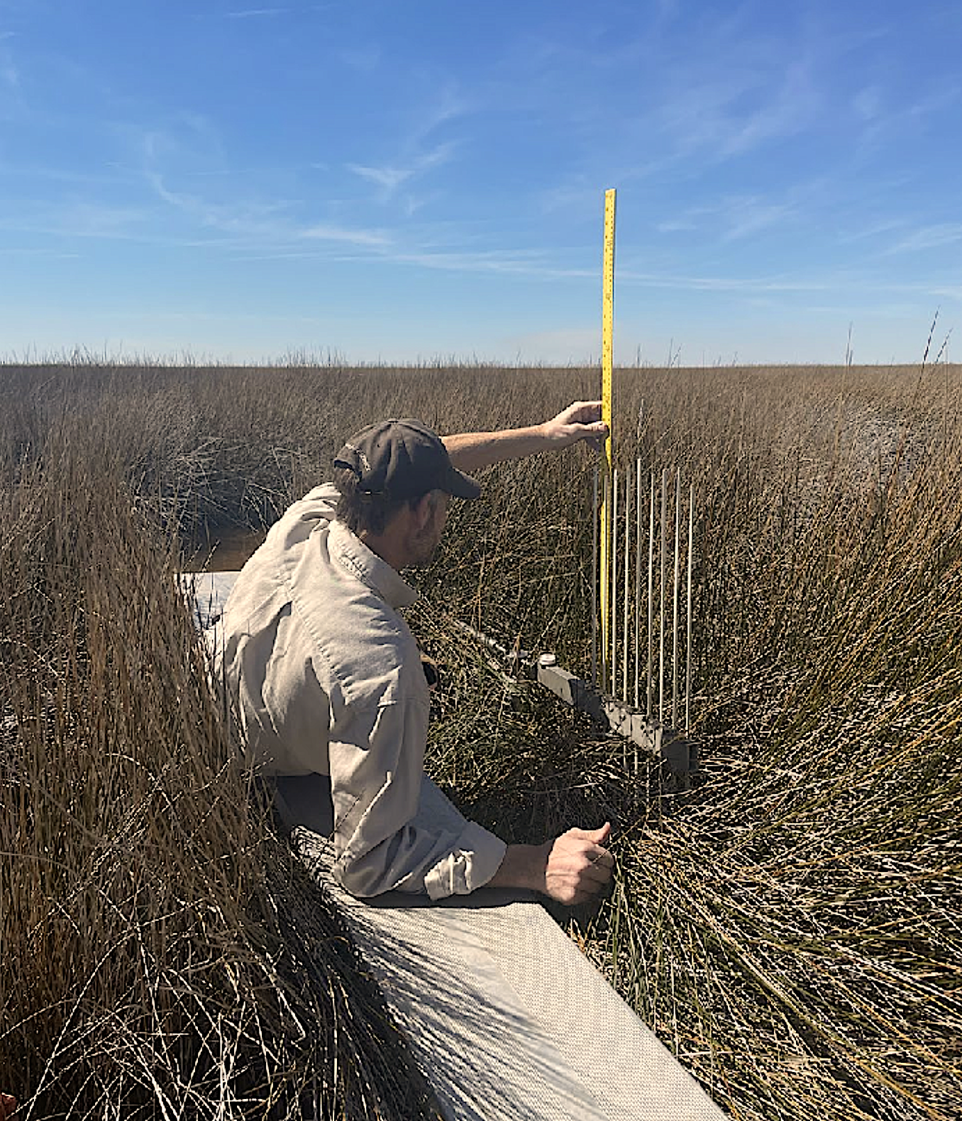
Since 1992 — when Don Cahoon installed the second surface elevation table (SET) in North America on Cedar Island — scientists in North Carolina have been monitoring net gains and losses of elevation in vegetated areas of the Coastal Plain. Each SET can measure changes in surface elevation to within 0.06 inches, making use of a metal rod that researchers install as deep as 75 feet, depending on the site. As trapped sediment, changes in root systems, shifting tides, winds, storms, and erosion all transform the terrain, the rod provides an anchored benchmark for new measurements.
Sarah Spiegler, North Carolina Sea Grant’s coastal resilience specialist, provided a primer for Coastwatch readers about SETs, sea level rise, and the shoreline forces at play in “Land Versus Sea” (Summer 2019). At the time, she served as coordinator for North Carolina’s SET Community of Practice, which had formed the year before to bring together scientists who were collecting data from over 100 SETS.

“In 2015, when Jenny Davis and Carolyn Currin from the NOAA Beaufort Lab went with Don Cahoon out to the Cedar Island SET, the island’s marsh essentially was rising at the same average long-term rate as sea levels at the Beaufort tide station,” Spiegler says. “The battle of land versus sea at that site looked like it was a draw.”
Since then, questions about elevation changes at our coast have become even more urgent. Chief among them: As the land sinks and sea level rise continues to accelerate, are saltmarshes and other coastal terrain building elevation fast enough to keep pace with the swelling Atlantic?
Nine years after measuring the Cedar Island SET with Davis and Cahoon, Currin is retired from her role as NOAA ecologist but remains an active member of the NC SET Community of Practice. “At first we were very happy with the Cedar Island results,” she says. “Until we calculated sea level rise during the time that the more recent SETs have been deployed.”
And in light of accelerating sea level rise and other local factors, Spiegler says, the latest findings from North Carolina’s SETs tell a much different story: “Land versus sea is not a draw.”
Sea Over Land
From 2002 to 2020, relative to coastal North Carolina’s sinking land, the Atlantic rose roughly 4.5 inches at Duck, 6 inches at Beaufort, and 8 inches at Wilmington.
“These are considerably faster rates of change up and down the North Carolina coast than from 1978 to 2002,” says Cayla Cothron, North Carolina Sea Grant’s coastal planning specialist and the current coordinator of the NC SET Community of Practice.
In fact, over the last 15 years, relative sea levels along the Southeast have risen at up to three times the rate of the global average.
“As sea level rise has accelerated over the past decade in particular,” Cothron says, “land elevations at fewer than 10% of the SETs in our state have kept pace.”
Currin says these findings suggest our state will experience “tremendous losses of saltmarsh” in the next few decades. “And with that loss, we’re going to lose fish and bird habitat. We’re going to lose protection from erosion.”
The implications for North Carolina’s saltmarsh are consistent with a global trend. As we reported last summer, a 50-year study of saltmarsh ecology, which Sea Grant funded in part, found that 90% of the world’s saltmarshes would be underwater by the end of the century.
“I think I tend to be more measured, if anything, than I should be,” Currin says. “But I can use words like alarming. I can use words like catastrophic. I mean, these findings show what has just happened over the last 18 years. And virtually none of these marsh systems that we’ve been measuring are keeping up with sea level rise.”
She says the data passes the eyeball test, too.
“We see SETs that we established inside the saltmarsh, on the shoreline, that are now located 20 feet away from the marsh in a mud flat,” Currin says. “And this has happened in place after place after place.”
In 2022, Currin and her colleagues published a study that modeled saltmarsh loss to sea level rise, determining North Carolina and five other East Coast states would lose 83% of their existing coastal marshes and 26% of existing seagrasses over the next 80 years.
“When we first got that result,” she says, “I was like, O.K., you know, something’s wrong. We doublechecked every single parameter, and now our SETs are telling us the same thing as these model results.”
Jenny Davis, a research ecologist with NOAA and a member of the NC SET Community of Practice, says SETs provide invaluable, clear-cut historical evidence.
“When you’re modeling, you’re always making assumptions,” Davis says. “Here we’ve got years of data from multiple sites that show that these marshes are not able to keep up with sea level rise. And having a tangible record that suggests that the trends in those models are correct is pretty powerful.”
Michelle Moorman, ecologist at the U.S. Fish and Wildlife Service, calls the NC SET findings “the canary in the coal mine.” Moorman led a recent study that took a regional look at SETs in coastal wetlands, studying land elevations at 20 sites from southern Virginia to northern Florida.
“Only six sites in our study were keeping up with long-term rates of sea level rise,” she says. “Many coastal wetlands, particularly in the Southeast, are undergoing ecological transformations.”
Ecological Transformations and the Costs to Our Coast
When Michael J. Osland, research ecologist with the U.S. Geological Survey, looked at 166 estuaries across the country in 2022, he and his colleagues determined the landward migration of coastal wetlands “will transform coastlines but not counter seaward losses.”
According to Osland’s team, as sea level rise forces saltwater wetlands inland, that movement will occur largely at the expense of coastal freshwater wetlands and essential croplands, forests, pastures, and grasslands. Sea Grant researchers also have explored similar impacts from accelerating sea level rise that include, for instance, the inland spread of “ghost forests” from saltwater intrusion.
“Coastal terrain is clearly in transition,” Cothron says. “And that natural environment, in effect, serves coastal communities, generating food, fueling fisheries, drawing tourists, and offering so much more. From a planning perspective, we need to consider how this ecological transformation has the potential to stress ecosystems that provide key benefits to our coastal communities and economy.”
As for the effects of accelerating sea level rise on saltmarshes in particular, Davis says that marshes without room to migrate inland won’t survive. “They’ll become open water. Depending on where they’re sitting in the tidal frame, they might have 100 years. They might have 15.”
Davis says it’s difficult to overestimate the value of North Carolina’s saltmarsh or what its loss would mean.
For starters, marshes dampen wave energy and slow the inland transfer of water on flood tides — an increasingly important benefit as global warming causes more tropical systems that intensify more quickly and more strongly. (In fact, scientists from the First Street Foundation and the Lawrence Berkeley National Laboratory recently called for the addition of an even more severe “Category 6” hurricane rating to the Saffir-Simpson scale.)
“But as you lose saltmarsh,” Davis says, “you lose some of that protection from storms.”
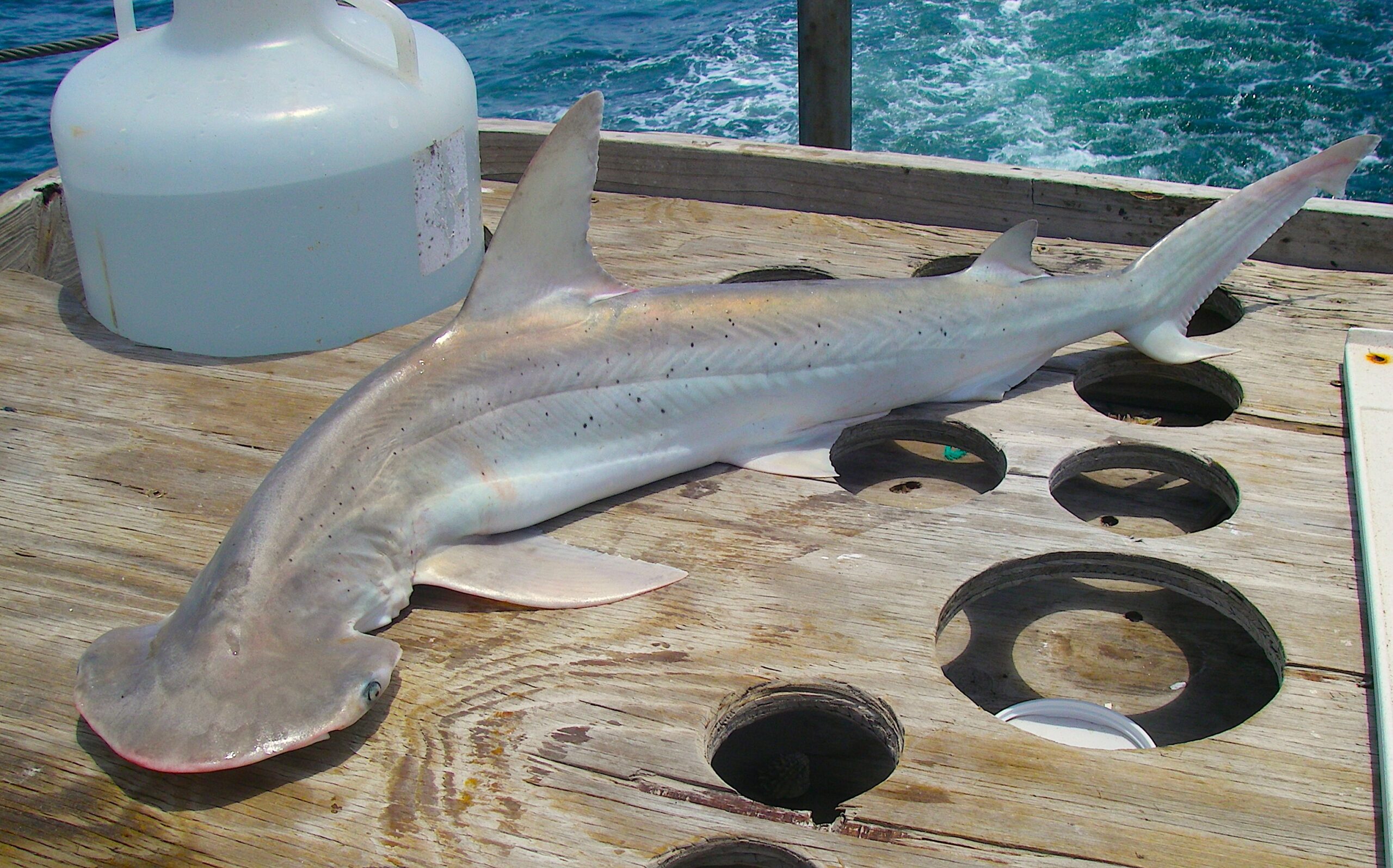
Saltmarsh, in particular, is also vitally important for our fisheries, says Currin. “And that’s a huge part of the eastern North Carolina economy. Oysters, clams — they live right along the salt marsh.”
As importantly, several species of fish as juveniles make saltmarsh their habitat, where they can take refuge from predators and find their own prey.
“I’ve caught grouper, flounder, and other species all as juveniles in saltmarsh,” Currin says. “It’s a critical phase of their life history. They eat the grass shrimp, the crabs, and so on — and that fuels our fisheries. Saltmarshes are crucial for the food web.”
By baffling waves “so the sediments fall out,” saltmarsh also promotes better water quality, Currin says, adding that saltmarsh uses substantial amounts of nitrogen and phosphorus — nutrients that otherwise could cause algal blooms, which have a range of potentially harmful outcomes. (Blooms block sunlight, for example, stifling the growth of seagrasses below surface.)
“Losing all the benefits of saltmarsh would be scary,” Currin says. “But we can’t prevent the loss of saltmarsh over the next 30 years. What we can do is hang onto as much as possible.”
The NC SET scientific community fully outlines their findings in “Surface Elevation Trends in North Carolina’s Coastal Wetlands” — in which they anticipate an unavoidable loss by the end of the century, despite any measures we take, of more than 98,000 acres of North Carolina’s existing 211,000 acres of marsh.
“This ecological transformation is happening no matter what we do,” Moorman says. “But we can still play a role in what it looks like.”
Shaping the Ecological Transformation
As coastal planning specialist for Sea Grant, Cothron’s work sits at the intersection of the latest science and the urgency for building coastal climate resiliency.
“The implication of the newest trends from the SET data is that accelerating sea level rise will claim substantial marsh habitat,” she says. “There’s also a lot of opportunity to act — and to constantly refine our strategies while we move ahead.”
More widespread use of living shorelines, for instance, could prove effective in slowing the submersion of saltmarsh. By mimicking natural shorelines, living shorelines morph and expand over time, and, unlike concrete seawalls or rigid structures, they don’t hinder plant and animal growth.
“We’ve got a number of SETs in living shorelines,” Davis says, “and the elevations at those sites are better than at nearby natural sites.They’re still not keeping up with sea level rise, but living shorelines are a band-aid that can help buy time.”
Currin also sees the use of living shorelines as a stop-gap measure — and a necessary one.
“It’s true that in many cases living shorelines might be submerged in 30 years,” she says. “O.K., but in that 30 years, you’ve preserved some habitat. You’re giving the ecosystem’s plants and animals the chance to migrate, to move themselves, to adapt. So, I think that even within that 30 years, it’s worthwhile doing everything we can.”
Moorman says that even though marshes aren’t self-sustaining at the current rate of sea level rise, “they’re more self-sustaining than a breakwater or some kind of man-made infrastructure. Keeping the marshes in place is good practice.”
That approach dovetails with a movement in some communities across the U.S. to use coastal wetland habitats to protect infrastructure and property. “But,” Moorman adds, “unfortunately, some people feel more secure about having a solid breakwater.”
The current unrestricted use of hardened sea walls in North Carolina only places additional stressors on saltmarshes, Currin says.
“If you build a seawall in front of a saltmarsh, that marsh is going to be gone in 15, 20 years.”
In addition, as the coastline changes, strategically conserving terrain inland will be critical. Currin says “migration corridors” could prove effective, at least to some extent, for marsh preservation.
“If there’s going to be a persistent saltmarsh habitat in the future, we need to provide places for marshes to go,” she says. “We need to provide for marsh migration into uplands. The boundary between public trust waters and private property — how will that be allowed to shift? As sea level rises, how we preserve marsh migration pathways is going to be really, really important.”
The Inner Banks, especially, could provide excellent ground for marsh migration. “There’s even an opportunity to create some wildlife habitat there, as the land transforms,” Moorman says, “areas that could even be used for duck hunting, for instance.”
At the same time, some areas of coastal North Carolina are unsuited for marsh corridors. “Carteret County could be one of them,” Currin explains, “because we don’t have a broad plain there that’s undeveloped, where marshes could migrate.”
Cothron believes understanding opportunities for migration and other options is essential if North Carolina communities hope to continue to reap “resilience benefits” from marsh habitats.
“If I’m planning at a community level,” she says, “I’m looking at the potential vulnerability of any ecosystem that provides services that are vital for the long-term resilience of my town. I need to know what my shoreline looks like and how hardened it is, how much of my land creates space for marsh migration, how much of it doesn’t. Our natural and built environments are inextricably linked, and incorporating these types of considerations into our planning is critical to any path forward.”
The Old Coast and the New Coast
Next time you’re driving Interstate 95 in North Carolina, imagine the ocean lapping at the guardrails. With the Coastal Plain to the east, the highway runs roughly north-south along the Fall Line, four lanes of speeding traffic marking the Atlantic coastline of 60 million years ago. If everything from the poles and in between melts, including those glaciers above Grindelwald, the old coastline will return.
Even if 195 more feet of sea level rise seems too fanciful to contemplate, what’s already happened at our coast over just the last two decades requires no imagination at all. Thanks to hard evidence from our state’s SETs, we know that much less than a single foot of sea level rise has signaled an ecological transformation. Marshes will migrate or drown, saltwater will continue to intrude landward, ghost forests will continue to spread, and wetlands will claim uplands — including farmland.
“We have a detailed record that tells us what accelerating sea level rise now means for coastal North Carolina,” Cothron says. “At the same time, there’s uncertainty. Our planning will have to include processes that are flexible — and always evolving — to face the challenges of our changing coast.”
More
- The NC SET Community of Practice’s “Surface Elevation Trends in North Carolina’s Coastal Wetlands” [White Paper]
- “Vital Signs” on NOAA’s projection of 7 feet of sea level rise (Coastwatch Winter 2024)
- “Land Versus Sea” (Coastwatch Summer 2019)
- “Vital Signs” on the global impact of sea level rise on saltmarsh (Coastwatch Summer 2023)
- Carolyn Currin and colleagues on how sea level rise drives habitat loss
- Michelle Moorman and colleagues on coastal transformation in response to sea level rise
- Michael J. Osland and colleagues on the migration and transformation of coastal wetlands
- “A Brief History of Sea Level Rise in North Carolina” (Coastwatch Winter 2019)
- more from Coastwatch on sea level rise and climate change
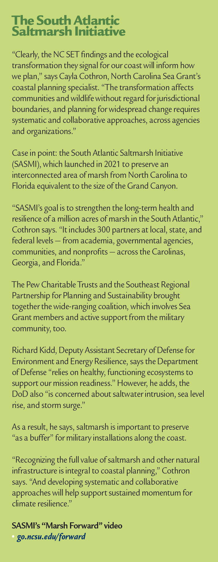
- The South Atlantic Saltmarsh Initiative
Related: In this issue, see “Coastwatch Classroom” for a lesson plan on climate change and coastal marsh. “Warming Waters” covers trends in hurricane intensification, and “Sunny with a Chance of Floods” explores climate-driven flooding unrelated to storms. In addition, “Vital Signs” reports on all-time highs for greenhouse gas emissions. Last, the inaugural edition of “The Guide to Coastal Living” provides info and tips about living shorelines.
- Categories: