Shifting Shorelines: North Carolina Inlet Atlas
North Carolina’s coastal history is closely tied to changes in its barrier islands, and to the inlets that link protected sounds to the open ocean. Each year during hurricane season and on into winter — notorious for nor’easters — coastal residents and geologists alike ponder the possibility: Will a storm move enough water to cut a new inlet, or enough sand to close an existing one?
Since the initial publication in 1999 of Shifting Shorelines: A Pictorial Atlas of North Carolina Inlets, many significant changes have occurred within the N.C. inlet systems and along the adjacent shorelines. The major natural changes include the closure of three inlets: Old Topsail, New and Mad. Anthropogenic-related changes include the relocation of an entire inlet, Mason, and the realignment/relocation of all or a portion of the ebb channel at three inlets — Bogue, Cape Fear and Shallotte.
In the playlist below, you can see how Tubbs, Bogue, Lockwood Folly, Mason, and Shallotte Inlets have all changed over the past 70 years. To see a specific inlet, click the playlist icon in the upper right hand corner of the video window and a drop-down list will appear. To see these videos full screen, click on the square icon in the bottom right corner.
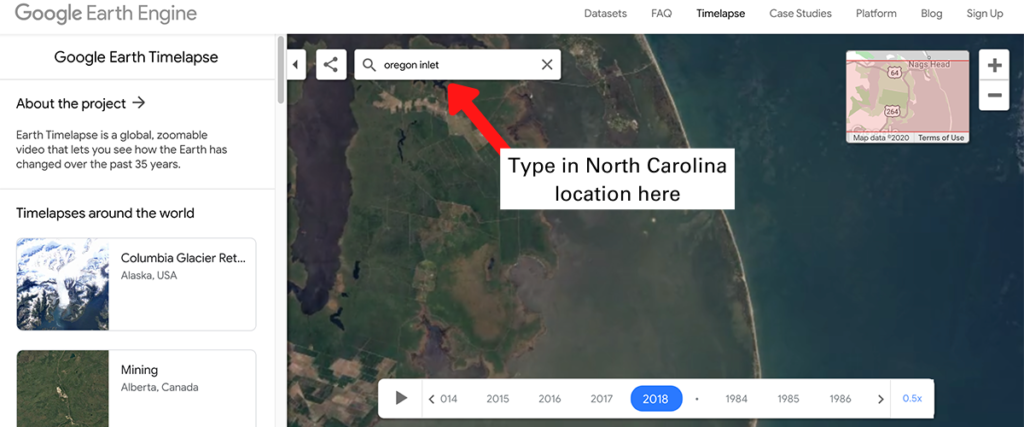
Additionally, you can use Google Earth Timelapse to see how all of North Carolina’s inlets have changed since 1984. Just insert a location into the search bar, such as Cape Hatteras or Oregon Inlet. See the example below.