
Surface Elevation Table (SET) Map
What is the NC SET map?
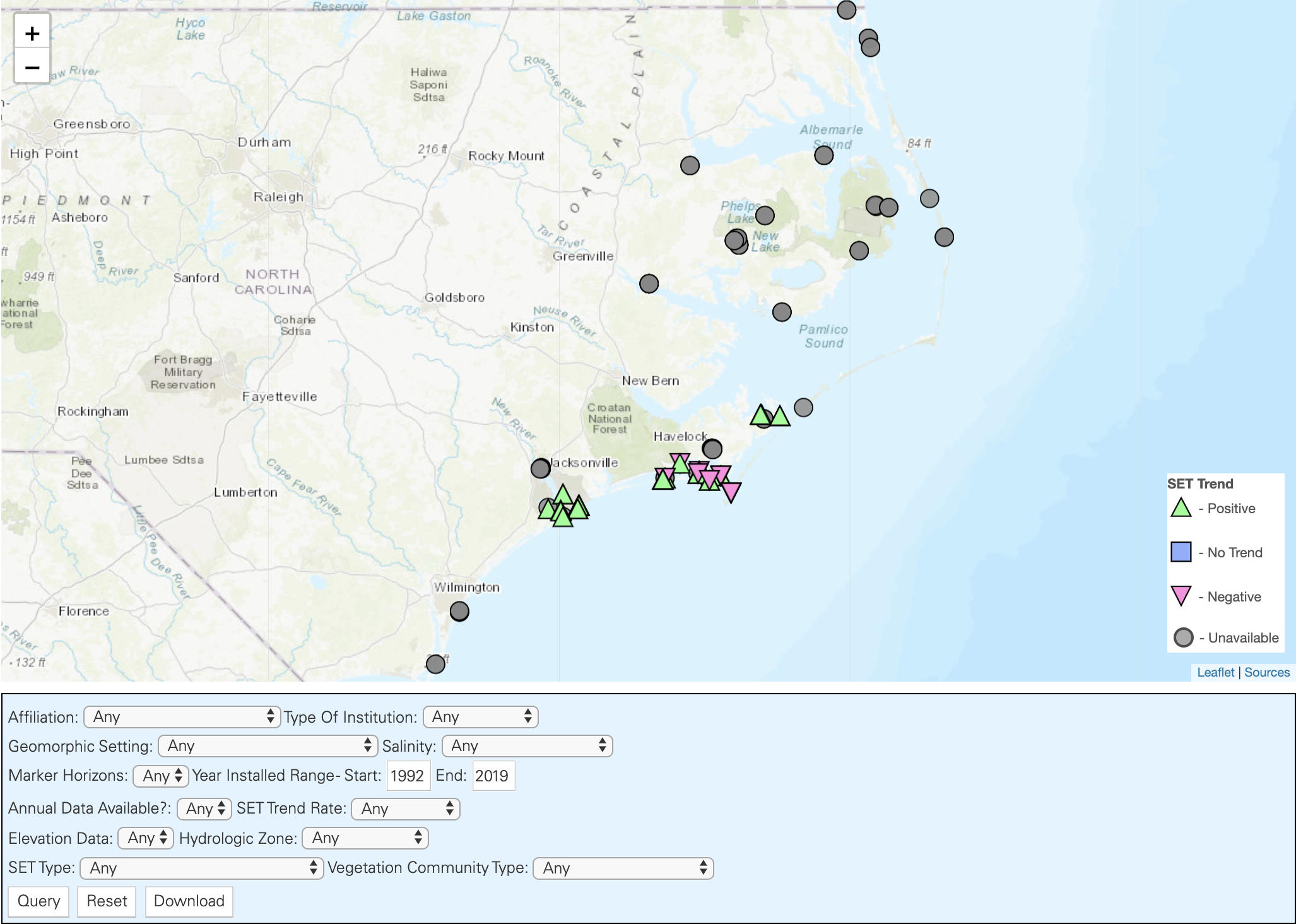
This map illustrates the location of Surface Elevation Tables (SETs) installed throughout the coastal zone of North Carolina and provides links to descriptive data about the location in which each device is installed. The NC SET Community of Practice has developed this interactive map by collecting SET metadata from partners throughout North Carolina. If you are aware of SETs that are missing from the map, please contact us.
What is a SET?
A SET is a portable, mechanical leveling device that allows for the detection of changes in sediment surface elevation with millimeter-scale precision (Cahoon et al. 2002). SETs help scientists understand how coastal surface elevations respond to changes in relative sea level. The data provided by SETs are used by coastal managers and decision makers to prioritize areas for restoration and by modelers to inform predictions about the extent of marsh habitat under future sea level rise scenarios.
How do I use the NC SET map?
Each shape on the map represents a SET sampling station and has a suite of information associated with it. The ecosystem within which the SET is located affects the potential for sediments to accumulate on wetland surfaces, so several ecological parameters are included in the metadata. The availability of data at each site depends on how each organization operates and measures the SETs.
- Click on a SET shape to access the metadata associated with the station.
- Use the query box to search for a subset of SETs based on the parameters you choose. You can also download this subset as a .csv file.
Please note: SETs are research plots and should not be tampered with.
Questions? Please contact Sarah Spiegler (sespiegl@ncsu.edu) or Jenny Davis (jenny.davis@noaa.gov).