NC Sea Grant and Space Grant Launch New Study on Ghost Forests
for immediate release
contact: John Fear, jmfear@ncsu.edu
Jobi Cook, jobi_cook@ncsu.edu
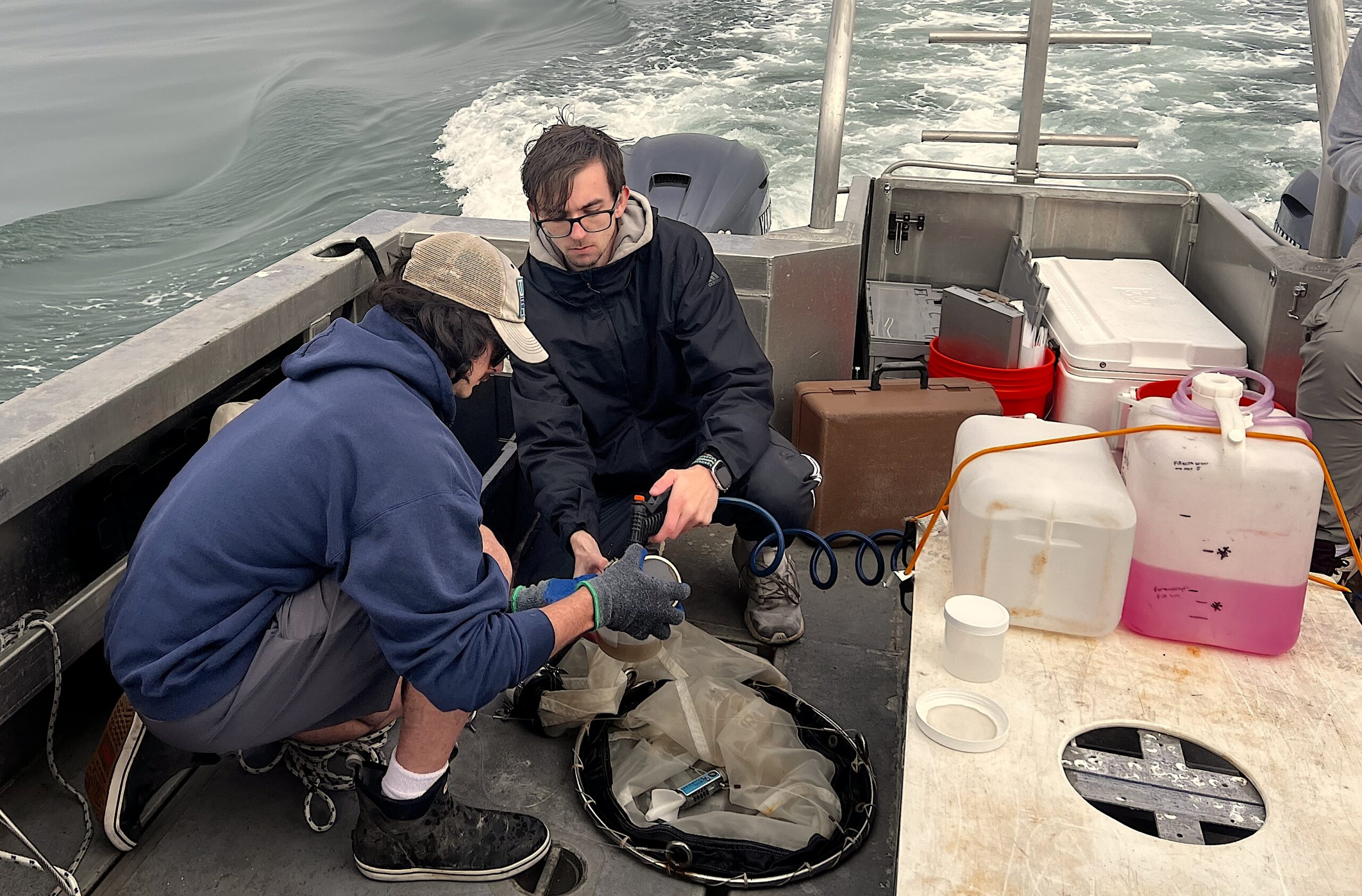
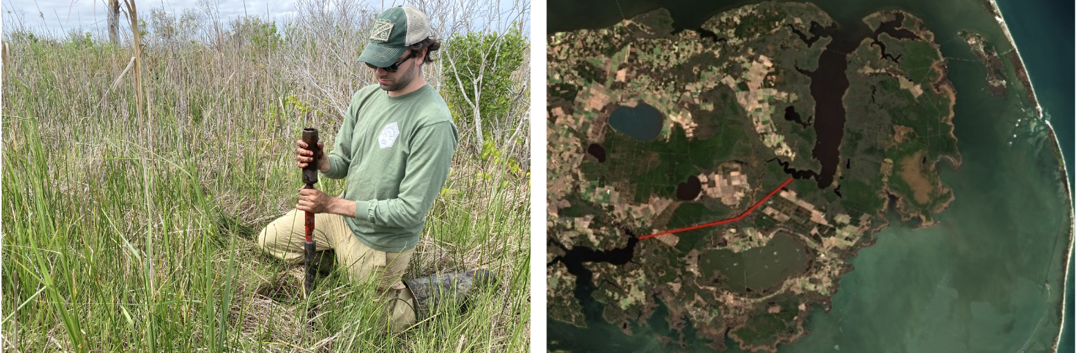
Spencer Rhea, a Ph.D. student in biology at Duke University, is investigating when and where ghost forests will form next. Using satellite data to evaluate water color, Rhea is mapping coastal water salinity for a special research project for North Carolina Sea Grant and NC Space Grant.
“This research provides opportunities for students to utilize NASA satellite data to develop tools that can be used regionally to predict and monitor ghost forest development,” says Jobi Cook, associate director of NC Space Grant.
North Carolina Sea Grant and NC Space Grant are providing this research opportunity in collaboration with Louisiana Sea Grant and Louisiana Space Grant. John Fear, deputy director of North Carolina Sea Grant, says the study of ghost forests is especially timely.
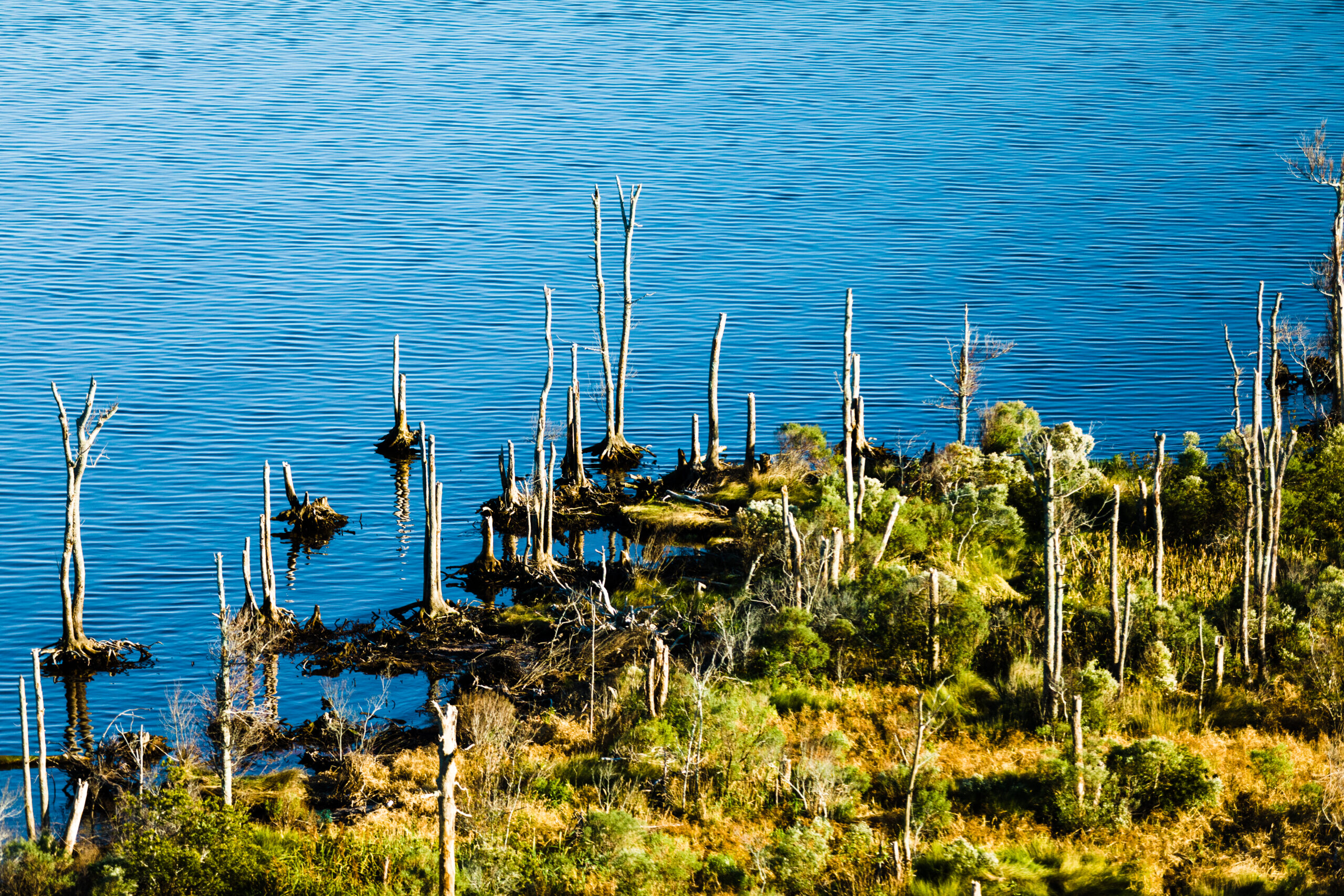
“One of the impacts of sea level rise is the conversion of coastal forests to wetlands and eventually open water,” Fear explains. “This process proceeds through a ‘ghost forest’ stage. Tracking the loss of forests and its effects is a sentinel tool in understanding and responding to how our coastal habitats are changing.”
Coastal forested wetlands die off as a result of flooding, hurricanes, and soil salinization, and determining where salinization most occurs could lead to measures that protect vulnerable areas. When seawaters and waters from wetlands mix, carbon from the wetland water attaches to salt from the seawaters to form solid matter that sinks and leaves behind clearer waters.
Rhea will use remote-sensing tools and mapping technology from NASA and NOAA to see where clearer waters are forming, thus determining where salt water is encroaching into coastal forested wetlands.
“Using remote sensing to detect saltwater intrusion through a change in watercolor is a novel approach,” says Rhea. “It could be a powerful new tool to understand and predict ghost forest formation.”
Rhea will speak about his research at the 2024 NC Space Grant Symposium.
more Sea Grant funding opportunities
Lead image by Baxter Miller
###
- Categories: