By RHETT REGISTER
After a dusty ride down farm roads bordered by carpets of soybeans and the stubble of late-season cornfields, Mike Burchell stops the truck next to what looks like an impenetrable swamp.
He and his lab manager, Tiffany Messer, don work boots and snake chaps. She pockets a hand-held GPS unit while he shoulders a bush axe. Then the pair heads down an overgrown trail into the dense vegetation.
They are in a portion of Hyde County on the Albemarle Peninsula — a flat, mitten-shaped piece of land, much of which is barely above sea level. A short walk past a sinkhole filled with black water, over fallen trees and through tangles of wild grapevines leads them to what they seek.
“This is why we do these in replicate,” Burchell says, pointing to tooth marks and threads of black hair on a PVC pipe jutting up from the forest floor.
The pipe is a well that Burchell, an ecological engineer with the North Carolina State University’s Department of Biological and Agricultural Engineering, and Messer dug a year ago to monitor groundwater levels on the peninsula. A curious black bear had shaken the batteries out of the data logger that records information on water levels from a sensor in the well.
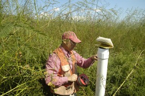
Mike Burchell checks the depth of the groundwater near the proposed restoration site. Photo Courtesy Rhett Register.
The researchers will combine data from the wells — those that haven’t been throttled by black bears — with lab work funded by North Carolina Sea Grant and the N.C. Water Resources Research Institute of the University of North Carolina System. It is among the first projects to be jointly funded by both programs.
“The freshwater work done by WRRI dovetails nicely with the coastal concerns that Sea Grant focuses on, ” says Susan White, executive director of both organizations. “Results from this project will have broad applicability in both freshwater and saltwater environments.”
In fact, results from the research will be used for what could become the largest wetlands restoration project in North Carolina.
IT BEGINS WITH OYSTERS
In 2003, the N.C. Coastal Federation, a nonprofit coastal advocacy organization, sought to devise a plan for restoring oysters in the northern portion of Pamlico Sound as part of a coastwide effort.
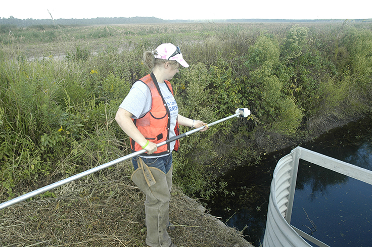
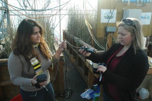
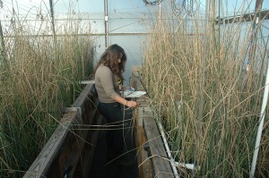
Tiffany Messer samples water near Lux Farms to ensure her model accurately represents conditions in the field. Photo Courtesy Rhett Register.
Oysters filter dirty water. Their beds help prevent erosion and are a favored habitat of many fish species and blue crabs. Helping oysters can help an entire ecosystem.
Through stakeholder meetings, the federation identified areas within the region where water quality issues may have affected historical oyster beds, and sought input from stakeholders as to possible ways to improve oyster restoration success.
The federation focused on a region near the central coast of the peninsula where aerial photographs showed intermittent tannic plumes coming from drainage canals. Federation scientists say the canals — used to drain the peninsula to make it suitable for farming — are discharging water that contains sediment and bacteria that are harmful to oysters.
This runoff, they say, combines with disease, storms and harvest pressure to reduce oyster populations in the area.
FROM WATER TO LAND
“We realized for oyster restoration to be successful, we needed to address some of the water quality concerns that were stemming from land-use changes,” says Erin Fleckenstein, a coastal scientist who manages the federation’s northeast regional office.
In the 1960s, the peninsula was ditched and drained to log cypress, pine and cedar trees. After timber operations dwindled, agriculture moved in, bringing more economic development to the area. Today, farms in the region typically grow commodity crops such as corn, wheat, soybeans and cotton. In some areas, the land must be kept dry using an extensive system of pumps and ditches. In northern Hyde County, the Mattamuskeet Drainage Association maintains and operates a pump and canal system that makes farming, timber production and some recreational activities possible on a 64-square-mile portion of the peninsula.
Fleckenstein and other federation staff approached Wilson Daughtry, then president of the association, to discuss ways of reducing flow from their drainage canals into the sensitive oyster waters of the Pamlico Sound. They hoped that some of the association members would be willing to restore a portion of their land to wetlands, which could improve water quality and reduce the amount of water leaving the area.
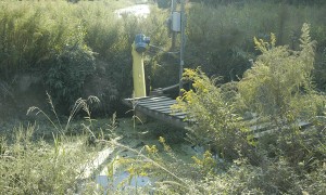
Pumps are needed to move water through the Mattamuskeet Drainage Association’s canals. Photo Courtesy Rhett Register
Wetlands act as nature’s kidneys by filtering water as it moves through them. They absorb water and slow its flow, allowing sediment to fall out, reducing bacteria and processing excess nutrients — all actions that improve water quality.
Daughtry is part owner and manager of the 4,700-acre Lux Farms. He also owns Alligator River Growers, a smaller adjacent farm famous for its onions. Both farms are contained within the Mattamuskeet Association. As it turned out, landowners in the association already were thinking about ways to reduce drainage to the Pamlico Sound. Daughtry told the scientists that in the 1990s, association landowners began capitalizing on the Wetlands Reserve Program, or WRP. The program, run by the U.S. Department of Agriculture’s Natural Resources Conservation Service, or NRCS, purchases perpetual easements on land and restores the hydrology to wetland status.
According to Daughtry, for several decades, owners of Lux Farms have wanted to try and limit the amount of water leaving the land.
“I would say going all the way back to the mid ’80s there was a desire to try to hold water in certain — what we would classify as unproductive — parts of the farm and more or less keep that water from being pumped out of the system to where we couldn’t get it back and reuse it.”
Daughtry also surprised the federation by producing an aerial photograph of the property, taken in the late 1980s, that showed the outline of a dry slough running northward through the Lux Farms property.
The image meant that originally, water flowed toward the Alligator River, north of the property, rather than east to the sound. If the original hydrology could be restored, drainage from the land that was flowing into the Pamlico Sound would be reduced or stopped altogether.
In 2011, Daughtry and fellow owners of Lux Farms agreed to put 4,033 acres — an area bordering the Alligator River National Wildlife Refuge — into the WRP.
PLANS AND MORE PLANS
With the land now available for restoration, the federation turned to Burchell and fellow Biological and Agricultural Engineering department members Chip Cheschier and Kris Bass to work with WRP officials to create a plan for restoring wetlands on the property.
The group decided a phased approach would work best, with the first phase restoring 1,400 acres of the Lux Farms land. The plan calls for the WRP to restore wetland habitat using dikes and drainage modifications to make the area wetter. It also will add new trees to replace lost habitat and threatened tree species.
“We try to get as close as possible, to the extent practical, of what we consider to be what the site was historically,” says Bill Edwards, NRCS area biologist and WRP team leader for the project.
The Coastal Federation will work with the WRP to ensure that the restoration will improve water quality in the sound.
To connect the restored parcel to the existing drainage network, Burchell and his team plan to add pumps, sloughs and water-control structures to the WRP work. These additions will help reproduce flows that historically occurred through the project area.
“By mimicking the hydrologic regime that once existed,” Burchell says, “the farm will not need to pump as much to the sounds.” That’s where the wells come in. Burchell will use information the wells provide to monitor the hydroperiod, or the signature of how water changes at the surface and in the soil, in the wetland areas before and after restoration.
REFUGE CONCERNS
Much has changed since the 1960s when the water was initially was routed east into the sound. In 1984, the U.S. Fish and Wildlife Service established the 154,000-acre Alligator River National Wildlife Refuge. Home to the largest concentration of black bears on the East Coast, the refuge protects plants, such as carnivorous pitcher plants, and habitat types, such as pocosins. These are an unusual phenomenon where a swamp occurs on ground that is higher than the surrounding land.
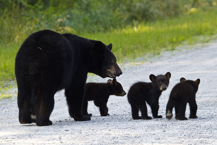
A mother black bear and her cubs cross the road in the refuge. Photo Courtesy Jackie Orsulak.
When the Coastal Federation approached the agency about the restoration, officials were supportive. Additional fresh water into the refuge might help stay saltwater intrusion that kills trees, and could raise the water table, making the refuge less susceptible to underground peat fires that sometimes occur in the region. Refuge officials voiced concern, however, about the quality of water that would be coming into the refuge from the farm.
“We didn’t want to see over-nitrification of Swan Creek Lake,” says Scott Lanier, deputy manager of the refuge. “We deal with invasive plant species control — those lakes can be impacted by alligator weed. We didn’t want to see any other stressors on there that would negatively impact them.”
To address the managers’ concerns and to understand how effective the restored wetlands will be at removing nitrogen from water headed toward the Alligator River, Burchell and Messer sought research funding from Sea Grant and WRRI, for work in Raleigh.
HYDE COUNTY IN RALEIGH
Opaque plastic covers a greenhouse in west Raleigh where soft-stemmed bulrush sway in the breeze coming in through open windows. The bulrush, a tall spikey plant common to North Carolina wetlands, grow in a series of large wooden planters filled with soils Messer and Burchell have brought back from the proposed restoration site.
The system — called a mesocosm — acts as a representative environment that researchers can study to answer questions about how the larger environmental system works at the coast.
Funding from Sea Grant and WRRI allowed Messer to recreate this little slice of Hyde County in a Raleigh lab. As part of her doctoral project, she measures how the miniature wetlands process nitrogen.
“You can’t do this kind of data analysis on a site that is four hours away,” she says. “We can’t go every day to get samples.” The lab also allows the researchers to control all of the parameters that factor into a wetland absorbing nitrogen, something that would be impossible in the field.
Maggie Rabiipour (left) and Messer (right) show a sensor they use for monitoring the mesocosms. Photo Courtesy Rhett Register.
Above the bulrush planters hangs a latticework of clear aquarium tubing. The plants are given water that mimics the site’s agricultural runoff. Periodically, a sensor system automatically sips water samples through the tubes from each of the mesocosms. The system measures the water’s contents and stores the information for Messer to download.
From the data, she can determine how much of the nitrogen is being removed from the water.
Plants love nitrogen. That’s why it is used for fertilizer. But it is not the bulrush that neutralizes all of the nitrogen fertilizer in the water. The organisms that often do the heavy lifting are the bacteria that reside around the root structures of the plants in the soil. Under the right conditions, these bacteria use nitrogen instead of oxygen. The result is the breakdown of active fertilizer in the water into solidly bonded, inactive nitrogen. Results from this process, called denitrification, bubble up from the soil to join the inert nitrogen gas that makes up 78 percent of our atmosphere.
Wires dangle from probes inserted into the soil to test for the redox potential — a measurement of how likely the bacteria will be to convert the fertilizer. Messer and her assistant, undergraduate Maggie Rabiipour, collect data from them and also check pH, dissolved oxygen and temperature in each of the mesocosm systems.
By December, Messer had run 11 rounds of tests on the mesocosms and planned five more. The preliminary results are encouraging in terms of nitrogen absorption.
“It appears that that the wetlands will be able to reduce nitrogen concentrations to a level that will not be a problem for the refuge,” she says.
NITROGEN’S FATE
The projects also answer broader questions about how nitrogen flows through wetlands.
“Everyone knows that wetlands remove nitrate. I knew that when I was getting my Ph.D. But where’s it going?” Burchell asks.
Nitrogen fertilizer moving into a wetland could be used by plants or bacteria in the soil, escape into the air, or dissolve in water. Thus, Messer and Burchell devised a tracer study that uses a rare form of nitrogen to map the fate of the element as it moves through a wetland.
After injecting the nitrogen-15 isotope into the mesocosms, the pair took samples of all of the places it could have gone — air, water, soil and plants. They sent the samples to a U.S. Geological Survey lab and the Duke Environmental Stable Isotope Lab and are waiting for the results as of January 2014.
Rabiipour records information from mesocosms that mimic conditions at the restoration site in Hyde County. Photo Courtesy Rhett Register
“I now understand why more people haven’t done this study,” Burchell says. “It is a lot of work and it is expensive. But we’ve persevered through this. Our preliminary analysis has shown that most of the nitrogen loss is from complete denitrification from nitrate to nitrogen gas.”
That is a good thing because the denitrification process has a few intermediate forms of nitrogen, such as nitrous oxide, that are potent greenhouse gases.
Despite the effort involved, results from piecing together the route nitrogen takes once it enters a wetland will help engineers estimate how much nitrogen a wetland can absorb in restoration projects in North Carolina and beyond.
“This project is using science to make the most accurate prediction about what will happen to nutrients when water is diverted from agricultural land to restored wetlands,” says Sea Grant water quality specialist Barbara Doll. “Their efforts will further advance the science of nitrogen fate and transport in coastal wetland systems.”
MOVING FORWARD
If the project is successful in improving water quality in the Pamlico Sound, the federation has plans for additional phases.
“The work that is being initiated with Mike and the mesocosm study will be initially applied to the Lux Farms project,” Fleckenstein says, “but also will help to inform these other 10 projects that have been identified within the association and how we best manage them for nutrient removal and water quality benefits.”
Future phases could end up restoring as much as 10,400 acres within the drainage association making it, according to Fleckenstein, one of the largest wetland restorations in the nation.
If all goes according to plan, ground could be broken on the Lux Farms project as early as spring of this year. Burchell is ready for the project to begin and is optimistic that the results will show that wetlands restoration can play a big role in addressing water quality issues throughout the state.
“I’m enthusiastic about the ability of wetlands to treat nitrogen,” he says. “With proper management, I believe diverting runoff into wetlands systems will allow us to treat a sizeable portion of our nonpoint source pollution problems.”
This article was published in the Winter 2014 issue of Coastwatch.
For contact information and reprint requests, visit ncseagrant.ncsu.edu/coastwatch/contact/.