STRING OF SENTRIES: SENTINELS FORM A NETWORK OF EYES ON THE COAST
Download PDF here
The whole is greater than the sum of its parts. That classic saying is the basis of the National Oceanic and Atmospheric Administration’s Sentinel Site Program.
Along the nation’s coasts, NOAA strives to help coastal communities and critical habitats become more resilient to the effects of sea-level rise and changing coastal flooding patterns. By collecting and sharing a wide variety of environmental observations — and developing models and tools to understand and predict changes taking place along the coasts — NOAA is enabling coastal decision makers to apply science in their adaptation and mitigation plans.
NOAA’s National Ocean Service, or NOS, created the Sentinel Site Program in 2011. This collaborative effort focuses a wide range of science, service and stewardship activities to address specific issues in specific places. The program brings together partners from many scientific and management disciplines.
The program has focused on quantifying impacts of coastal flooding and sea-level rise, and applying science-based solutions to coastal regions.
Sea-level rise and coastal inundation are global issues, but their effects in communities are unique because sea levels are changing at different rates in different places. The impacts are best addressed at the local level — using local forecasts, land-elevation and water-level data, and local information about the people and resources in affected areas.
Other cooperatives focusing on challenges such as ocean acidification, water quality or marine debris have been envisioned for the future.
Sentinel sites are located in coastal environments that can support intensive study and sustained observations to detect — and understand — physical and biological changes. Cooperatives are the collection of agencies and people that are working toward understanding and addressing the impacts from sea-level rise and coastal flooding, and helping to apply the lessons learned within the sentinel sites to broader areas.
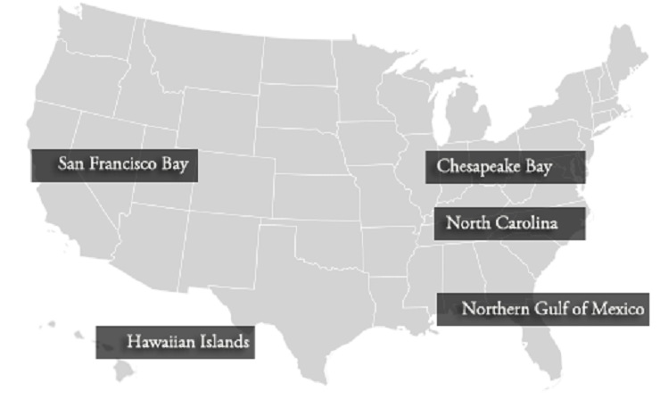
There are five cooperatives: North Carolina, Chesapeake Bay, Northern Gulf of Mexico, the Hawaiian Islands and San Francisco Bay. Each cooperative can address its locality’s unique assets, geography and concerns. The network structure of the program fosters collaboration and knowledge sharing among the cooperatives.
They allow NOAA to make efficient use of its assets — human and geographic — and those of partner organizations to develop management plans that protect, build, and enhance coastal communities and ecosystems.
Each cooperative was selected using factors such as:
- inclusion of a National Estuarine Research Reserve or National Marine Sanctuary with ongoing ecosystem monitoring programs within each cooperative’s boundary;
- the potential for measuring ecological impact of sea-level change; and
- the potential to apply science-based solutions to solve specific regional coastal problems associated with sea-level rise.
Partners include local, state and federal agencies, as well as academic institutions, nonprofit organizations, local communities and regional organizations.
This structure enables the cooperatives to better coordinate existing resources among partners, while reducing redundancy and increasing effectiveness in understanding sea-level rise and coastal flooding.
The cooperatives focus on translating data into valuable sea-level change and coastal inundation information that informs management strategies — and could lead to better overall stewardship of the nation’s coastal resources.
In 2014, NOAA’s National Sea Grant College Program joined the Sentinel Site Program. This partnership added the participation of five state-based Sea Grant Programs: North Carolina, California, Hawaiʻi, Maryland, and Mississippi/Alabama.
Through funding from NOS and the NOAA Office of Oceanic and Atmospheric Research, National Sea Grant provides coordinators for each of the cooperatives. They maintain relationships among the partners, from researchers and decision makers to other members of the community.
Each cooperative benefits from effective collaboration through aligning member and partner resources, and focusing efforts toward common goals. Participants also identify ways that they each can collect and analyze scientific data, and apply that information to support coastal decision making.
Below, the coordinators of each of the sentinel sites describe the efforts of their programs.
Go to oceanservice.noaa.gov/sentinelsites for more on the national Sentinel Site Program and each individual site.
NORTH CAROLINA: A Wealth of Resources
By Jennifer Dorton, North Carolina Sea Grant
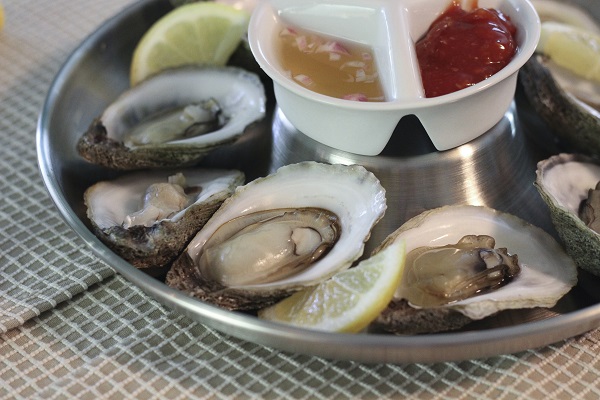
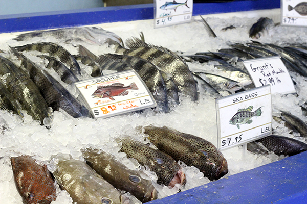
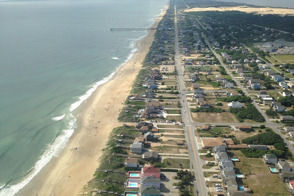
The central North Carolina coastline is renowned for the wide, sandy beaches along the Outer Banks and Crystal Coast, and expansive marshes and seagrass beds.
The communities also host a wealth of academic and scientific talent based at NOAA organizations, universities, and state agencies for coastal management and fisheries.
Combined, these factors make the region an ideal location for NOAA Sentinel Site designation. NOAA tide gauges positioned along the North Carolina coast show sea-level rise trends that vary from higher rates in the north to lower measurements in the south. The central coast falls in the middle of that spectrum. The NOAA tide gauge at Beaufort, closest to the midpoint of North Carolina’s coast, shows an estimated sea-level rise trend of 2.83 millimeters — approximately the thickness of two dimes — per year. The 2013 Intergovernmental Panel on Climate Change report noted that annual global mean sea-level rise between 1993 and 2010 was 3.2 millimeters, about the thickness of a nickel and a dime.
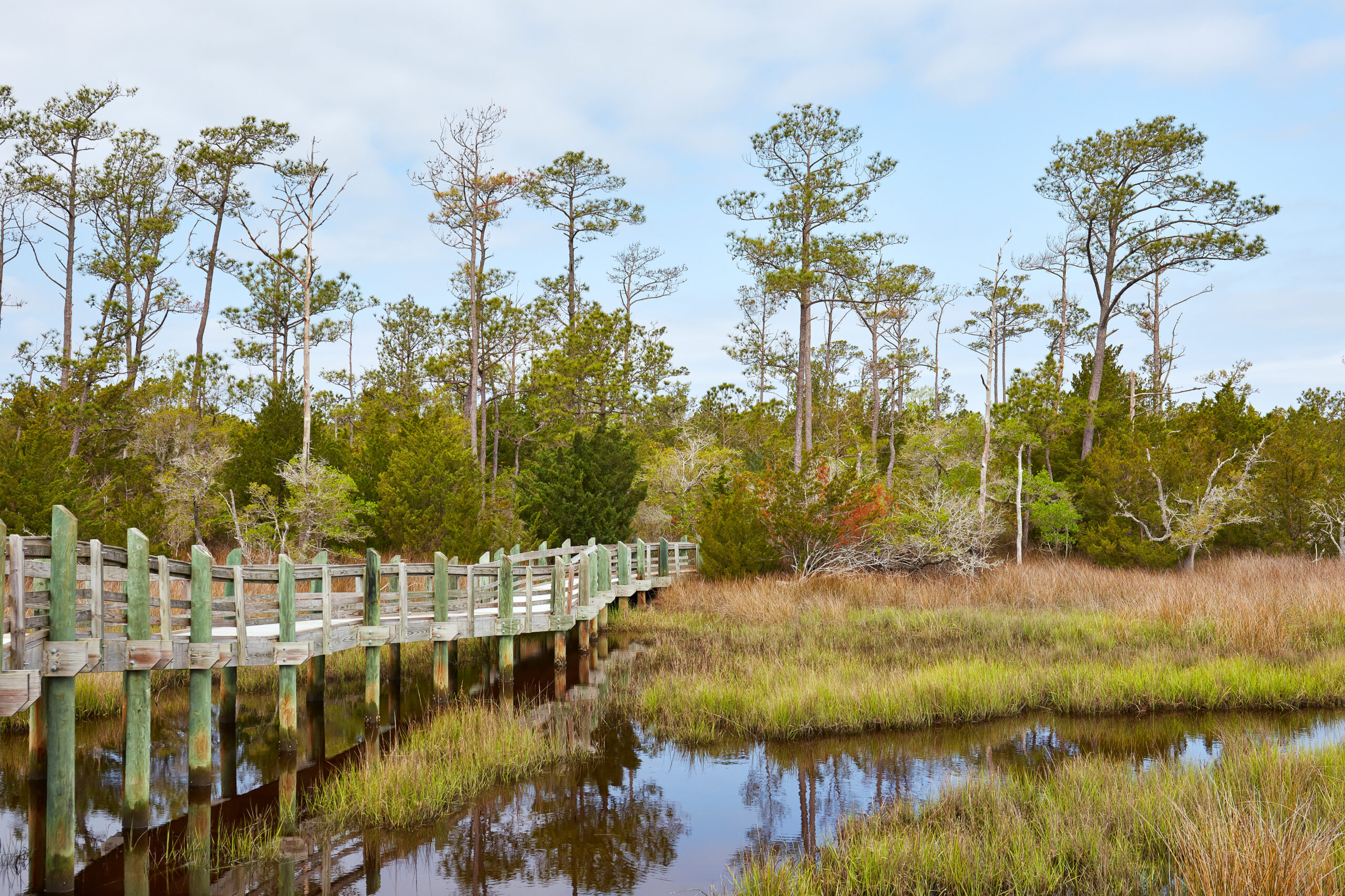
Ecosystems within the North Carolina Sentinel Site Cooperative, or NCSSC, such as barrier islands sustain rich ecosystems, host valuable infrastructure, and protect the mainland coast from sea-level rise and storms.
NCSSC partner organizations work together to continue long-term monitoring efforts and to establish demonstration projects within the NCSSC boundary. Through these activities, the NCSSC provides decision-makers from federal agencies such as NOAA and state agencies such as the Department of Environmental Quality’s, Division of Coastal Resources, with the information to protect the state’s coastal resources and ecosystems.
Projects include:
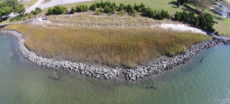
- Comparing the effects of estuarine shoreline hardening with living shorelines on the ecological function of salt marshes.
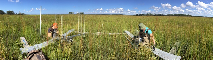
- Monitoring established surface elevation tables, or SETs, and adding SET locations within the cooperative to identify sea-level trends within marsh ecosystems.
- Conducting living shoreline demonstration projects where marsh grasses are planted for shoreline stabilization.
In 2015, NOAA funded two Ecological Effects of Sea Level Rise, or EESLR, projects for work to be conducted within the NCSSC geographic footprint.
The first project, led by Christine Voss, from the University of North Carolina at Chapel Hill’s Institute of Marine Sciences, will address rising sea levels and changes in exposure to storms that are aspects of climate change that challenge the resilience of coastal ecosystems and human communities. Protecting coastal populations and property, as well as preventing the loss of ecosystem services provided by marsh habitat represent crucial challenges faced in North Carolina.
Voss and her team will determine how factors such as tide, wind and water level affect the marsh ecosystem. The researchers also will examine how the ability of a marsh to reduce wave force varies across these conditions.
Their results will provide officials and residents with knowledge and recommendations to manage coastal marshes. This will enable managers to maximize the use of these valuable resources to help coastal communities face increasing sea levels and storm intensities.
In the second EESLR project, Peter Ruggiero from Oregon State University and a team of coastal scientists from Oregon State University and UNC Chapel Hill will develop a new model to evaluate how beach dune systems respond to and recover from storms.
They will combine the feedback between dune vegetation and sand transport with a recently developed coastal dune model. The team intends to assess beach and dune evolution in both natural (e.g., Cape Lookout National Seashore) and managed systems (e.g., nourished areas) in response to sea-level rise and extreme storms.
Ruggiero and his team also will identify how dunes may respond to and recover from storms at the current sea levels, and also model how dunes might recover under a series of different sea levels.
CHESAPEAKE BAY: National Icon
By Sarah Wilkins, Maryland Sea Grant
The Chesapeake Bay often conjures up images of waterman tending their boats, saltmarsh cordgrass swaying in the evening breeze and crab cake sandwiches seasoned with Old Bay. An iconic national treasure, the Chesapeake Bay is under pressure from nutrient pollution, overfishing, urban development and rising sea levels.
Rising water levels and land subsidence — or the sinking of land — are responsible for relative sea-level rise in the bay.
In a 2015 paper for Geological Society of America Today, scientists from the U.S. Geological Survey, or USGS, noted that that relative sea levels around the bay are rising at 3.4 millimeters per year, twice the average global rate of 1.7 millimeters per year. During the last century, the relative sea level has risen more than a foot in the Chesapeake Bay.
The USGS also reports that the southern portion of the bay has subsided at a rate of 3 millimeters per year since 1940. This is due to a combination of glacial isostatic adjustment — the rise or fall of a land mass that was depressed by the weight of ice during the last glacial period — and water withdrawn from the ground to meet demand from urban centers.
The combination of rapidly rising waters and sinking land means more land is at risk of going underwater at a faster rate, further exacerbating the sea-level rise challenge.
A recent publication in the journal Nature warns that rising sea levels could make the citizens of Tangier Island, Virginia, among the first climate-change refugees in the continental United States.
The Chesapeake Bay Sentinel Site Cooperative, or CBSSC, is made up of seven sites. Each location collects long-term data, including marsh elevations, water levels, water quality, and vegetation type and distribution. The CBSSC extends from the mouth of the bay just north of Virginia Beach to the bay’s source east of Havre de Grace, Maryland, where it meets the Susquehanna River.
These sites include Chesapeake Bay National Estuarine Research Reserves in Maryland and Virginia, Assateague Island National Seashore, the Virginia Coast Reserve/Long-Term Ecological Research Program, Smithsonian Environmental Research Center, Blackwater National Wildlife Refuge, and the Paul S. Sarbanes Ecosystem Restoration Project at Poplar Island.
The locations cover a diverse range of wetland types, including tidal freshwater marshes, back-barrier lagoons, estuarine brackish marshes and managed wetlands. The CBSSC also connects to — and relies on — broader observing networks, such as NOAA’s Chesapeake Bay Interpretative Buoy System.
Norfolk, Virginia, home to the largest naval complex in the world, is at increased risk from rising sea levels. Responding to this threat, CBSSC partner Old Dominion University, recently launched a two-year pilot project to coordinate regional resilience and adaptation planning efforts throughout the Hampton Roads metropolitan area. The university is working with the United States Army, the U.S. Army Corps of Engineers, the U.S. Coast Guard, NOAA, and many other federal, state and local agencies, businesses and communities.
The CBSSC engages directly with these organizations, increasing collaborations among its members and those working on the pilot project.
Accurate elevation data is critical to better understanding the local and regional subsidence patterns, enabling improved vulnerability assessments and informing adaptive management plans. In 2015, NOAA’s National Geodetic Survey, or NGS, served as a consultant for many CBSSC efforts.
With technical assistance from the NGS, staff from the National Park Service and U.S. Fish and Wildlife Service, or USFWS, conducted GPS surveys at Assateague Island National Seashore and Blackwater National Wildlife Refuge. These surveys provided updated height information on the survey control marks within these managed areas as part of long-term monitoring.
NORTHERN GULF OF MEXICO: Vulnerable to Change
By Renee Collini, Mississippi-Alabama Sea Grant Consortium
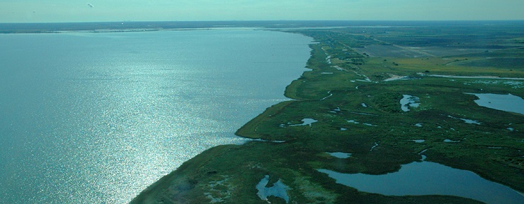
The northern Gulf of Mexico is famous for great seafood, low-key living on beautiful deltas, and picturesque coastal wetlands and pine forests. However, the geographic aspects that are so productive and eye catching — the low-level topography and extensive marsh — make this area highly susceptible to sea-level change.
Recognition of this vulnerability has led to much research and community planning focused on forecasting future conditions, and mitigating and adapting to sea-level rise. The Northern Gulf of Mexico Sentinel Site Cooperative, or NGOM SSC, was developed to facilitate coordination of these efforts.
Its mission is to “improve integration, translation, and transition of coastal data and research products in the northern Gulf of Mexico for application by regional and local resource managers” to help them adapt to sea-level rise and coastal flooding.
The top three gaps and needs in the upcoming years, as identified by NGOM SSC partners, are:
- Develop consistent sea-level rise scenarios, agreed upon by local, regional and national experts, for input into models and tools;
- Provide recommendations to resource managers and decision makers on how to use available information, particularly models, with an understanding of uncertainty and limitations; and
- Inventory sea-level observation infrastructure and conduct a gap analysis to identify where additional infrastructure is needed.
NGOM SSC has worked closely with its partners to address these prioritized needs and gaps. The NOAA Regional Collaboration Team and the USFWS have provided funding to conduct inventories of elevation and Continuously Operating Reference Stations, or CORS, as well as gap analyses on a recently completed SET inventory and the elevation and CORS inventories.
Further, the cooperative is working closely with local, regional and national experts to facilitate discussion and agreement upon a suite of recommended sea-level rise scenarios to develop models for the Gulf Coast. The NGOM SSC is also helping experts in model evaluation and community planning to collaborate on guidance documents for model recommendations for community planning and adaptation.
In addition, some partners are working on an EESLR project in the northern Gulf of Mexico. The team conducted extensive research on the dynamics of climate and sea-level change on coastal habitats, including precipitation, tidal velocities, sedimentation and inundation. The project resulted in the development of habitat suitability models for marshes, oysters and submerged aquatic vegetation in Apalachicola Bay in Florida. These models can predict where future environmental conditions will be optimum for these economically and ecologically critical habitat.
NGOM SSC coordinated with the EESLR project team to present the models to conservationists, natural resource managers and restoration specialists, seeking feedback to increase the application of these models in future restoration, management and conservation efforts.
For more information on the NGOM SSC, visit www.ngomssc.org.
HAWAI‘I: Ecological and Cultural Diversity
By Maya Walton, Hawai‘i Sea Grant
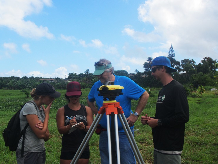
The locations in the Hawaiian Islands Sentinel Site Cooperative, or HISSC, include coral reefs, atolls, tropical estuaries and anchialine (AN-key-ah-lin) pools — enclosed bodies of water with an underground connection to the ocean. The sites that make up the HISSC offer unique habitats for many species that are found only in Hawaiʻi.
The HISSC is made up of Midway and French Frigate shoals in the Papahānaumokuākea Marine National Monument in the Northwestern Hawaiian Islands, He‘eia watershed on the island of Oahu, and watersheds on the leeward coast of HawaiʻI Island (West Hawaiʻi).
The sites cover more than 1,500 miles, spanning almost the entire length of the Hawaiian archipelago. They are situated along a human-impact gradient, with two sites (Heʻeia and West Hawaiʻi) in heavily populated and urbanized areas, and two sites (Midway Atoll and French Frigate Shoals) in remote and unpopulated areas.
In a coastal state such as Hawaiʻi, sea-level rise, inundation and other climate change-related coastal hazards present a challenge for communities that have homes, roads, important cultural sites and unique habitats in coastal areas that may be at risk.
HISSC partners have a shared mission to improve understanding of, long-range planning for, and adaptation to climate change impacts. The cooperative’s work builds upon a long history of conservation planning, collaboration, research and community-based efforts in the Hawaiian Islands.
The HISSC also facilitates community preparedness. In 2015, several HISSC partner groups engaged in research based on a request from Kākoʻo ʻŌiwi, a nonprofit organization that manages 405 acres of wetland and agricultural land.
Researchers from NOAA’s Office for Coastal Management, NGS and Hawaiʻi Sea Grant completed a project that led to a more accurate digital elevation model of the Heʻeia watershed. Managers from Kākoʻo ʻŌiwi are using this new data to plan where to restore wetlands and where to plant taro fields.
These conservation practices may increase the absorptive capacity of the land and reduce flooding, ultimately leading to increased community and coastal resilience in the area.
On Hawaiʻi Island, HISSC is partnering with researchers from USGS to help fill a locally identified science need that could guide local watershed management plans. The study will map erosion “hot spots” in the watershed draining into Pelekane Bay, West Hawaiʻi, and will collect data on where sediment is being introduced into streams.
This research will provide important information on how to prevent sedimentation, one of the largest threats to the health of nearby coral reefs. In the Hawaiian Islands, corals provide an important buffer against coastal storms, sea-level rise and storm surge. In addition, the health of coral reefs is a key component of coastal resilience in Hawaiʻi.
SAN FRANCISCO: Urban Centers and Natural Areas at Risk
By Maya Hayden, California Sea Grant Extension Program
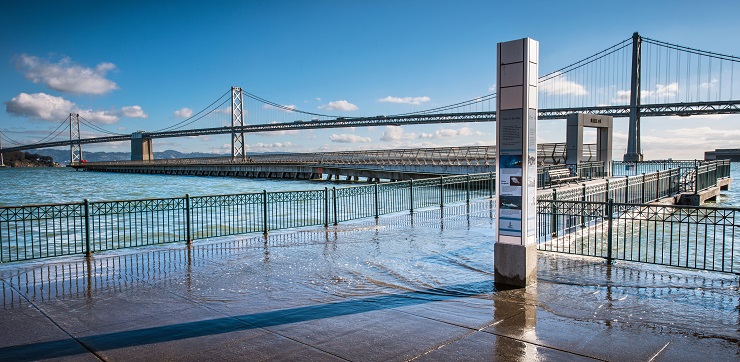
San Francisco Bay and its outer coast comprise the largest estuarine area on the West Coast of the United States. The estuary serves as a major urban and economic center, and supports significant ecological value.
It is home to more than seven million people, and retains some of the largest natural areas along the West Coast, including the Greater Farallones and Cordell Bank National Marine Sanctuaries, Point Reyes National Seashore, the San Francisco Bay National Estuarine Research Reserve, and several National Wildlife Refuge complexes.
The estuary serves as a major hub of commerce and supports the most intact Mediterranean-climate wetlands in North America. The Bay Area also is on the leading edge of efforts to support the resilience of this wealth of socioecological resources in light of changing sea levels and coastal flood conditions.
The San Francisco Bay and Outer Coast Sentinel Site Cooperative is a partnership to advance regional actions that improve this community and ecosystem resilience. Addressing impacts of sea-level rise requires creative and cross-jurisdictional efforts.
With an emphasis on sea-level rise, SF Cooperative activities fall under three main focus areas:
- Bridging adaptation-planning efforts aimed at natural vs. built systems.
- Supporting development of a regional network for early detection and forecasting of marsh ecosystem changes.
- Fostering resilience efforts that incorporate connections between the ocean/outer coast and bay.
Cooperative members are leading or assisting in efforts to assess the vulnerability of natural and built assets along the bay and outer coast shoreline. These assessments typically use modeled projections of sea-level rise and coastal flooding to evaluate what might be at risk under different flood scenarios.
In California, a multitude of decision-support tools exist that incorporate different models of sea-level rise and coastal processes (e.g., storms, riverine flooding and erosion) for forecasting coastal change. Decision makers need clear, synthesized information and training to understand and evaluate these tools.
SF Cooperative members, along with partners at The Nature Conservancy, Coravai LLC and the Tijuana River National Estuarine Research Reserve, developed a project called “Lifting the Fog.” The project resulted in workshops and communications products to better equip California coastal decision makers in navigating the range of available tools.
Building on current efforts by cooperative members and partners, the cooperative is comparing approaches used to incorporate natural resources into vulnerability assessments and adaptation planning, with an initial focus on wetlands. The goal is to facilitate sharing of lessons learned among partners, and to identify tools that can be used to better integrate natural and built assets in the adaptation planning process.
A key concern in the Bay Area is whether marsh ecosystems that currently provide critical habitat and flood buffering services will be able to keep up with sea-level rise. This depends not only on how quickly water rises, but also on how fast marshes can build upward — called vertical accretion — or shift landward to higher ground. The availability of sediment is a key component in a marsh’s ability to vertically accrete, and the bay is experiencing a reduction in sediment inputs.
To help prioritize the scientific needs of managers around this topic, the SF Cooperative helped to plan and implement the 2015 Science of Sediment workshop, under the leadership of the San Francisco Bay Conservation and Development Commission’s Sediment Management Team. Topics included understanding sediment fate and transport as it affects wetland and shoreline management, flood control, and navigational dredging.
Management needs and prioritized research strategies identified during the workshop and further developed with partners will feed into BCDC’s long-term sediment management planning process and will facilitate the targeting of research and monitoring needed for the region.
For more on the SF Cooperative, go to sfsentinelsitecooperative.org.
This article was published in the Winter 2016 issue of Coastwatch. Download article in PDF here.
For contact information and reprint requests, visit ncseagrant.ncsu.edu/coastwatch/contact/
- Categories: